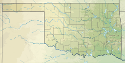
Tenkiller Ferry Lake, or more simply, Lake Tenkiller, is a reservoir in eastern Oklahoma formed by the damming of the Illinois River. The earth-fill dam was constructed between 1947 and 1952 by the United States Army Corps of Engineers for purposes of flood control, hydroelectric power generation, water supply and recreation. It went into full operation in 1953.[1] The lake and dam were named for the Tenkiller family, prominent Cherokees who owned the land and ferry that were bought for the project.[2] This is the 6th largest lake in Oklahoma, based on water capacity.[a]
| Tenkiller Ferry Lake | |
|---|---|
 Tenkiller Ferry Lake and Dam | |
| Location | Cherokee / Sequoyah counties, Oklahoma, US |
| Coordinates | 35°39′29″N 94°59′31″W / 35.65806°N 94.99194°W |
| Lake type | reservoir |
| Primary inflows | Illinois River |
| Primary outflows | Illinois River |
| Catchment area | 1,610 square miles (4,170 km2) |
| Basin countries | United States |
| Max. length | 35 miles (56,327 m) |
| Surface area | 12,900 acres (5,200 ha) |
| Water volume | 677,000 acre⋅ft (0.835 km3) |
| Shore length1 | 130 miles (210 km) |
| Surface elevation | 632 feet (193 m) |
| Islands | Goat Island |
| Settlements | Muskogee, Oklahoma |
| 1 Shore length is not a well-defined measure. | |
Geography
editThe lake covers 12,900 acres (52 km2) and has a shoreline of over 130 miles (210 km) in the Cookson Hills of the Ozark Mountains of Cherokee and Sequoyah counties, about seven miles (11 km) northeast of the town of Gore and 10 miles (16 km) from the intersection of I-40 and the Muskogee Turnpike.
The distance from major cities include: 150 miles (240 km) east of Oklahoma City, 50 miles (80 km) west of Fort Smith, Arkansas, 75 miles (121 km) southeast of Tulsa and 30 miles (48 km) from Muskogee.[1]
One of the townships bordering this lake is Paradise Hill, at the far southwestern edge of the lake. It is known for its violent drop-offs, some going from a grown man's waist level to over his head. This is the cause of many deaths in the lake.[1]
Electric power generation
editThe hydroelectric power station is remotely controlled from the control center at Fort Gibson Lake. Two generators, each rated for 17 megawatts, provide a total capacity of 34 megawatts (MWe). The facility can handle 40 MWe for a short period of time. However, the amount of power that can actually be generated depends heavily on the lake elevation at any given time.[1]
Water supply
editOriginally, the amount of water delivered by the project was considered incidental, although the quality of water was much higher than that of the Arkansas River (the closest alternative source). Much of this water was expected to be used by the Kerr-McGee Nuclear Fuel Plant. That plant closed in 1975. The cities of Muskogee and Sallisaw are now major consumers.[1]
Recreation
editAttractions near the lake include scuba diving, camping, hiking, fishing, golfing, water sports, scenic nature, fishing, and hunting. In addition there are eight miles (13 km) of trout fishing along the Illinois River. There are also ten marinas, fourteen parks, 24 boat launching ramps, five floating restaurants, and many islands including Goat Island which is famous for the goats that inhabit it.[3] Scuba divers can even see the ruins of old communities that were flooded by the lake, such as the original town of Cookson. This lake is the venue of several fishing tournaments including the popular Bassmaster series championship.
Other than the goats, many other animals inhabit the area including Canada geese, white tail deer, ducks, monarch butterflies, warblers, otters, mink, beaver, bear, mountain lion, wild hogs, wild turkey and bald eagles.
Tenkiller State Park, Cherokee Landing State Park, and several Corps parks are among the parks bordering the lake.
Wildlife Management Area
editThe Tenkiller Wildlife Management Area consists of 2,950 acres (11,900,000 m2) on the southwest shoreline of the lake, a mixture of upland and riparian habitat. The upland portion is covered with oak and hickory. The riparian portion contains mostly willow, sycamore, hackberry, elm, ash and birch.[4]
Notes
editReferences
edit- ^ a b c d e Warner, Badger and Lage, 1973.
- ^ A Little History of the Tenkiller Lake Area. www.tenkiller.net Accessed May 4, 2013.
- ^ Lake Tenkiller area visitors guide. www.laketenkiller.com Accessed May 4, 2013.
- ^ "Tenkiller Wildlife Management Area". Oklahoma Department of Wildlife Conservation. Retrieved May 4, 2013.
External links
edit- Official website
- U.S. Army Corps of Engineers website
- U.S. Army Corps of Engineers: Corps Lake Getaway
- U.S. Army Corps of Engineers lake website
- U.S. Army Corps of Engineers lake data
- Lake Tenkiller Home Page
- Lake Tenkiller Depth map
- Oklahoma Digital Maps: Digital Collections of Oklahoma and Indian Territory
- Warner, Larkin; Daniel D. Badger; and Gerald M. Lage. U.S. Army Corps of Engineers Tulsa District. "Impact Study of the Construction and Operation of the Tenkiller Ferry Lake, Oklahoma. August 1973.
- Overflow release on YouTube

