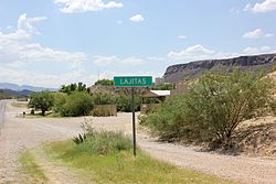
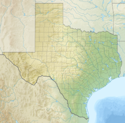
Lajitas is an unincorporated community in Brewster County, Texas, United States, near the Big Bend National Park. According to the Handbook of Texas, the community had a population of 75 in 2010.[1]
Lajitas, Texas | |
|---|---|
 Lajitas, July 2014 | |
| Coordinates: 29°15′42″N 103°46′36″W / 29.26167°N 103.77667°W | |
| Country | United States |
| State | Texas |
| County | Brewster |
| Elevation | 2,342 ft (714 m) |
| Time zone | UTC-6 (Central (CST)) |
| • Summer (DST) | UTC-5 (CDT) |
| ZIP codes | 79852 |
| Area code | 432 |
| GNIS feature ID | 1339481 |
History
editThe settlement is named after the Boquillas flagstone found in the area. "Lajitas" translates to "little flat rocks" in Spanish.[2]
Starting in the 1980s as a joke, for many years the purported mayor of Lajitas was Clay Henry III, a "beer-drinking" goat.[3] After two replacements of the original Clay Henry, the trading post and stable where the actual mayor lived is now closed and the goat no longer resides there.[4][5] The election included incumbent human mayor Tommy Steele, as well as a trading post wooden Indian, and a dog named Buster. Since Clay Henry, goats have been mayors of the community ever since.[6]
Geography
editLajitas is located on the eastern end of the Big Bend Ranch State Park. It is located on a bluff overlooking the Rio Grande at San Carlos ford of the old Comanche Trail, in the northern part of the Chihuahuan Desert in southwestern Brewster County.[1] It is also located 95 mi (153 km) south of Alpine and 50 mi (80 km) east of Presidio.[7]
Columnar basalt that is similar to that of the Devils Postpile National Monument in California can be found in a high desert dry river falls area just north of Lajitas.
Climate
editLajitas has a hot arid climate with very hot summers and mild winters.
| Climate data for Lajitas, Texas, 1991–2020 normals, extremes 1978–present | |||||||||||||
|---|---|---|---|---|---|---|---|---|---|---|---|---|---|
| Month | Jan | Feb | Mar | Apr | May | Jun | Jul | Aug | Sep | Oct | Nov | Dec | Year |
| Record high °F (°C) | 89 (32) |
98 (37) |
103 (39) |
109 (43) |
115 (46) |
115 (46) |
113 (45) |
113 (45) |
110 (43) |
104 (40) |
97 (36) |
92 (33) |
115 (46) |
| Mean maximum °F (°C) | 83.5 (28.6) |
89.9 (32.2) |
95.5 (35.3) |
101.5 (38.6) |
107.8 (42.1) |
110.8 (43.8) |
108.5 (42.5) |
106.3 (41.3) |
104.0 (40.0) |
99.7 (37.6) |
90.1 (32.3) |
83.0 (28.3) |
111.4 (44.1) |
| Mean daily maximum °F (°C) | 67.9 (19.9) |
74.0 (23.3) |
82.0 (27.8) |
90.3 (32.4) |
97.5 (36.4) |
102.4 (39.1) |
100.6 (38.1) |
99.6 (37.6) |
94.7 (34.8) |
88.1 (31.2) |
76.4 (24.7) |
68.1 (20.1) |
86.8 (30.5) |
| Daily mean °F (°C) | 50.5 (10.3) |
55.9 (13.3) |
63.7 (17.6) |
72.1 (22.3) |
80.9 (27.2) |
87.9 (31.1) |
87.4 (30.8) |
86.4 (30.2) |
81.1 (27.3) |
72.0 (22.2) |
59.5 (15.3) |
50.7 (10.4) |
70.7 (21.5) |
| Mean daily minimum °F (°C) | 33.0 (0.6) |
37.9 (3.3) |
45.4 (7.4) |
53.9 (12.2) |
64.3 (17.9) |
73.4 (23.0) |
74.3 (23.5) |
73.2 (22.9) |
67.5 (19.7) |
55.9 (13.3) |
42.7 (5.9) |
33.3 (0.7) |
54.6 (12.5) |
| Mean minimum °F (°C) | 23.1 (−4.9) |
26.2 (−3.2) |
32.5 (0.3) |
41.1 (5.1) |
51.4 (10.8) |
64.7 (18.2) |
68.4 (20.2) |
66.8 (19.3) |
56.9 (13.8) |
41.2 (5.1) |
30.1 (−1.1) |
21.6 (−5.8) |
19.3 (−7.1) |
| Record low °F (°C) | 14 (−10) |
5 (−15) |
19 (−7) |
29 (−2) |
35 (2) |
59 (15) |
61 (16) |
53 (12) |
47 (8) |
27 (−3) |
21 (−6) |
4 (−16) |
4 (−16) |
| Average precipitation inches (mm) | 0.36 (9.1) |
0.24 (6.1) |
0.30 (7.6) |
0.31 (7.9) |
0.88 (22) |
1.28 (33) |
1.86 (47) |
1.22 (31) |
1.32 (34) |
0.90 (23) |
0.37 (9.4) |
0.25 (6.4) |
9.29 (236.5) |
| Average snowfall inches (cm) | 0.1 (0.25) |
0.0 (0.0) |
0.0 (0.0) |
0.0 (0.0) |
0.0 (0.0) |
0.0 (0.0) |
0.0 (0.0) |
0.0 (0.0) |
0.0 (0.0) |
0.0 (0.0) |
0.0 (0.0) |
0.4 (1.0) |
0.5 (1.25) |
| Average precipitation days (≥ 0.01 in) | 2.1 | 1.6 | 1.6 | 1.5 | 3.2 | 4.3 | 6.3 | 4.5 | 5.1 | 3.4 | 2.4 | 1.7 | 37.7 |
| Average snowy days (≥ 0.1 in) | 0.1 | 0.0 | 0.0 | 0.0 | 0.0 | 0.0 | 0.0 | 0.0 | 0.0 | 0.0 | 0.0 | 0.0 | 0.1 |
| Source 1: NOAA[8] | |||||||||||||
| Source 2: National Weather Service[9] | |||||||||||||
Economy
editThe Lajitas Golf Resort and Spa is a 20,000-acre golf resort business in Lajitas owned by Texas businessman Kelcy Warren, who bought the resort from previous owner Steve Smith while the business was going through financial distress.[10] It is located on the Rio Grande, bordering Mexico,[11] between Big Bend National Park and Big Bend Ranch State Park.[12] The Robert E. Lee on Traveller statue is on display at the resort.
Education
editLajitas is zoned to schools in the Terlingua Common School District.[13] In 1912, Lajitas had a school with 50 students.[1]
Media
editIn the 1970s the community had one telephone, and newspapers were delivered one day later than their normal dates. Additionally, there were no televisions, the latter a rarity among communities in the decade.[13]
Frank Q. Dobbs directed his first film, Enter the Devil, in Lajitas in 1972.[14]
Infrastructure
editAirport
editDue to the remoteness of the resort, Lajitas is served by the Lajitas International Airport, a private airport with a 6,503-foot (1,982 m) concrete runway.[11] There is regular service between Lajitas and Dallas Love Field on JSX.[15]
Military bases
editThe 90th Fighter Squadron of the United States Army Border Air Patrol had a sector that traveled to Lajitas from Eagle Pass. The 11th Bomb Squadron operated from Marfa Field along the Rio Grande to El Paso.[16]
See also
editReferences
edit- ^ a b c Lajitas, TX from the Handbook of Texas Online
- ^ "Old Cemetery In Lajitas, Texas, A Tiny Town That Abuts Big Bend National Park In Southwestern Brewster County, On A Bluff Overlooking The Rio Grande River In The Northern Part Of The Chihuahuan Desert". Library of Congress. Retrieved August 22, 2018.
- ^ Cannon, B. (2004). Texas: Land of Legend and Lore. Wordware Publishing, Incorporated. p. 204. ISBN 978-1-55622-949-7.
- ^ "Mayor Clay Henry III: A Word About the Mayor". Lajitas Resort & Spa. Archived from the original on May 7, 2009. Retrieved June 12, 2012.
- ^ RoadsideAmerica.com staff (May 2011). "Clay Henry - Famous Beer-Drinking Dead Goat". RoadsideAmerica.com. Retrieved June 12, 2012.
- ^ "Meet Lajitas' Mayor: Clay Henry III". www.nationalparkreservations.com. Retrieved May 10, 2019.
- ^ "Lajitas, Texas". Texas Escapes Online Magazine. Retrieved December 5, 2022.
- ^ "U.S. Climate Normals Quick Access – Station: Lajitas, TX". National Oceanic and Atmospheric Administration. Retrieved April 30, 2023.
- ^ "NOAA Online Weather Data – NWS Midland". National Weather Service. Retrieved April 30, 2023.
- ^ Fenton, Tom (September 14, 2015). "Lajitas Resort: Why you better go now - El Paso Inc.: Publishers Column". El Paso Inc. Retrieved April 4, 2017.
- ^ a b Black Jack's Crossing Golf Club, Bradley S. Klein, Business Jet Traveler, August 2012.
- ^ Texas: Bordering on the bizarre, by Russell Baillie, New Zealand Herald, 5:00 PM Thursday, Mar 16, 2017.
- ^ a b Thomas, Les (December 19, 1976). "Last bastion of silence: Town enjoys lack of TV". Fort Worth Star-Telegram. p. 2B. - Clipping from Newspapers.com. It states the students attend Terlingua Common School.
- ^ Villafranca, Armando (February 19, 2006). "Death: Frank Q. Dobbs, producer, director and writer for television and movies". Houston Chronicle. Hearst Newspapers, LLC. Retrieved September 3, 2018.
- ^ "Where We Fly". JSX. April 15, 2024. Retrieved April 19, 2024.
- ^ Maurer, Maurer, ed. (1982) [1969]. Combat Squadrons of the Air Force, World War II (PDF) (reprint ed.). Washington, DC: Office of Air Force History. ISBN 0-405-12194-6. LCCN 70605402. OCLC 72556.
External links
edit
