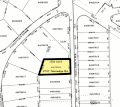
File:Ottawahillsplatmap.gif

Original file (800 × 715 pixels, file size: 140 KB, MIME type: image/gif)

Summary

Description
English: Example for a plat.
Source http://www.treas.gov/auctions/customs/ottawahills02pm.html; Transferred from en.wikipedia to Commons.
Author
Object location41° 40′ 19″ N, 83° 38′ 40″ W Kartographer map based on OpenStreetMap.View this and other nearby images on: OpenStreetMapinfo

Licensing

Public domain
Public domain
This image is a work of the United States Department of the Treasury, taken or made as part of an employee's official duties. As a work of the U.S. federal government, the image is in the public domain in the United States.

US Treasury seal
US Treasury seal
English  español  eesti  日本語  македонски  polski  português  українська  简体中文  繁體中文  +/−

Original upload log

The original description page was here. All following user names refer to en.wikipedia.
  • 2004-11-29 02:33 Jengod 800×715×8 (143134 bytes) {{PD-USGov}} Source: http://www.treas.gov/auctions/customs/ottawahills02pm.html

Captions

Add a one-line explanation of what this file represents

Items portrayed in this file

depicts

41°40'18.998"N, 83°38'39.998"W

File history

Click on a date/time to view the file as it appeared at that time.

Date/TimeThumbnailDimensionsUserComment
current19:34, 11 March 2008Thumbnail for version as of 19:34, 11 March 2008800 × 715 (140 KB)Avron{{Information |Description={{en|Example for a plat.}} |Source=http://www.treas.gov/auctions/customs/ottawahills02pm.html; Transferred from [http://en.wiki.x.io en.wikipedia] |Date=2004-11-29 (original upload date) |Author=Original uploader was [[:en:U

The following 3 pages use this file:

Global file usage

The following other wikis use this file: