Size of this preview: 408 × 599 pixels. Other resolutions: 163 × 240 pixels | 520 × 764 pixels.
Original file (520 × 764 pixels, file size: 889 KB, MIME type: image/png)
| This is a file from the Wikimedia Commons. Information from its description page there is shown below. Commons is a freely licensed media file repository. You can help. |
Summary
| Description |
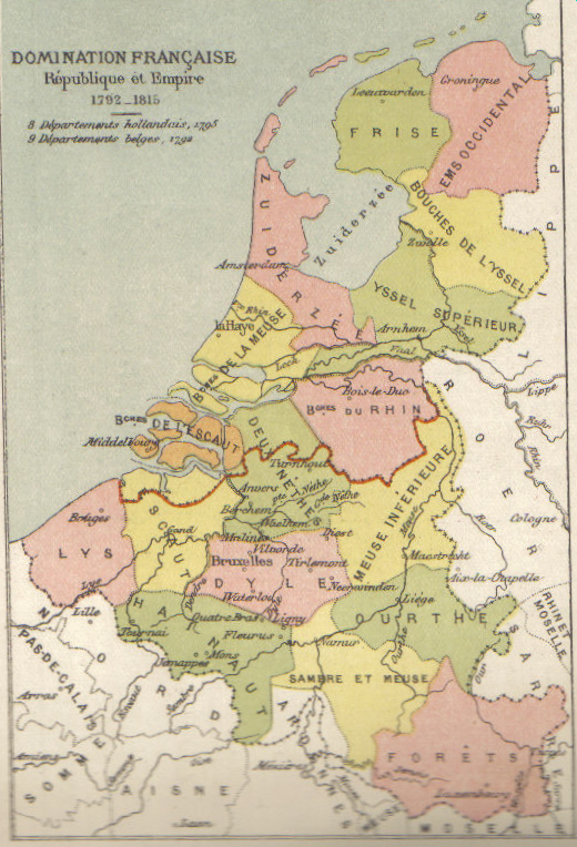
English: Map of Belgium and the Netherlands during the French occupation. Français : Carte de la Belgique et des Pays-Bas pendant l'occupation française. |
||||||||||||||||||||
| Date | before 1910 | ||||||||||||||||||||
| Source | Scan from Atlas de géographie physique, politique et historique à l'usage de l'enseignement primaire et de l'enseignement moyen, Dessain, Liège, 35e éd., s.d., p. 40. | ||||||||||||||||||||
| Author |
|
||||||||||||||||||||

Licensing
|
This work is in the public domain in its country of origin and other countries and areas where the copyright term is the author's life plus 100 years or fewer. This work is in the public domain in the United States because it was published (or registered with the U.S. Copyright Office) before January 1, 1929. | |
| This file has been identified as being free of known restrictions under copyright law, including all related and neighboring rights. | |
File history
Click on a date/time to view the file as it appeared at that time.
| Date/Time | Thumbnail | Dimensions | User | Comment | |
|---|---|---|---|---|---|
| current | 11:16, 31 October 2005 | | 520 × 764 (889 KB) | BrightRaven | Map of Belgium and the Netherlands during the French occupation. Author : MG Alexis |
File usage
The following 4 pages use this file:
Global file usage
The following other wikis use this file:
- Usage on ar.wiki.x.io
- Usage on ast.wiki.x.io
- Usage on br.wiki.x.io
- Usage on ca.wiki.x.io
- Usage on cs.wiki.x.io
- Usage on eo.wiki.x.io
- Usage on es.wiki.x.io
- Usage on fr.wiki.x.io
- Usage on fy.wiki.x.io
- Usage on gl.wiki.x.io
- Usage on id.wiki.x.io
- Usage on it.wiki.x.io
- Usage on la.wiki.x.io
- Usage on li.wiki.x.io
- Usage on nl.wiki.x.io
- Usage on vls.wiki.x.io
- Usage on zh.wiki.x.io