Size of this preview: 533 × 600 pixels. Other resolutions: 213 × 240 pixels | 427 × 480 pixels.
Original file (800 × 900 pixels, file size: 157 KB, MIME type: image/png)
File history
Click on a date/time to view the file as it appeared at that time.
| Date/Time | Thumbnail | Dimensions | User | Comment | |
|---|---|---|---|---|---|
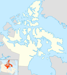
| current | 12:03, 8 September 2010 |  | 800 × 900 (157 KB) | Blofeld Dr. | {{Information |Description={{en|1=Map of Nunavut}} |Source=Based on File:Canada location map.svg |Author=Algkalv and Dr. Blofeld |Date=2010-09-08 |Permission= |other_versions= }} Category:Nunavut |
File usage
No pages on the English Wikipedia use this file (pages on other projects are not listed).
Global file usage
The following other wikis use this file:
- Usage on de.wiki.x.io
- Usage on pt.wiki.x.io
- Iqaluit
- Ilha de Baffin
- Ilha Victoria
- Alert (Nunavut)
- Ilha Mansel
- Monte Thor
- Ilha de Devon
- Ilha do Príncipe de Gales (Nunavut)
- Ilha Southampton
- Ilha do Rei Guilherme
- Ilha North Kent
- Grise Fiord
- Ilha de Bjarnason
- Pico Barbeau
- Cratera de Haughton
- Ilha Buckingham
- Ilha Charles (Nunavut)
- Península de Fosheim
- Predefinição:Mapa de localização/Nunavut
- Estreito de Fisher
- Canal de Foxe
- Ilha Jens Munk
- Ennadai
- Golfo da Rainha Maud
- Ilha Kugong
- Monte Angilaaq
