Size of this preview: 499 × 599 pixels. Other resolutions: 200 × 240 pixels | 637 × 765 pixels.
Original file (637 × 765 pixels, file size: 893 KB, MIME type: image/png)
| This is a file from the Wikimedia Commons. Information from its description page there is shown below. Commons is a freely licensed media file repository. You can help. |
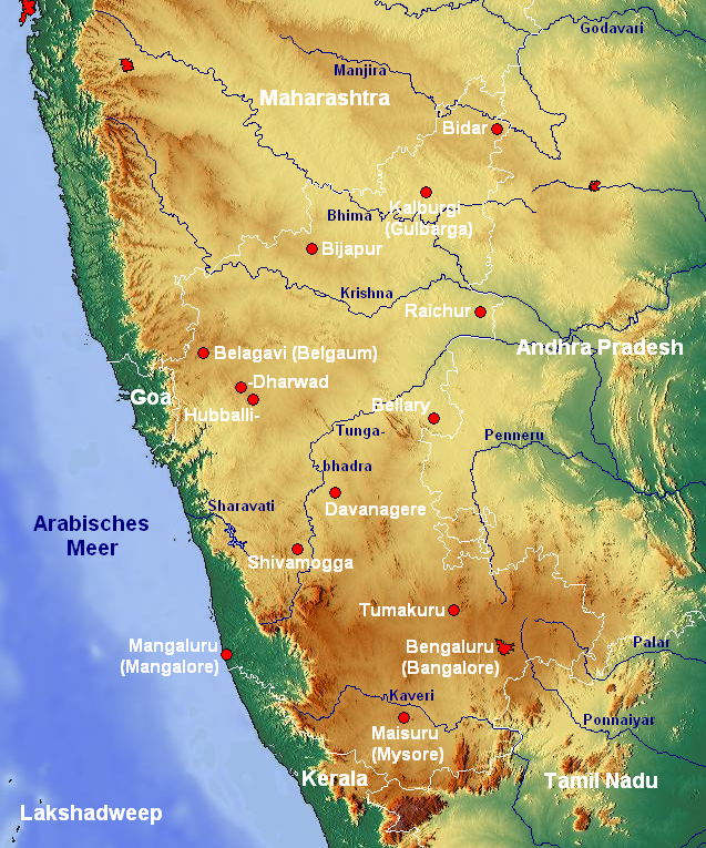
| Description | Topographische Karte von Karnataka (Indien) mit Städten und Flüssen |
| Date | |
| Source | www.maps-for-free.com |
| Author | Jungpionier |
This file is licensed under the Creative Commons Attribution-Share Alike 3.0 Unported license.
- You are free:
- to share – to copy, distribute and transmit the work
- to remix – to adapt the work
- Under the following conditions:
- attribution – You must give appropriate credit, provide a link to the license, and indicate if changes were made. You may do so in any reasonable manner, but not in any way that suggests the licensor endorses you or your use.
- share alike – If you remix, transform, or build upon the material, you must distribute your contributions under the same or compatible license as the original.
File history
Click on a date/time to view the file as it appeared at that time.
| Date/Time | Thumbnail | Dimensions | User | Comment | |
|---|---|---|---|---|---|
| current | 17:54, 26 February 2008 | | 637 × 765 (893 KB) | Jungpionier | {{Information |Description=Topographische Karte von Karnataka (Indien) mit Städten und Flüssen |Source=[http://www.maps-for-free.com/ www.maps-for-free.com] |Date=26. Februar 2008 |Author= Jungpionier }} {{cc-by-sa-3.0}} [[Categor |
File usage
The following pages on the English Wikipedia use this file (pages on other projects are not listed):
Global file usage
The following other wikis use this file:
- Usage on azb.wiki.x.io
- Usage on bh.wiki.x.io
- Usage on bn.wiki.x.io
- Usage on de.wiki.x.io
- Usage on en.wiktionary.org
- Usage on fr.wiki.x.io
- Usage on hi.wiki.x.io
- Usage on hr.wiki.x.io
- Usage on hu.wiki.x.io
- Usage on kn.wiki.x.io
- Usage on ml.wiki.x.io
- Usage on mn.wiki.x.io
- Usage on mr.wiki.x.io
- Usage on no.wiki.x.io
- Usage on or.wiki.x.io
- Usage on pnb.wiki.x.io
- Usage on sa.wiki.x.io
- Usage on ta.wiki.x.io
- Usage on te.wiki.x.io
- Usage on tr.wiki.x.io
- Usage on xmf.wiki.x.io
- Usage on zh.wiki.x.io