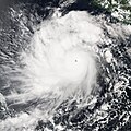
Size of this preview: 450 × 600 pixels. Other resolutions: 180 × 240 pixels | 360 × 480 pixels | 576 × 768 pixels | 768 × 1,024 pixels | 1,536 × 2,048 pixels | 6,001 × 8,001 pixels.
Original file (6,001 × 8,001 pixels, file size: 8.46 MB, MIME type: image/jpeg)
File history
Click on a date/time to view the file as it appeared at that time.
| Date/Time | Thumbnail | Dimensions | User | Comment | |
|---|---|---|---|---|---|
| current | 22:29, 3 December 2018 |  | 6,001 × 8,001 (8.46 MB) | FleurDeOdile | worldview |
| 22:29, 20 August 2006 |  | 4,000 × 4,000 (2.56 MB) | Good kitty | {{Information |Description=The MODIS instrument flying aboard NASA's Aqua satellite captured this true-color image of Hurricane Javier on September 13, 2004 at 20:40 UTC (4:40 PM EDT). At the time this image was taken Javier was located approximately 982 |
File usage
The following 3 pages use this file:
Global file usage
The following other wikis use this file:
- Usage on de.wiki.x.io
- Usage on pt.wiki.x.io
- Usage on simple.wiki.x.io
- Usage on vi.wiki.x.io
- Usage on www.wikidata.org
- Usage on zh.wiki.x.io


