Size of this preview: 800 × 593 pixels. Other resolutions: 320 × 237 pixels | 640 × 474 pixels | 1,024 × 759 pixels | 1,280 × 949 pixels | 2,560 × 1,898 pixels | 2,806 × 2,080 pixels.
Original file (2,806 × 2,080 pixels, file size: 1.36 MB, MIME type: image/png)
File history
Click on a date/time to view the file as it appeared at that time.
| Date/Time | Thumbnail | Dimensions | User | Comment | |
|---|---|---|---|---|---|
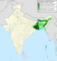
| current | 15:05, 2 July 2022 |  | 2,806 × 2,080 (1.36 MB) | NikosLikomitros | A few districts of Arunachal Pradesh have a notable Bengali presence above of 1%, probably part of the Indian efforts to increase its presence in the region. |
| 16:55, 1 July 2022 |  | 2,806 × 2,080 (1.36 MB) | NikosLikomitros | Two extra fixes. | |
| 16:53, 1 July 2022 |  | 2,806 × 2,080 (1.36 MB) | NikosLikomitros | Minor fixes. | |
| 16:44, 1 July 2022 |  | 2,806 × 2,080 (1.36 MB) | NikosLikomitros | Now, this map covers all districts of India. Includes also extra information and a new colour key. The basemap is from Distribution_of_Jats_in_South_Asia.png. | |
| 21:09, 26 June 2022 |  | 1,902 × 2,048 (1,002 KB) | NikosLikomitros | Uploaded own work with UploadWizard |
File usage
The following 3 pages use this file:
Global file usage
The following other wikis use this file:
- Usage on bn.wiki.x.io
- Usage on dv.wiki.x.io
- Usage on el.wiki.x.io
- Usage on fa.wiki.x.io
- Usage on fr.wiki.x.io
- Usage on gl.wiki.x.io
- Usage on hi.wiki.x.io
- Usage on mn.wiki.x.io