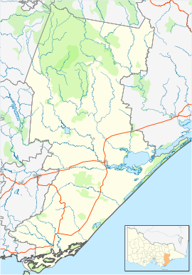
Carrajung is a town in eastern Victoria, Australia. Carrajung is situated between Yarram and Traralgon, about 5 kilometres from the Hyland Highway at a height of approximately 520 metres above sea level. Carrajung is situated close to the eastern end of the Grand Ridge Road.
| Carrajung Victoria | |||||||||
|---|---|---|---|---|---|---|---|---|---|
| Coordinates | 38°22′S 146°41′E / 38.367°S 146.683°E | ||||||||
| Population | 102 (2016 census)[1] | ||||||||
| Postcode(s) | 3844 | ||||||||
| Elevation | 700 m (2,297 ft) | ||||||||
| Location | |||||||||
| LGA(s) | Shire of Wellington | ||||||||
| County | Buln Buln | ||||||||
| State electorate(s) | Gippsland South | ||||||||
| Federal division(s) | Gippsland | ||||||||
| |||||||||
It has a population of around 100 people. Carrajung has a football oval, one church,a community hall and a primary school that is now closed. Carrajung Post Office opened on 1 November 1887 and closed in 1974. Carrajung Lower, nearby, had a Post Office open from 1902 until 1911, and from 1922 until 1969 although known as Bruthen Creek until 1926.[2]
The name Carrajung is thought to have been derived from an Aboriginal word meaning a fishing line.[3]
References
edit- ^ Australian Bureau of Statistics (27 June 2017). "Carrajung (State Suburb)". 2016 Census QuickStats. Retrieved 20 August 2020.
- ^ Phoenix Auctions History, Post Office List, retrieved 5 April 2021
- ^ "Carrajung | Victorian Places". victorianplaces.com.au. Retrieved 22 June 2017.
