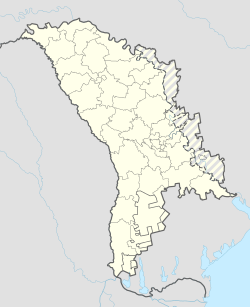
Bălțata is a commune in Criuleni District, Moldova. It is composed of four villages: Bălțata, Bălțata de Sus, Sagaidac and Sagaidacul de Sus.[2]
Bălțata | |
|---|---|
| Coordinates: 47°03′04″N 29°03′06″E / 47.0511111111°N 29.0516666667°E | |
| Country | |
| District | Criuleni District |
| Population | |
• Total | 1,750 |
| Time zone | UTC+2 (EET) |
| • Summer (DST) | UTC+3 (EEST) |
Climate
edit| Climate data for Bălțata (1991–2020) | |||||||||||||
|---|---|---|---|---|---|---|---|---|---|---|---|---|---|
| Month | Jan | Feb | Mar | Apr | May | Jun | Jul | Aug | Sep | Oct | Nov | Dec | Year |
| Mean daily maximum °C (°F) | 1.6 (34.9) |
3.9 (39.0) |
9.9 (49.8) |
17.2 (63.0) |
23.1 (73.6) |
26.8 (80.2) |
29.1 (84.4) |
29.0 (84.2) |
23.0 (73.4) |
16.1 (61.0) |
8.7 (47.7) |
3.2 (37.8) |
16.0 (60.8) |
| Daily mean °C (°F) | −1.8 (28.8) |
−0.2 (31.6) |
4.4 (39.9) |
10.8 (51.4) |
16.4 (61.5) |
20.3 (68.5) |
22.3 (72.1) |
21.8 (71.2) |
16.3 (61.3) |
10.3 (50.5) |
4.8 (40.6) |
−0.1 (31.8) |
10.4 (50.7) |
| Mean daily minimum °C (°F) | −5.1 (22.8) |
−3.9 (25.0) |
−0.5 (31.1) |
4.5 (40.1) |
9.6 (49.3) |
13.7 (56.7) |
15.6 (60.1) |
14.6 (58.3) |
10.0 (50.0) |
5.0 (41.0) |
1.3 (34.3) |
−3.3 (26.1) |
5.1 (41.2) |
| Average precipitation mm (inches) | 29 (1.1) |
24 (0.9) |
30 (1.2) |
33 (1.3) |
50 (2.0) |
68 (2.7) |
63 (2.5) |
48 (1.9) |
45 (1.8) |
40 (1.6) |
37 (1.5) |
34 (1.3) |
501 (19.7) |
| Average precipitation days (≥ 1.0 mm) | 6 | 5 | 6 | 5 | 7 | 7 | 6 | 5 | 5 | 5 | 5 | 6 | 67 |
| Mean monthly sunshine hours | 70 | 96 | 155 | 210 | 283 | 301 | 326 | 308 | 220 | 162 | 81 | 65 | 2,277 |
| Source: NOAA[3] | |||||||||||||
References
edit- ^ Results of Population and Housing Census in the Republic of Moldova in 2014: "Characteristics - Population (population by communes, religion, citizenship)" (XLS). National Bureau of Statistics of the Republic of Moldova. 2017. Retrieved 2017-05-01.
- ^ Clasificatorul unităților administrativ-teritoriale al Republicii Moldova (CUATM) (in Romanian)
- ^ "Bălțata Climate Normals 1991–2020". World Meteorological Organization Climatological Standard Normals (1991–2020). National Oceanic and Atmospheric Administration. Archived from the original on 21 August 2023. Retrieved 21 August 2023.
