Wikipedia:Graphics Lab/Map workshop
The Graphics Lab is a project to improve the graphical content of the Wikimedia projects. Requests for image improvements can be added to the workshop pages: Illustrations, Photographs and Maps. For questions or suggestions one can use the talk pages: Talk:Graphics Lab, Talk:Illustrations, Talk:Photographs and Talk:Maps.
This specific page is the requests page for the Map workshop. Anyone can make a request for a map to be created or improved for a Wikipedia article. The standard format for making a request is shown below, along with general advice, and should be followed.
You are encouraged to share information and request advice from others. Also see possible conventions toolbox, map tutorials and topographic map tutorials.
| Advice to requesters |
|---|
|
What do we do?
|


| If you have completed work and not received a reply you may use the {{GL Map reply}} template to inform the requester. |
| Map makers and other visitors to the Graphics Lab may be interested in the RSS feed of changes to this page. You may find it here. |
| See also our sister Map workshop at Commons and the WikiProject Maps |
| Result | Code | Usage |
|---|---|---|
{{resolved}} ~~~~
|
Mark a thread as resolved and request archiving | |
{{subst:bump}}
|
Delay automatic archiving of a section for 30 days | |
{{I take|~~~~}}
|
When you'll be working on the request | |
{{Done}} ~~~~
|
When the request is done |
This page is automatically archived by ClueBot III. | |
| This page has a backlog that requires the attention of willing editors. Please remove this notice when the backlog is cleared. |
US Map of Uncommitted vote
edit- Article(s)
- Uncommitted (voting option)
- Uncommitted National Movement
- Results of the 2024 Democratic Party presidential primaries
- Israel–Hamas war protest vote movements,
- Request
I am just wondering can somebody make a Map of US states with the Uncommitted vote in 2024 Democratic Party presidential primaries. The higher the % number the darker the color of the state would be. Here are the numbers.
| State | Votes | Percentage | Delegates | Reference |
|---|---|---|---|---|
| Nevada | 7,448 | 5.81% | 0 | [1] |
| Michigan | 101,436 | 13.21% | 2 | [2] |
| Alabama | 11,213 | 6% | 0 | [3] |
| Colorado | 43,439 | 8.1% | 0 | [4] |
| Massachusetts | 58,462 | 9.4% | 1 | [5] |
| Minnesota | 45,913 | 18.9% | 11 | [6] |
| North Carolina | 88,021 | 12.7% | 0 | [7] |
| Tennessee | 10,464 | 7.9% | 0 | [8] |
| Hawaii | 455 | 29.1% | 7 | [9] |
| Democrats Abroad | 1,136 | 13.2% | 0 | [10] |
| Washington | 89,753 | 9.8% | 2 | [11] |
| Kansas | 4,286 | 10.3% | 0 | [12] |
| Missouri | 2,229 | 11.7% | 3 | [13] |
| Connecticut | 7,492 | 11.5% | 0 | [14] |
| Rhode Island | 3,732 | 14.9% | 1 | [15] |
| Wisconsin | 48,162 | 8.3% | 0 | [16] |
| Maryland | 63,743 | 9.7% | 0 | [17] |
| Kentucky | 32,908 | 17.9% | 8 | [18] |
| New Jersey | 43,758 | 8.9% | 1 | [19] |
| Final results | 706,591 | 4.25% | 37 | [20][21][22][23][24][25] |
Muaza Husni (talk) 09:17, 2 October 2024 (UTC)
- Discussion
References
- ^ "Nevada Democrat Presidential Nominating Process". thegreenpapers.com. Retrieved March 3, 2023.
- ^ "Michigan Democratic Primary Election Results". The New York Times. February 28, 2024. Retrieved February 28, 2024.
- ^ "Alabama Democratic Primary Election Results". The New York Times. March 5, 2024.
- ^ "Colorado Democratic Primary Election Results". The New York Times. March 5, 2024.
- ^ "Massachusetts Democratic Primary Election Results". The New York Times. March 5, 2024.
- ^ "Minnesota Democratic Primary Election Results". The New York Times. March 5, 2024.
- ^ "North Carolina Democratic Primary Election Results". The New York Times. March 5, 2024.
- ^ "Tennessee Democratic Primary Election Results". The New York Times. March 5, 2024.
- ^ "Hawaii Democratic Primary Election Results". The New York Times. March 7, 2024.
- ^ "Democratic Presidential Primaries: Democrats Abroad". CNN. Retrieved March 19, 2024.
- ^ "March 12, 2024 Presidential Primary Results". Washington Secretary of State. March 23, 2024. Retrieved March 23, 2024.
- ^ "Kansas Democratic Primary Election Results". New York Times. 19 March 2024.
- ^ "Missouri Presidential Primary". The AP. Retrieved March 22, 2024.
- ^ "Connecticut Presidential Primary". The AP. Retrieved April 1, 2024.
- ^ "Rhode Island Presidential Primary". The AP. Retrieved April 1, 2024.
- ^ "Wisconsin Presidential Primary". The AP. Retrieved April 1, 2024.
- ^ "Maryland Presidential Primary Election Results 2024". NBC News. Retrieved May 14, 2024.
- ^ "Kentucky Presidential Primary". The AP. Retrieved May 20, 2024.
- ^ "New Jersey Primary Election Results". New York Times. June 5, 2024. Retrieved 9 June 2024.
- ^ "Democratic Presidential Primaries and Caucuses 2024". cnn.com. CNN. Retrieved 12 September 2024.
- ^ "Netanyahu's Visit Is Kamala's First Challenge. It's Also An Opportunity". progressivehub.net. Retrieved 12 September 2024.
- ^ "Nationwide Popular Vote, excluding MO, MS, IN". The Green Papers. Retrieved July 4, 2024.
- ^ "Mississippi Presidential Primary Election Results 2024". NBC News. Retrieved March 21, 2024.
- ^ "Missouri Presidential Primary Election Results 2024". NBC News. Retrieved March 28, 2024.
- ^ "Indiana Presidential Primary Election Results 2024". NBC News. Retrieved May 8, 2024.
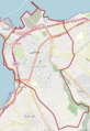
Request for a pushpin map for Tripoli, Lebanon
edit-
 Open source image from commons with rough city limits
 -
 Open source image from commons with rough city limits 2
_OSM_01.png)
_OSM_02.png)
- Article(s)
- Tripoli, Lebanon
- All articles pertaining to city landmarks in Tripoli
- Request
- I would like to request a pushpin map for Tripoli, Lebanon, to be used on all pages related to locations within the city. This would greatly enhance the geographical context for readers and contribute to the overall quality of the articles. For your reference, I have included two links:
- A link showcasing the neighborhoods within the city on on page 7 map. Please don't include al-Mina, Beddaoui, Mejdlaya, and other areas outside of the city limits.
- A link showcasing the neighborhoods within the city on on page 7 map. Please don't include al-Mina, Beddaoui, Mejdlaya, and other areas outside of the city limits.
- Thank you for considering this request. -- el.ziade (talkallam) 18:29, 15 October 2024 (UTC)
- Discussion
- @Syced, Did you know that we already have a way to show landmarks in the vicinity?
- For instance:
- Click on the top right corner [ ] of these maps, to get a full screen map
- Click right bottom buttton "Show nearby articles"
- Groetjes, Peter (talk) 07:47, 22 November 2024 (UTC)


North Lebanon Branches

(Red colour is only used for clarity)
- I ended up making three maps. The list of articles grew too large, so splitting them up seemed right.
- Do you have suggestions for improvement?
- Do you want a border around the centre like in the example maps?
- Groetjes, Peter (talk) 22:49, 23 November 2024 (UTC)
Request: World map for for Information privacy law (80+ countries)
edit- Article(s)
- Information privacy law
- Request
- 80+ countries have an Information privacy law. I went to the article because I needed to see where in the world these are. Unfortunately there is no such map on the article. The paper cited in the article is from 2012 so I hope a better source can be found, but even a 2012 data map would be better than no map. Thanks a lot! -- Syced (talk) 02:35, 24 October 2024 (UTC)
- Discussion
- @Syced Why only ask a question and not provide the latest data?
- A quick search shows 2023 as the latest of 8 reports by the same author. 2024 seems not available.
- Graham Greenleaf (2023-02-10). "Global Data Privacy Laws 2023: 162 National Laws and 20 Bills".
- Graham Greenleaf (2023-05-09). "Global Tables of Data Privacy Laws and Bills (8th Ed.) 2023". » map data

Example of a small size (kb) world map - Would you be ok with a map like this one, if we'd leave out the states in CAN, USA, MEX, AUS, ...?
- Data Privacy Laws around the World
- Only Private Sector
- Both Private and Public
- Only Public Sector
- No data
- Groetjes, Peter (talk) 08:44, 22 November 2024 (UTC)
- @Groetjes, Peter Thanks a lot, it looks like you are better at finding data than me! Your example map looks great! :-) Syced (talk) 13:08, 22 November 2024 (UTC)

Request: Australia/Canada Abortion gestational Map by states and territory
edit- Article(s)
- Abortion in Australia
- Abortion in Canada
- Request
- I want one map of Australia by states and territory with each state territory abortion gestational rule. and one map for Canada.
(Australia)
| State or territory[1] | Status[1] | Details[1] | ||
|---|---|---|---|---|
| Australian Capital Territory[a] | Must be provided by medical doctor. Health Minister may set 50 metre exclusion zones for protests.[4][5] | |||
| New South Wales[b] | Beyond 22 weeks legal with two doctors' approval.[9] Safe access zones are set at 150 metres around abortion clinics.[10][11] | |||
| Northern Territory | Beyond 24 weeks legal with two doctors' approval.[12][13] Safe access zones of 150 metres provided around abortion clinics.[5] | |||
| Queensland[b] | Beyond 22 weeks legal with two doctors' approval. Safe access zones of 150 metres are provided around abortion clinics.[14][15][16] | |||
| South Australia | Beyond 22 weeks and 6 days legal with two doctors' approval.[17] Safe access zones of 150 metres provided around abortion clinics.[18] | |||
| Tasmania | Beyond 16 weeks legal with two doctors' approval. Safe access zones of 150 metres provided around abortion clinics.[5] | |||
| Victoria | Beyond 24 weeks legal with two doctors' approval. Safe access zones of 150 metres provided around abortion clinics.[5] | |||
| Western Australia[c] | Beyond 23 weeks legal with two doctors' approval. Safe access zones of 150 metres provided around abortion clinics.[21] |
(Canada)
| Region | Gestational limits[1] | # of providers[1] | Notes |
|---|---|---|---|
| 20 weeks | 5 | The province has abortion services accessible in Edmonton and Calgary.[22] All abortion services are offered.[23] | |
| 23 weeks and 6 days | 24 | The province is governed by the Access to Abortion Services Act, which limits political demonstrations outside abortion-providing facilities, doctor's offices, and doctor's homes to set distances. BC Women's Hospital & Health Centre can provide late-term abortions in Vancouver up until the 25th week of pregnancy (its CARE Program).[24] There are six abortion clinics throughout the province that can be accessed without a doctor referral and upwards of 30 hospitals that are required to perform abortions with a doctor's referral.[25][26] | |
| 19 weeks and 6 days | 4 | The province has limited access for those in rural communities. Aspiration or surgical procedures are available for up to 19 weeks and 6 days. Medical abortions up to 9 weeks.[27] | |
| 16 weeks | 5 | New Brunswick does not use public funding to pay for abortion services outside of hospital settings. This means that abortions provided in clinics are not funded by the government.[28] | |
| 15 weeks | 4 | Planned Parenthood Newfoundland and Labrador is the only sexual health clinic in the province.[29][3] Full spectrum doula services.[30] | |
| 19 weeks and 6 days | 1 | Northern Options for Women (abbreviated as NOW) provides both medical and surgical abortion services in the Northwest Territories and Nunavut.[31] | |
| 16 weeks | 11 | In Nova Scotia, there is an abortion clinic in Halifax or someone needing an abortion can call the abortion helpline for other options throughout the province that may be closer to them.[32] | |
| 12 weeks | 2 | All abortions must be performed in a hospital.[33] | |
| 23 weeks and 6 days | 38 | Intimidation of and interference with patients or providers are illegal in "safe access zones" around abortion-providing clinics and other requesting health care facilities; the offices (on request) of providing doctors, nurses, pharmacists and some other providers; and providers' homes under the Safe Access to Abortion Services Act, 2017.[34] There are nine regions in Ontario where abortion is available with full spectrum doula services.[30][3] | |
| 12 weeks and 6 days | 1 | Prince Edward Island offers in province abortions up until 12 weeks and 6 days pregnant. After that limit, an out of province surgical abortion would have to be performed. A referral must be obtained through a PEI physician prior to any surgical procedure.[35] | |
| 23 weeks and 6 days | 49 | The province has a multitude of options for abortion access.[36] Historically, late-term abortions (beyond 30 weeks) had to be performed in the US with all expenses paid by the Quebec government. This changed in 2020 because of Covid travel restrictions.[37] | |
| 18 weeks and 6 days | 3 | Few resources available to those in rural areas.[38] | |
| 12 weeks and 6 days | 1 | Whitehorse General Hospital is the only location in Yukon available for both medical and early aspiration abortions.[30][3] |
Muaza Husni (talk) 07:03, 25 October 2024 (UTC)
- Discussion
 Color-coded map illustrating availability of abortion in Canada, in weeks of embryonic age (from fertilization). Abortion is legal at all stages in Canada, but availability is subject to medical guidelines.Available first 12 weeks (PEI)Available first 13 weeksAvailable first 16 weeksAvailable first 19 weeksAvailable first 20 weeksAvailable first 24 weeksAvailable first 25 weeks
- @Muaza Husni, for clarification:
- Canada
- There's already a template that shows the Canadian situation: Is it OK (23 weeks + 6 days = 24 weeks)? Does it need an update? If so, what adjustments does it need?
- Australia
- {{Abortion map of Australia}} does not yet exist. Here's a map.svg that is related, but it doesn't portrait the limits nor the same style as the other maps on Abortion law#Comparative limits for countries with elective abortions.

Map Australia, Abortion legality - As an improvement of the map, I suggest to put a circle around the capitol, so it's way more visible what policy it has.
- 1) Do you want such an Australian map in the "Canadian style"?
- 2) Does the left map display the current Australian abortion laws? Or does it need an update?
- Groetjes, Peter (talk) 08:15, 22 November 2024 (UTC)
- @Groetjes, Peter Hi again, The Canadian map looks like the kind of map i wanted with the 'gestational age' (fertilization age), in weeks. The Australian map sadly doesn't have the 'gestational age' (fertilization age), in weeks. I would like the Australian abortion map to be like the Canadian and United states map with 'gestational age' (fertilization age), in weeks. It makes it simpler and similar. Thanks. Muaza Husni (talk) 01:39, 23 November 2024 (UTC)
- Just FYI, US gestational age differs from fertilization age by 2 weeks, and from pregnancy by 3 weeks [cf. the mexico map]. — kwami (talk) 04:58, 23 November 2024 (UTC)
- Let's not use confusing US standards / measurements in maps of other countries. The colours in the different maps are in sync, keeping in mind the differences kwami talked about.
- Canadian:
- What I need to know, with sources, is whether the map is up to date.
- Has Nunavut changed its medical guidelines from up to 20 weeks, down to up to 12 weeks?
- Has Manitoba changed its medical guidelines from 16 weeks, to up to 20 weeks (19w+6d)?
- Australian:
- I'll make the map, based on the data in the above table.
- I know it's a slightly different map, but it would be nice if you could look into the laws behind it, to see if it's still up to date.
- I'm just a mapmaker, not an expert on every topic. As a mapmaker, I think this old map displays the capitol policy very poorly. I'd like to improve it, but when I don't know whether things have changed, I'd better not.
- legend:
- Legal on request
- Legal for maternal life, rape, health, fetal defects, mental health, economic factors, and/or social factors
- Legal for maternal life, rape, health, fetal defects, and/or mental health
- Legal for maternal life, health, and/or mental health
- Groetjes, Peter (talk) 08:43, 23 November 2024 (UTC)
- Just FYI, US gestational age differs from fertilization age by 2 weeks, and from pregnancy by 3 weeks [cf. the mexico map]. — kwami (talk) 04:58, 23 November 2024 (UTC)


References
- ^ a b c d e f Cite error: The named reference
Actionwas invoked but never defined (see the help page). - ^ "Jervis Bay Territory Acceptance Act 1915". 2 October 2001., Federal Register of Legislation.
- ^ a b c d e "No-cost abortions now available in the ACT". Government of the Australian Capital Territory. 20 April 2023. Archived from the original on 28 April 2023.
- ^ Cite error: The named reference
nolimitwas invoked but never defined (see the help page). - ^ a b c d Children by Choice Assoc, "Australian Abortion Law". Archived from the original on 31 March 2021. Retrieved 12 April 2017.
- ^ Norfolk Island Applied Laws Ordinance 2016, Federal Register of Legislation.
- ^ Norfolk Island Applied Laws and Service Delivery (Queensland) Ordinance 2021, Federal Register of Legislation.
- ^ Criminal Code 2007 (NI), Federal Register of Legislation.
- ^ "Reproductive Health Care Reform Bill". Parliament of New South Wales. Retrieved 3 October 2019.
- ^ "Abortion 'safe-access zones' laws passed in NSW". SBS News.
- ^ Visentin, Lisa (7 June 2018). "Abortion clinic "safe access zones" become law in NSW". The Sydney Morning Herald.
- ^ "Explainer: Is abortion legal in Australia and what are the laws in each state?". the Guardian. 27 June 2022.
- ^ Perera, Alicia; Mabin, Saskia (1 December 2021). "Abortion laws making it easier to terminate later-term pregnancies passed by NT parliament". ABC News. Archived from the original on 1 December 2021.
- ^ "Abortion legalised in Queensland after historic vote in Parliament". ABC News. 19 October 2018.
- ^ "Termination of Pregnancy Act 2018". legislation.qld.gov.au.
- ^ "Proclamation made under the Termination of Pregnancy Act 2018". legislation.qld.gov.au.
- ^ ""Historic day for women" as abortion officially decriminalised in South Australia". SBS News. 3 March 2021. Archived from the original on 3 March 2021. Retrieved 3 March 2021.
- ^ "LZ". 22 November 2021.
- ^ "Christmas Island Act 1958". 18 December 2020., Federal Register of Legislation.
- ^ "Cocos (Keeling) Islands Act 1955". 18 December 2020., Federal Register of Legislation.
- ^ Cite error: The named reference
wasafewas invoked but never defined (see the help page). - ^ "Abortion Services". Alberta Health Services. Retrieved 2020-10-16.
- ^ "Abortion". myhealth.alberta.ca.
- ^ "Abortion Services". www.bcwomens.ca. Retrieved 2020-10-16.
- ^ "THE PRO-CHOICE ACTION NETWORK". www.prochoiceactionnetwork-canada.org. Retrieved 2020-10-16.
- ^ "Abortion". HealthLink BC.
- ^ "Abortion | Women's Health Clinic".
- ^ "New Brunswick abortion restriction lifted by Premier Brian Gallant". CBC News. 26 November 2014. Retrieved 2 February 2018.
- ^ "Clinics". Planned Parenthood - NL Sexual Health Centre. Retrieved 2020-10-16.
- ^ a b c Cite error: The named reference
Clinicswas invoked but never defined (see the help page). - ^ "Northern Options for Women (NOW)". Northwest Territories Health and Social Services Authority. Retrieved 2020-10-16.
- ^ "Nova Scotia Women's Choice Clinic | Nova Scotia Health Authority". www.nshealth.ca. Retrieved 2020-10-16.
- ^ "Abortion | IRespectMyself". www.irespectmyself.ca.
- ^ Safe Access to Abortion Services Act, 2017, S.O. 2017, c. 19, Sched. 1
- ^ "Abortion Services". www.princeedwardisland.ca. 2018-01-31. Retrieved 2020-10-16.
- ^ "Abortion services". www.quebec.ca.
- ^ "Des avortements tardifs faits au Québec à cause de la COVID". August 3, 2021.
- ^ "Abortion Services". www.rqhealth.ca.
- ^ Also applies to Jervis Bay Territory.[2]
- ^ a b Most laws of New South Wales and Queensland, including their abortion laws, are set to apply to Norfolk Island after 2026.[6][7] The Criminal Code of Norfolk Island, which remains in force in the territory, does not prohibit abortion.[8]
- ^ Also applies to Christmas Island and the Cocos (Keeling) Islands.[19][20]
Map of Sheetz and Wawa store locations in the U.S. state of Pennsylvania
edit- Article(s)
- Sheetz–Wawa rivalry
- Request
- I'd like to have a map showing all Sheetz and Wawa locations in Pennsylvania. The New York Times made one some time ago and I found a fairly recent ArcGIS web map with data points but don't know how to turn it into the Wikipedia map style. Dan Leonard (talk • contribs) 05:35, 28 October 2024 (UTC)
- Discussion

- Hi @Dan Leonard, I'm not familiar with ArcGIS data, but if you can copy the data tables, and select the Pennsylvanian nodes, you can convert them to a map like this one to the right. Click on edit source to see the code.
- Type, coord, title, description, marker and marker-color all have the same unique number per row.
- In this example, row3 defines a line around Pennsylvania (id3 = Wiki data id Q1400)
- If a quick selection isn't possible, you can always trim the dataset down by coords (Pennsylvania is pretty square).
- Groetjes, Peter (talk) 09:59, 22 November 2024 (UTC)
Map of Leagues Cup teams
edit

- Article(s)
- Leagues Cup
- Request
- The article Leagues Cup, a soccer tournament in North America, has a section on its format. I need help with displaying the locations of the teams from each organization into one single labeled map of all teams from Mexico (Liga MX teams shown at bottom), Canada, and the US (both countries' MLS teams shown at top). This format would have MLS team location dots in blue and Liga MX teams in green. This map doesn't have to have individual states shaded (as the one in MLS). I am hoping that an editor may help me with creating one, or if possible, may please create one for me. Here are the maps in question that are to be used for reference:
—𝚈𝚘𝚟𝚝 (𝚝𝚊𝚕𝚔𝚟𝚝) 20:52, 6 November 2024 (UTC)
- Discussion
- Would a map like on this page 2024–25 UCI Cyclo-cross World Cup be good? Viewers can [ ] enlarge the map to fullscreen mode and zoom in, show nearby articles.
- Leagues Cup Teams
- Western League name
- Eastern League name
- Liga Mexico
- Former Leagues Cup Teams
- Groetjes, Peter (talk) 08:59, 22 November 2024 (UTC)

Test 1: Using template MLS labeled map and location map Mexico.
Results:
- MLS is not in needed map coords: lookup coords stadiums in format 49.276667|-123.111944|Vancouver Whitecaps FC
- MEX map example is not in stadium, zoom in to see difference, lookup coords stadiums too.
- The old maps don't use any logo of the clubs. I'd suggest adding them to the labels: click on pins to see them. Click enlarge map to zoom/pan/check all the details. Reload to refresh map. San Jose = big logo 200px, the rest in 50px version.
Any ideas about what should be included in the descriptions?

- Test 2
- Hi @𝚈𝚘𝚟𝚝, did you see the maps? Any thoughts?
- A bot removed a lot of the logos from the map.
- We'll need to test whether they can be displayed through a template, if that counts as displaying the images on an article, which is allowed. This page doesn't count as an article... Groetjes, Peter (talk) 09:01, 23 November 2024 (UTC)
- Hello Groetjes, Peter, thank you for approaching my proposal. My apologies for not swiftly responding to your feedback. I have seen the map and at a glance, is very reminiscent of what I’m looking for. The map includes the needed coordinates without being cluttered with the individual team names. I appreciate your dedication. 𝚈𝚘𝚟𝚝 (𝚝𝚊𝚕𝚔𝚟𝚝) 02:15, 26 November 2024 (UTC)
Map request of Auckland region local government areas
editHello, I'm requesting a map of the former local government areas in the Auckland Region based on a map contained in this source: [1] (page 30) Traumnovelle (talk) 07:24, 12 November 2024 (UTC)
Attributing a Source Map
edit- Article(s)
- United States Climate Alliance
- Request
- I am trying to update the map for the United States Climate Alliance which seriously needs a new version with all the states correctly highlighted with better colors as well. I already have a new SVG file for it, (no need to make a new map on your end) but I have a question:
- My version derives from another file, so I want to attribute to it on the "File usage on commons" section below. How does that work?
BrakeCoach (talk) 22:55, 13 November 2024 (UTC)
- Discussion
Hi @BrakeCoach, It does not work that way. Usage on commons refers to files that are used in infoboxes, galleries and such. Commons is not Wikipedia, so I won't edit those. The flag is an example of usage on Commons.
You can use the description of your file to honour the original file/user. Enter it while uploading, or edit the Summary on Commons, once you've uploaded it. The blue warning sign sums up the other signs in a coloured series. You might click edit of said paragraph and see how this particular example is coded.
~~~~
PS: can you please sign your replies and entries with four ~ tildes? They leave your name and timestamp. Groetjes, Peter (talk) 10:48, 22 November 2024 (UTC)
- Thank you for letting me know, I am pretty new with everything, so I didn't know where to ask, I think I have asked the question in 2ish different places here. I realized that I just had to ask to gain edit access from wikimedia commons.
- BrakeCoach (talk) 04:41, 24 November 2024 (UTC)
Request: Map of The laws in Wales Acts along the Wales-England
editI have been recommended to do this I am hoping you can help make a SVG map based on these images:


The images in Question were mainly based off sources such as
- Rees maps
- Historic county trust
- RCAHMW[Commotes and Cantrefs ect]
If you want to know more about sources used, please ask. Lastly, im fairly sure the asthetic sould look professional in a way sombody like me could not recreate to meet the standards of some people anyway im sure you guys know what you're doing when it comes to this. Editor account 2222 (talk) 23:52, 15 November 2024 (UTC)
Roger Waters' Berlin Wall concert
edit- Article(s)
- The Wall – Live in Berlin
- Request
- Please will sone kindly take a modern map of the relevant part of Berlin city centre, and overlay the perimeter and stage ("Bühne") of the above concert, based on the diagram seen part-way down this web page? Andy Mabbett (Pigsonthewing); Talk to Andy; Andy's edits 14:07, 17 November 2024 (UTC)
- Discussion
Okinawa Island (not prefecture) location map
edit-
 An existing topo map of Okinawa

- Article(s)
- Shō Taikyū
- Request
- Howdy. I'm looking for a map of Okinawa Island itself that will work with Template:Location map. Currently, it seems like only a map of the Ryukyu Islands and the Okinawa Prefecture exist with it, which are much too big for what I'm looking for. This would be useful to mark the locations of individual gusuku and other cultural heritage sites. -- Generalissima (talk) (it/she) 17:04, 24 November 2024 (UTC)
- Discussion