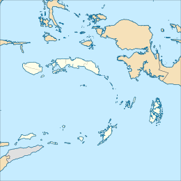
Waigeo is an island in the Southwest Papua province of eastern Indonesia. The island is also known as Amberi or Waigiu. It is the largest of the four main islands in the Raja Ampat Islands archipelago, between Halmahera and about 65 kilometres (40 miles) to the northwest coast of New Guinea. The Dampier Strait (a.k.a. Augusta's Strait) separates it from Batanta, and the Bougainville Strait from the Kawe Islands to its northwest. The "inner sea" that nearly cleaves the island in two is Mayalibit Bay, also known as the Majoli Gulf.[1][2]
Location in Raja Ampat Islands Location in Papua | |
| Geography | |
|---|---|
| Coordinates | 0°12′S 130°50′E / 0.200°S 130.833°E |
| Archipelago | Raja Ampat Islands |
| Area | 3,155 km2 (1,218 sq mi) |
| Highest elevation | 958 m (3143 ft) |
| Highest point | Buffalo Horn |
| Administration | |
Indonesia | |
| Province | Southwest Papua |


The area of the island is 3,155 square kilometres (1,218 square miles); the highest elevations are 958-metre-high (3,143-foot) Buffalo Horn (Gunung Nok) and 939-metre-high (3,081-foot) Serodjil.[3] From west to east, the island measures approximately 110 km (68 mi), north–south about 50 kilometres (31 miles).
The town of Waisai in the south of the island is the capital of the Raja Ampat Regency.
History
editWaigeo was connected to Gam and Batanta during most of the Pleistocene period, forming an island called Waitanta.[4] Waitanta was first inhabited by humans over 50,000 years ago and excavations at Mololo Cave indicate people were making tree resin artefacts and hunting native animals.[5] The first pottery-making communities were present around Waigeo about 3500–3000 years ago and may have brought Austronesian languages to the area.[6]
Jorge de Menezes, a Portuguese explorer, may have landed on Waigeo Island in 1526–27.[7]
Islam first arrived in the Raja Ampat archipelago in the 15th century due to political and economic contacts with the Bacan Sultanate.[8] During the 16th and 17th centuries, the Sultanate of Tidore had close economic ties with the island.[8][9] During this period, Islam became firmly established, and local chiefs began adopting Islam.[9]
Alfred Russel Wallace spent some time on the island and studied the flora and fauna during the late 1850s while on his scientific exploration trip.
Since 1997, the island has been the site of a substantial pearl farming operation owned by the Australian company Atlas Pacific.[citation needed]
Languages
editLanguages spoken on Waigeo include Papuan Malay, Biak, Ma'ya, and Ambel.[10] Their distributions within the island are given below.[11]: 5
Fauna and flora
edit- Waigeo brushturkey (Aepypodius bruijnii)
- Waigeou cuscus (Spilocuscus papuensis)
- Waigeo rainbowfish (Melanotaenia catherinae)
- Waigeo seaperch (Psammoperca waigiensis)
- Wilson's bird-of-paradise (Diphyllodes respublica)
- Golden-spotted tree monitor (Varanus boehmei)
- Achaea simplex
- Hypochlorosis ancharia
- Hypolycaena phorbas
- Karstarma waigeo
- Nepenthes danseri
Protected Areas
editReferences
edit- ^ Straelen, Victor Émile van (1930). ... Résultats scientifiques du voyage aux Indes Orientales Néerlandaises de LL AA RR le prince et la princesse Léopold de Belgique (in French). Musée royale d'histoire naturelle de Belgique.
- ^ "Raja Ampat Marine Park Authority". Kawasan Konservasi Perairan di Raja Ampat. Retrieved 2024-09-20.
- ^ Pub164, 2004 Sailing Directions (Enroute): New Guinea
- ^ Gaffney, Dylan; Tanudirjo, Daud A.; Djami, Erlin Novita Idje; Mas'ud, Zubair; Macap, Abdul Razak; Russell, Tristan; Dailom, Moses; Ray, Yulio; Higham, Thomas; Bradshaw, Fiona; Petchey, Fiona; Florin, S. Anna; Roberts, Patrick; Lucas, Mary; Tromp, Monica (2024-08-13). "Human dispersal and plant processing in the Pacific 55 000–50 000 years ago". Antiquity: 1–20. doi:10.15184/aqy.2024.83. hdl:11568/1264968. ISSN 0003-598X.
- ^ Tanudirjo, Daud Aris; Gaffney, Dylan (2024-08-12). "New evidence from West Papua offers fresh clues about how and when humans first moved into the Pacific". The Conversation. Retrieved 2024-09-03.
- ^ Gaffney, Dylan; Tanudirjo, Daud (2024). "Late Holocene potting traditions in the far western Pacific: Evidence from the Raja Ampat Islands, 3500–1000 BP" (PDF). Terra Australis. 57: 359–390 – via ANU Press.
- ^ Gaffney, Dylan; Tanudirjo, Daud; Arnold, Laura; Gaman, Wolter; Russell, Tristan; Djami, Erlin; Macap, Abdul (2024-05-23). "Five Centuries of Settlement Dynamics and Mobility in the Northern Raja Ampat Islands of West Papua". The Journal of Pacific History: 1–41. doi:10.1080/00223344.2024.2328015. ISSN 0022-3344.
- ^ a b Wanggai, Toni V. M. (2008). Rekonstruki sejarah umat Islam di tanna Papua [Reconstruction of the History of lslam in Papua]. Syariff Hidayatullah State Islamic University Jakarta (in Indonesian). Retrieved 2022-03-13.
- ^ a b Slama, Martin (2015), "Papua as an Islamic Frontier: Preaching in 'the Jungle' and the Multiplicity of Spatio-Temporal Hierarchisations", From 'Stone-Age' to 'Real-Time': Exploring Papuan Temporalities, Mobilities and Religiosities, ANU Press, pp. 243–270, ISBN 978-1-925022-43-8
- ^ Remijsen, Bert, 2001. Word Prosodic systems of the Raja Ampat languages. Utrecht: LOT Publications.
- ^ Arnold, Laura Melissa (2018). Grammar of Ambel, an Austronesian language of Raja Ampat, west New Guinea (PhD). University of Edinburgh. hdl:1842/31120.
- ^ "Protected Planet | Waigeo Barat Timur". Protected Planet. Retrieved 2024-09-20.
- ^ "Raja Ampat Marine Park Authority". Kawasan Konservasi Perairan di Raja Ampat. Retrieved 2024-09-20.
External links
edit- Media related to Waigeo at Wikimedia Commons

