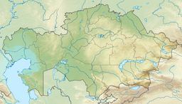
Toraigyr (Kazakh: Торайғыр) is a lake in Bayanaul District, Pavlodar Region, Kazakhstan.[1][2]
| Toraigyr | |
|---|---|
| Торайғыр | |
 Panorama of the lake | |
| Location | Bayanaul Range |
| Coordinates | 50°52′N 75°39′E / 50.867°N 75.650°E |
| Type | Tectonic |
| Catchment area | 12.9 square kilometers (5.0 sq mi) |
| Basin countries | Kazakhstan |
| Max. length | 1.8 kilometers (1.1 mi) |
| Max. width | 0.6 kilometers (0.37 mi) |
| Surface area | 0.88 square kilometers (0.34 sq mi) |
| Average depth | 6 meters (20 ft) |
| Max. depth | 11 meters (36 ft) |
| Shore length1 | 5 kilometers (3.1 mi) |
| Surface elevation | 345 meters (1,132 ft) |
| Settlements | Bayanaul |
| 1 Shore length is not a well-defined measure. | |
Toraigyr falls within the perimeter of the Bayanaul National Park, a protected area.[3] The lake is one of the places in Kazakhstan named after Kazakh poet Sultanmahmut Toraygirov.[4]
Geography
editToraigyr is an elongated lake that lies in the Bayanaul Range, below the slopes of the northern side of the mountains. It is the third largest lake of the Bayanaul area. Mount Akbet, the highest point of the range, is located nearby. There are two rocky islets near the southwestern end of the lake. Part of the shore is rocky and the water is slightly brackish.[2][4]
Toraigyr village lies close to the western shore of the lake. The nearest town is Bayanaul, located 8 kilometers (5.0 mi) to the southeast.[4]
Fauna
editThe main fish species in Toraigyr lake are carp and perch.[5]
See also
editReferences
edit- ^ "M-43 Topographic Chart (in Russian)". Retrieved 29 July 2022.
- ^ a b Google Earth
- ^ Toraigyr lake in Bayanaul
- ^ a b c Kazakhstan National encyclopedia, Volume VIII; Chief editor A. Nysanbayev - Almaty "Kazakh encyclopedia" General editor, 1998. ISBN 5-89800-123-9
- ^ Bayanaul National Park, Kazakhstan
External links
edit- Media related to Toraigyr at Wikimedia Commons
- Legends of Bayanaul • Toraigyr kal
- Toraigyr lake - WildTicket Asia
