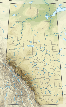
Sibbald is a hamlet in southern Alberta, Canada within Special Area No. 3.[2][3] It is located on Highway 9, approximately 10 kilometres (6.2 mi) west of the provincial border with Saskatchewan and 154 kilometres (96 mi) northeast of Medicine Hat.
Sibbald | |
|---|---|
| Coordinates: 51°23′18″N 110°09′01″W / 51.38833°N 110.15028°W | |
| Country | Canada |
| Province | Alberta |
| Region | Southern Alberta |
| Census division | 4 |
| Special area | Special Area No. 3 |
| Government | |
| • Type | Unincorporated |
| • Governing body | Special Areas Board |
| Population (1991)[1] | |
• Total | 33 |
| Time zone | UTC−07:00 (MST) |
| • Summer (DST) | UTC−06:00 (MDT) |
| Area code(s) | 403, 587, 825 |
Climate
editSibbald experiences a semi-arid climate (Köppen climate classification BSk). Winters are cold, while summers are warm to hot, and dry. Precipitation is generally low year round, with an annual average of 313.8 millimetres (12.35 in), and is heavily concentrated in the warmer months.
| Climate data for Sibbald | |||||||||||||
|---|---|---|---|---|---|---|---|---|---|---|---|---|---|
| Month | Jan | Feb | Mar | Apr | May | Jun | Jul | Aug | Sep | Oct | Nov | Dec | Year |
| Record high °C (°F) | 11.1 (52.0) |
11.7 (53.1) |
21.5 (70.7) |
31.0 (87.8) |
36.5 (97.7) |
37.5 (99.5) |
38.5 (101.3) |
40.6 (105.1) |
36.1 (97.0) |
29.4 (84.9) |
21.5 (70.7) |
14.5 (58.1) |
40.6 (105.1) |
| Mean daily maximum °C (°F) | −10.4 (13.3) |
−5.6 (21.9) |
1.0 (33.8) |
12.3 (54.1) |
18.2 (64.8) |
22.4 (72.3) |
25.3 (77.5) |
25.2 (77.4) |
18.9 (66.0) |
11.7 (53.1) |
1.0 (33.8) |
−6.7 (19.9) |
9.4 (48.9) |
| Daily mean °C (°F) | −16.5 (2.3) |
−11.6 (11.1) |
−4.9 (23.2) |
5.0 (41.0) |
10.7 (51.3) |
15.1 (59.2) |
17.7 (63.9) |
17.2 (63.0) |
11.2 (52.2) |
4.4 (39.9) |
−5.0 (23.0) |
−12.6 (9.3) |
2.6 (36.7) |
| Mean daily minimum °C (°F) | −22.4 (−8.3) |
−17.6 (0.3) |
−10.7 (12.7) |
−2.2 (28.0) |
3.2 (37.8) |
7.7 (45.9) |
10.2 (50.4) |
9.1 (48.4) |
3.5 (38.3) |
−3.0 (26.6) |
−11.1 (12.0) |
−18.3 (−0.9) |
−4.3 (24.3) |
| Record low °C (°F) | −46.1 (−51.0) |
−43.3 (−45.9) |
−40.0 (−40.0) |
−30.0 (−22.0) |
−10.0 (14.0) |
−5.0 (23.0) |
0.6 (33.1) |
−1.5 (29.3) |
−9.0 (15.8) |
−27.0 (−16.6) |
−38.0 (−36.4) |
−43.9 (−47.0) |
−46.1 (−51.0) |
| Average precipitation mm (inches) | 13.7 (0.54) |
9.0 (0.35) |
16.7 (0.66) |
19.4 (0.76) |
38.4 (1.51) |
65.2 (2.57) |
54.3 (2.14) |
34.7 (1.37) |
23.2 (0.91) |
12.6 (0.50) |
12.4 (0.49) |
14.1 (0.56) |
313.8 (12.35) |
| Source: Environment Canada[4] | |||||||||||||
Demographics
editSibbald recorded a population of 33 in the 1991 Census of Population conducted by Statistics Canada.[1]
See also
editReferences
edit- ^ a b c 91 Census (PDF). Population and Dwelling Counts. Vol. Unincorporated Places. Ottawa: Statistics Canada. 1993. Retrieved September 26, 2024.
- ^ "Specialized and Rural Municipalities and Their Communities" (PDF). Alberta Municipal Affairs. June 3, 2024. Retrieved June 14, 2024.
- ^ Statistics Canada (5 March 2010). "Standard Geographical Classification 2006 – Special Area No. 3, geographical codes and localities, 2006". Archived from the original on 6 July 2011. Retrieved 11 July 2010.
- ^ "Canadian Climate Normals 1971-2000 Station Data - Climate - Environment and Climate Change Canada". climate.weather.gc.ca. Environment and Climate Change. January 19, 2011. Retrieved May 19, 2020.
- ^ Ninth Census of Canada, 1951 (PDF). Vol. SP-7 (Population: Unincorporated villages and hamlets). Dominion Bureau of Statistics. March 31, 1954. Retrieved September 22, 2024.
- ^ Census of Canada, 1956 (PDF). Vol. Population of unincorporated villages and settlements. Dominion Bureau of Statistics. October 25, 1957. Retrieved September 23, 2024.
- ^ 1961 Census of Canada: Population (PDF). Series SP: Unincorporated Villages. Vol. Bulletin SP—4. Ottawa: Dominion Bureau of Statistics. April 18, 1963. Retrieved September 25, 2024.
- ^ Census of Canada 1966: Population (PDF). Special Bulletin: Unincorporated Places. Vol. Bulletin S–3. Ottawa: Dominion Bureau of Statistics. 1968. Retrieved September 25, 2024.
- ^ 1971 Census of Canada: Population (PDF). Special Bulletin: Unincorporated Settlements. Vol. Bulletin SP—1. Ottawa: Statistics Canada. 1973. Retrieved September 25, 2024.
- ^ "Geographical Identification and Population for Unincorporated Places of 25 persons and over, 1971 and 1976". 1976 Census of Canada (PDF). Supplementary Bulletins: Geographic and Demographic (Population of Unincorporated Places—Canada). Vol. Bulletin 8SG.1. Ottawa: Statistics Canada. 1978. Retrieved September 26, 2024.
- ^ 1981 Census of Canada (PDF). Place name reference list. Vol. Western provinces and the Territories. Ottawa: Statistics Canada. 1983. Retrieved September 26, 2024.
- ^ 1986 Census of Canada (PDF). Population. Vol. Unincorporated Places. Ottawa: Statistics Canada. 1988. Retrieved September 26, 2024.

