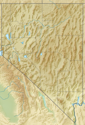
Railroad Valley is one of the Central Nevada Desert Basins in the Tonopah Basin and is about 80 miles (130 km) long north–south and up to 20 miles (32 km) wide, with some southern areas running southwest to northeast.[2]
| Railroad Valley | |
|---|---|
 State Route 375 through Railroad Valley with the Quinn Canyon Range in the distance | |
| Floor elevation | 7,036 to 10,745 ft (2,145 to 3,275 m) |
| Length | 80 mi (130 km) N–S |
| Width | 20 mi (32 km) SW–NE |
| Area | 90 sq mi (230 km2) |
| Geography | |
| Country | United States |
| State | Nevada |
| Region | Nye and White Pine County |
| Borders on | |
| Coordinates | 38°41′14″N 115°29′28″W / 38.68722°N 115.49111°W [1] |
Description
editThe southern end of the valley begins near Gray Top Mountain (elevation 7,036 feet [2,145 m]) and stretches north all the way to Mount Hamilton (elevation 10,745 feet [3,275 m]). To the east are the Quinn Canyon, Grant, and White Pine Ranges, while to the west are the Pancake and Reveille Ranges. Most of the valley lies in Nye County, but it crosses into White Pine County at its northern end.[3] The valley includes numerous springs including Kate Springs and Blue Eagle Springs,[1] ranches such as the Blue Eagle Ranch,[4] and 2 Tonopah Playas.
The valley has 4 separate Wildlife Management Areas ("Railroad Valley WMA"), and valley communities include Currant, Crows Nest, Green Springs, Lockes, and Nyala. The valley is the ancestral home of the Tsaidüka band of Western Shoshone, who are now enrolled in the Duckwater Shoshone Tribe of the Duckwater Reservation.[5]
Natural resources
editMost of Nevada's oil production (totalling about 553,000 barrels during 2002) comes from several small oil fields in Railroad Valley, including Eagle Springs, Trap Spring, and Grant Canyon oil fields.[3] The first well was drilled in 1954 by Shell Oil Company.[6][7] The Eagle Springs Field, as it came to be known, included 14 wells with an average production of approximately 20,000 barrels per well per year by 1968. Only 10 wells remained by 1985 producing approximately 3.8 million barrels in total. By 1986, when a second oil field was discovered by Northwest Exploration Co, the Valley had 27 wells producing 6.8 millions.[7][8]
The Valley also contains a playa with a lithium deposit which is "one of the 10 largest in the world and the largest in North America, with salt deposits 2,000 feet thick."[9]
NASA has used the flat ground for calibrating satellite geodesy, space-based radar, and height measurements, since the 1990s. In June 2023, NASA asked the USA's Bureau of Land Management to withdraw 36 sq mi (93 km2) from its inventory of federal lands open to potential mineral exploration and mining, in order that the calibration area was preserved.[10][11]
See also
editReferences
edit- ^ EROS Cal/Val Center of Excellence (ECCOE). "Railroad Valley Playa". USGS. Retrieved 10 September 2023.
- ^ U.S. Geological Survey Geographic Names Information System: Railroad Valley
- ^ a b Nevada Atlas & Gazetteer, 2001, pgs. 47, 55, and 61
- ^ McCracken, Robert D; Sharp Howerton, Jeanne (1996). A history of Railroad Valley, Nevada. Tonopah, NV: Central Nevada Historical Society. ISBN 978-0-9639119-6-4. OCLC 36634605.
- ^ "Duckwater Shoshone Tribe." Archived 2010-05-16 at the Wayback Machine Great Basin National Heritage Area. (retrieved 17 April 2010)
- ^ Moreno, Richard. "The Nevada Traveler: The vastness of Nevada become very real in Railroad Valley". www.nevadaappeal.com. Retrieved 10 September 2023.
- ^ a b "Oil & Gas Historical Summary". nbmg.unr.edu. Nevada Bureau of Mines and Geology. Retrieved 10 September 2023.
- ^ "North Grant Canyon Prospect Railroad Valley - Nye County, Nevada" (PDF). Houston Geological Society. 2010. p. 15. Retrieved 10 September 2023.
- ^ Vigliarolo, Brandon (26 June 2023). "NASA and miners face off over lithium deposits at satellite calibration site". The Register. Retrieved 26 June 2023.
- ^ "Public Lands Withdrawn in the Railroad Valley for NASA Satellite Calibration Activities | Bureau of Land Management". www.blm.gov. Bureau of Land Management. 26 April 2023. Retrieved 10 September 2023.
- ^ Sonner, Scott (23 June 2023). "NASA opposes lithium mining at tabletop flat Nevada desert site used to calibrate satellites". AP News. Retrieved 10 September 2023.
External links
editMedia related to Railroad Valley (Nevada) at Wikimedia Commons
