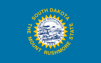
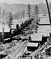
The South Dakota Portal South Dakota (/dəˈkoʊtə/ ; Sioux: Dakȟóta itókaga, pronounced [daˈkˣota iˈtokaga]) is a landlocked state in the North Central region of the United States. It is also part of the Great Plains. South Dakota is named after the Dakota Sioux tribe, which comprises a large portion of the population — with nine reservations currently in the state — and has historically dominated the territory. South Dakota is the 17th-largest by area, but the fifth-least populous, and the fifth-least densely populated of the 50 United States. Pierre is the state capital, and Sioux Falls, with a population of about 213,900, is South Dakota's most populous city. The state is bisected by the Missouri River, dividing South Dakota into two geographically and socially distinct halves, known to residents as "East River" and "West River". South Dakota is bordered by North Dakota to the north, Minnesota to the east, Iowa to the southeast, Nebraska to the south, Wyoming to the west, and Montana to the northwest. Humans have inhabited the area for several millennia, with the Sioux becoming dominant by the early 19th century. In the late 19th century, European-American settlement intensified after a gold rush in the Black Hills and the construction of railroads from the east. Encroaching miners and settlers triggered a number of Indian wars, ending with the Wounded Knee Massacre in 1890. As the southern part of the former Dakota Territory, South Dakota became a state on November 2, 1889, simultaneously with North Dakota. They are the 39th and 40th states admitted to the union; President Benjamin Harrison shuffled the statehood papers before signing them so that no one could tell which became a state first. Key events in the 20th century included the Dust Bowl and Great Depression, increased federal spending during the 1940s and 1950s for agriculture and defense, and an industrialization of agriculture that has reduced family farming. Eastern South Dakota is home to most of the state's population, and the area's fertile soil is used to grow a variety of crops. West of the Missouri River, ranching is the predominant agricultural activity, and the economy is more dependent on tourism and defense spending. Most of the Native American reservations are in West River. The Black Hills, a group of low pine-covered mountains sacred to the Sioux, is in the southwest part of the state. Mount Rushmore, a major tourist destination, is there. South Dakota has a temperate continental climate, with four distinct seasons and precipitation levels ranging from moderate in the east to semi-arid in the west. The state's ecology features species typical of a North American grassland biome. (Full article...) Selected article -The Black Hills is an isolated mountain range rising from the Great Plains of North America in western South Dakota and extending into Wyoming, United States. Black Elk Peak, which rises to 7,242 feet (2,207 m), is the range's highest summit. The name of the range in Lakota is Pahá Sápa. It encompasses the Black Hills National Forest. It formed as a result of an upwarping of ancient rock, after which the removal of the higher portions of the mountain mass by stream erosion produced the present-day topography. The hills are so called because of their dark appearance from a distance, as they are covered in evergreen trees. American Indian tribes have a long history in the Black Hills and consider it a sacred site. After conquering the Cheyenne in 1776, the Lakota took the territory of the Black Hills, which became central to their culture. In 1868, the federal US government signed the Fort Laramie Treaty of 1868, establishing the Great Sioux Reservation west of the Missouri River, and exempting the Black Hills from all non-indigenous settlement “forever”; however, when American settlers discovered gold here as a result of George Armstrong Custer's Black Hills Expedition in 1874, a gold rush swept in miners. The US government conquered the Black Hills and forcibly relocated the Lakota, following the Great Sioux War of 1876, to five smaller reservations in western South Dakota, selling off 9 million acres (36,000 km2) of their former land. Unlike most of South Dakota, the Black Hills were settled primarily by European Americans from population centers to the west and south of the region, as miners flocked there from earlier gold boom locations in Colorado and Montana. (Full article...) CategoriesRelated portalsEntries here consist of Good and Featured articles, which meet a core set of high editorial standards.
The Treaty of Fort Laramie (also the Sioux Treaty of 1868) is an agreement between the United States and the Oglala, Miniconjou, and Brulé bands of Lakota people, Yanktonai Dakota, and Arapaho Nation, following the failure of the first Fort Laramie treaty, signed in 1851. The treaty is divided into 17 articles. It established the Great Sioux Reservation including ownership of the Black Hills, and set aside additional lands as "unceded Indian territory" in the areas of South Dakota, Wyoming, Nebraska, and possibly Montana. It established that the US government would hold authority to punish not only white settlers who committed crimes against the tribes but also tribe members who committed crimes and were to be delivered to the government, rather than to face charges in tribal courts. It stipulated that the government would abandon forts along the Bozeman Trail and included a number of provisions designed to encourage a transition to farming and to move the tribes "closer to the white man's way of life." The treaty protected specified rights of third parties not partaking in the negotiations and effectively ended Red Cloud's War. That provision did not include the Ponca, who were not a party to the treaty and so had no opportunity to object when the American treaty negotiators "inadvertently" broke a separate treaty with the Ponca by unlawfully selling the entirety of the Ponca Reservation to the Lakota, pursuant to Article II of this treaty. The United States never intervened to return the Ponca land. Instead, the Lakota claimed the Ponca land as their own and set about attacking and demanding tribute from the Ponca until 1876, when US President Ulysses S. Grant chose to resolve the situation by unilaterally ordering the Ponca removed to the Indian Territory. The removal, known as the Ponca Trail of Tears, was carried out by force the following year and resulted in over 200 deaths. (Full article...) General images -The following are images from various South Dakota-related articles on Wikipedia.
Did you know -
TopicsLargest citiesCities in South Dakota, with their populations (as of July 1, 2020, as enumerated by the 2020 United States census):
WikiProjectsNew articlesThis list was generated from these rules. Questions and feedback are always welcome! The search is being run daily with the most recent ~14 days of results. Note: Some articles may not be relevant to this project.
Rules | Match log | Results page (for watching) | Last updated: 2024-11-22 22:20 (UTC) Note: The list display can now be customized by each user. See List display personalization for details.
Associated WikimediaThe following Wikimedia Foundation sister projects provide more on this subject:
Sources
|


