The Nebraska PortalMigrating sandhill cranes (Antigone canadensis) depart their overnight roosting area in the Platte River near Kearney, Nebraska, at dawn (2015).
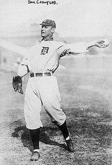
 Nebraska (/nəˈbræskə/ ⓘ nə-BRASS-kə) is a landlocked state in the Midwestern region of the United States. It borders South Dakota to the north; Iowa to the east and Missouri to the southeast, both across the Missouri River; Kansas to the south; Colorado to the southwest; and Wyoming to the west. Nebraska is the 16th-largest state by land area, with just over 77,220 square miles (200,000 km2). With a population of over 2 million as of 2024, it is the 38th-most populous state and the eighth-least densely populated. Its capital is Lincoln, and its most populous city is Omaha, which is on the Missouri River. Nebraska was admitted into the United States in 1867, two years after the end of the American Civil War. The Nebraska Legislature is unlike any other American legislature in that it is unicameral, and its members are elected without any official reference to political party affiliation. Nebraska is one of only two states that divide electoral college votes by district, and is not winner-take-all. Nebraska is composed of two major land regions: the Dissected Till Plains and the Great Plains. The Dissected Till Plains region consists of gently rolling hills and contains the state's largest cities, Omaha and Lincoln. The Great Plains region, occupying most of western Nebraska, is characterized by treeless prairie. Eastern Nebraska has a humid continental climate while western Nebraska is primarily semi-arid. The state has wide variations between winter and summer temperatures; the variations decrease in southern Nebraska. Violent thunderstorms and tornadoes occur primarily during spring and summer, and sometimes in autumn. The Chinook wind tends to warm the state significantly in the winter and early spring. Indigenous peoples, including Omaha, Missouria, Ponca, Pawnee, Otoe, and various branches of the Lakota (Sioux) tribes, lived in the region for thousands of years before European discovery and exploration. The state is crossed by many historic trails, including that of the Lewis and Clark Expedition. The completion of the Transcontinental Railroad through Nebraska and passage of the Homestead Acts led to rapid growth in the population of American settlers in the 1870s and 1880s and the development of a large agriculture sector for which the state is known to this day. (Full article...) Selected article - Creighton Preparatory School (simply referred to as Creighton Prep or Prep) is a private, Jesuit high school for boys in Omaha, Nebraska, United States. It was established in 1878 under the name Creighton College and is located in the Archdiocese of Omaha. Creighton College was founded by John A. Creighton and named after Edward Creighton, developer of the transcontinental telegraph line. It was founded from a $100,000 grant and donated to the Catholic Church, leading to its inception as a Jesuit institution. Creighton College separated into Creighton University and Creighton Preparatory School in 1958. Over the 142 years since its founding, Creighton Prep has grown from an initial class of 120 students to a student body of 1021 individuals (2016). Creighton Prep holds a rivalry with Westside High School and is the recipient of nearly 200 individual State Championship and All State Championship titles. Creighton Prep has received the U.S. Department of Education Blue Ribbon Award for Academic Excellence and has its education programs are grounded in Jesuit Philosophies. Admittance is dependent on an annually held entrance exam. Creighton Prep was used as a site for the filming of Downsizing, a 2017 American science fiction comedy-drama film directed by Alexander Payne. (Full article...) Selected biography -Samuel Earl Crawford (April 18, 1880 – June 15, 1968), nicknamed "Wahoo Sam", was an American outfielder in Major League Baseball (MLB). Crawford batted and threw left-handed, stood 6 ft 0 in (1.83 m) tall and weighed 190 pounds (86 kg). Born in Wahoo, Nebraska, he had a short minor league baseball career before rapidly rising to the majors with the Cincinnati Reds in 1899. He played for the Reds until 1902. (Full article...) Counties (clickable map)General images -The following are images from various Nebraska-related articles on Wikipedia.
Did you know -
Related portalsTopicsLargest cities
CategoriesNew articlesThis list was generated from these rules. Questions and feedback are always welcome! The search is being run daily with the most recent ~14 days of results. Note: Some articles may not be relevant to this project.
Rules | Match log | Results page (for watching) | Last updated: 2024-12-25 20:54 (UTC) Note: The list display can now be customized by each user. See List display personalization for details.
WikiProjectsAssociated WikimediaThe following Wikimedia Foundation sister projects provide more on this subject:
Sources
|


