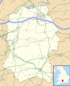
Pitton is a village in Wiltshire, England, about 7 miles (11 km) east of Salisbury, just off the A30 London Road.
| Pitton | |
|---|---|
 White Hill, Pitton | |
Location within Wiltshire | |
| Population | 751 (parish, in 2011)[1] |
| OS grid reference | SU212313 |
| Civil parish |
|
| Unitary authority | |
| Shire county | |
| Region | |
| Country | England |
| Sovereign state | United Kingdom |
| Post town | Salisbury |
| Postcode district | SP5 |
| Dialling code | 01722 |
| Police | Wiltshire |
| Fire | Dorset and Wiltshire |
| Ambulance | South Western |
| UK Parliament | |
| Website | Parish Council |
History
editA Roman road (now a bridleway) forms the northern boundary of the parish and is a scheduled monument.[2]
Local government
editThe civil parish of Pitton and Farley encompasses the villages of Pitton and Farley. The parish elects a parish council. It is in the area of Wiltshire Council unitary authority, which is responsible for all significant local government functions.
Churches
editThe Anglican Church of St Peter is Grade II* listed.[3][4] It dates from the 12th century and was restored in 1878–80 by Ewan Christian. There is a window by C.E. Kempe. The church was a chapelry of Alderbury until 1874 when the parish of Farley with Pitton was established, with Farley church as the parish church.[5] Today the parish is one of the ten covered by the Clarendon team ministry.[6]
A Wesleyan Methodist chapel was built in 1888 and extended with a schoolroom in 1934.[7] From 2008 to 2011 the building housed an independent school (Milford Park School) and in 2013 it was converted into two residential dwellings.[8]
Amenities
editThe village has a shop and post office, a pub (The Silver Plough), a park, a village hall and a small recreation ground. Pitton CE Primary School is on the western edge of the village.[9]
The Clarendon Way recreational footpath between Salisbury and Winchester passes through the village.
Buses into Pitton are run by Wilts & Dorset, serving two bus stops (one by the park, one at the crossroads). The main buses are the 88 & 89 to Winterslow, although there is also an X87.
References
edit- ^ "Pitton and Farley (Parish) - Population Density, 2011". Office for National Statistics. Retrieved 30 March 2015.
- ^ Historic England. "Roman road between A30 and Winterslow Corner (1005645)". National Heritage List for England. Retrieved 30 March 2015.
- ^ Historic England. "Church of St Peter, Pitton and Farley (1135702)". National Heritage List for England. Retrieved 30 March 2015.
- ^ "Church of St. Peter, Pitton". Wiltshire Community History. Wiltshire Council. Retrieved 30 March 2015.
- ^ "No. 24157". The London Gazette. 1 December 1874. pp. 5992–5995.
- ^ "St Peter's Church, Pitton". The Clarendon Team. Retrieved 8 November 2019.
- ^ "Wesleyan Methodist Chapel, Pitton". Wiltshire Community History. Wiltshire Council. Retrieved 30 March 2015.
- ^ "Planning Decision S/2012/1387/FULL" (PDF). Wiltshire Council. Archived from the original (PDF) on 2 April 2015. Retrieved 30 March 2015.
- ^ "Pitton Church of England Voluntary Aided Primary School". www.pitton.wilts.sch.uk. Retrieved 18 April 2024.
External links
editMedia related to Pitton at Wikimedia Commons
- "Pitton & Farley". Wiltshire Community History. Wiltshire Council. Retrieved 30 March 2015.
- Pitton and Farley Parish Council
- Pitton and Farley community website
