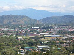
Palmares is a district of the Palmares canton, in the Alajuela province of Costa Rica.[1][2]
Palmares | |
|---|---|
 Skyline of Palmares | |
 Palmares district | |
| Coordinates: 10°03′19″N 84°25′58″W / 10.055229°N 84.4326974°W | |
| Country | |
| Province | Alajuela |
| Canton | Palmares |
| Area | |
| • Total | 1.14 km2 (0.44 sq mi) |
| Elevation | 1,017 m (3,337 ft) |
| Population (2011) | |
| • Total | 3,599 |
| • Density | 3,200/km2 (8,200/sq mi) |
| Time zone | UTC−06:00 |
| Postal code | 20701 |
Geography
editPalmares has an area of 1.14 km2[3] and an elevation of 1,017 metres.[1] It is in the Central Valley (Valle Central), 6 kilometers southeast of the city of San Ramón, 38 kilometers northwest of the provincial capital city of Alajuela, and 56 kilometers from the national capital city of San Jose.
Demographics
edit| Census | Pop. | ±% p.a. |
|---|---|---|
| 1883 | 2,142 | — |
| 1892 | 741 | −11.13% |
| 1927 | 1,364 | +1.76% |
| 1950 | 1,643 | +0.81% |
| 1963 | 2,348 | +2.78% |
| 1973 | 3,083 | +2.76% |
| 1984 | 3,766 | +1.84% |
| 2000 | 4,105 | +0.54% |
| 2011 | 3,599 | −1.19% |
| 2022 | 2,940 | −1.82% |
| Source: Instituto Nacional de Estadística y Censos[4] Centro Centroamericano de Población[5] | ||
For the 2011 census, Palmares had a population of 3,599 inhabitants. [6]
Transportation
editRoad transportation
editThe district is covered by the following road routes:
Culture
editFiestas de Palmares
editDuring January the city hosts their 'Fiestas', a large fair organized by a local committee which have become along with Zapote in December, and Liberia in July, one of the largest fairs in the country. This fair lasts for two weeks, with two days of special note: the 'Tope' (a massive horseback riding parade through town) and the 'Carnaval' (carnival); it is said that during these days you can find over 500,000 people in Palmares. It ranks 2nd in most beer consumed in a yearly festival (after Oktoberfest)[citation needed][dubious – discuss]
References
edit- ^ a b "Declara oficial para efectos administrativos, la aprobación de la División Territorial Administrativa de la República N°41548-MGP". Sistema Costarricense de Información Jurídica (in Spanish). 19 March 2019. Retrieved 26 September 2020.
- ^ División Territorial Administrativa de la República de Costa Rica (PDF) (in Spanish). Editorial Digital de la Imprenta Nacional. 8 March 2017. ISBN 978-9977-58-477-5.
- ^ "Área en kilómetros cuadrados, según provincia, cantón y distrito administrativo". Instituto Nacional de Estadística y Censos (in Spanish). Retrieved 26 September 2020.
- ^ "Instituto Nacional de Estadística y Censos" (in Spanish).
- ^ Centro Centroamericano de Población de la Universidad de Costa Rica. "Sistema de Consulta a Bases de Datos Estadísticas" (in Spanish).
- ^ "Censo. 2011. Población total por zona y sexo, según provincia, cantón y distrito". Instituto Nacional de Estadística y Censos (in Spanish). Retrieved 26 September 2020.
