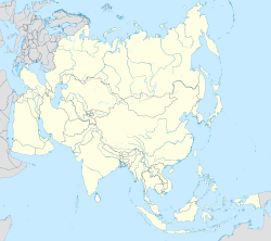
Old Malda is a census town in Malda district in the Indian state of West Bengal. It is a part of the Malda Metropolitan Area (Urban Agglomeration). It is located on the eastern bank of the river Mahananda.
Old Malda | |
|---|---|
City | |
| Coordinates: 25°02′N 88°08′E / 25.04°N 88.14°E | |
| Country | India |
| State | West Bengal |
| District | Malda |
| Government | |
| • Type | Municipality |
| • Body | Old Malda Municipality |
| • Chairman | Basistha Trivedi |
| Population (2011) | |
• Total | 84,012 |
| Languages | |
| • Official | Bengali[1][2] |
| • Additional official | English[1] |
| Time zone | UTC+5:30 (IST) |
| PIN | 732128, 732142 |
| Lok Sabha constituency | Maldaha Uttar |
| Vidhan Sabha constituency | Maldaha |
| Website | malda |
Geography
editOld Malda is located at 25°02′N 88°08′E / 25.04°N 88.14°E.[3]
Demographics
editAs of 2001[update] India census,[4] Old Malda had a population of 62,944. Males constitute 52% of the population and females 48%. Old Malda has an average literacy rate of 61%, higher than the national average of 59.5%: male literacy is 67%, and female literacy is 54%. In Old Malda, 15% of the population is under 6 years of age. Most of the people are Hindu. Some Muslim, Shikh, Christian people live here.
References
edit- ^ a b "Fact and Figures". www.wb.gov.in. Retrieved 15 January 2019.
- ^ "52nd Report of the Commissioner for Linguistic Minorities in India" (PDF). nclm.nic.in. Ministry of Minority Affairs. p. 85. Archived from the original (PDF) on 25 May 2017. Retrieved 15 January 2019.
- ^ "Yahoo maps location of Old Malda". Yahoo maps. Retrieved 7 December 2008.
- ^ "Census of India 2001: Data from the 2001 Census, including cities, villages and towns (Provisional)". Census Commission of India. Archived from the original on 16 June 2004. Retrieved 1 November 2008.


