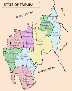
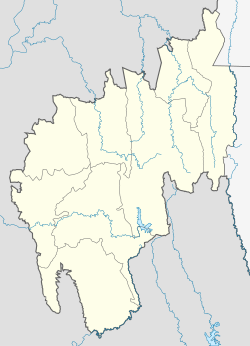
Mohanpur is a Municipal Council in Tripura, northeast India. It is the 10th largest town in the state and a subdivision of West Tripura district.[1]
Mohonpur | |
|---|---|
| Mohanpur | |
 | |
| Coordinates: 23°35′N 91°13′E / 23.58°N 91.22°E | |
| Country | India |
| State | Tripura |
| District | West Tripura |
| Legislative Assembly | Tripura Legislative Assembly |
| Government | |
| • Type | Municipal Council |
| • Chairman | Sri Motilal Das |
| • MLA | Ratan Lal Nath |
| Area | |
• City | 884 ha (2,184 acres) |
| Elevation | 45 m (148 ft) |
| Population (2011) | |
• City | 16,363 |
| • Rank | 10th |
| • Urban | 11,325 |
| Languages | |
| • Official | Bengali, English |
| Time zone | UTC+5:30 (IST) |
| PIN | 799211 |
| Area code | 0381 |
| Vehicle registration | TR 01 XX YYYY |
Mohanpur subdivision has a total of 30 village panchayats, among them Anangnagar is the most populated followed by Vijaynagar, brahmakunda, debendranagar.[2]
Demographics
editAccording to the 2011 census data, the total population of Mohanpur is 16,363. The number of males is 8,434 and the number of females is 7,929 Most of the population is urban with a number of 11,325, as well as, more than 5,050 people are from rural areas. Mohanpur had an average literacy rate of 80.43%, higher than the national average of 59.5%. The male literacy rate is 83.53% and female literacy rate is 77.13%.[3]
Forest
editIn the subdivision of Mohanpur there is a total of 73.869 km2 of forest land in which 73.869 km2 is Reserved forest .[4]
Transportation
editThe main transport system of the town is dependent on roadways. Mohanpur Road and Assam Agartala Road are the main roads. The town does not have any railway stations; the nearest railway station is at Jogendranagar. The distance of the town from the capital Agartala is about 23 km.[5]
Education
edit- Schools[6]
- MOHANPUR CLASS XII SCHOOL
- MOHANPUR GIRLS' H.S. SCHOOL
- TARAPUR HIGH SCHOOL
- MOHANPUR TEA GARDEN J.B SCHOOL
- GANDHIGRAM H.S. SCHOOL
- Colleges
References
edit- ^ "Subdivision & Blocks | West District, Government of Tripura | India". Retrieved 24 November 2022.
- ^ "STATEMENT SHOWING THE CATAGORY-WISE [sic] POPULATION OF GRAM PANCHAYATS VILLAGES UNDERDIFFERENT BLOCKS" (PDF). archive.ph. Retrieved 24 November 2022.
- ^ "PCA: Primary Census Abstract C.D. Block wise, Tripura - District West Tripura - 2011".
- ^ "Forest Department of Tripura". forest.tripura.gov.in. Retrieved 24 November 2022.
- ^ "Nearest Railway Stations to West Tripura Mohanpur Singarbil Tripura West Tripura - Search Nearest Railway Stations of Any Place". trainspy.com. Retrieved 24 November 2022.
- ^ "Affiliated Schools List as on 01.04 2020" (PDF).

