Lhünzê County (Tibetan: ལྷུན་རྩེ་རྫོང་།; Chinese: 隆子县, English: Lhöntse Dzong[2]) is a county of Shannan located in the south-east of the Tibet Autonomous Region, China. "Lhünzê" means "self-existing pinnacle" in Tibetan. Part of Lhünzê County is claimed by India as part of Arunachal Pradesh, which is a disputed area between China and India.[3]
Lhünzê County
隆子县 • ལྷུན་རྩེ་རྫོང་། Lhöntse | |
|---|---|
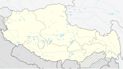
 Location of Lhünzê County (red) within Shannan City (yellow) and the Tibet Autonomous Region | |
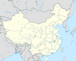
 The location of Lhünzê County in Shannan City (dark blue and light blue in the middle; disputed area contained) | |
| Coordinates: 28°49′56″N 93°16′25″E / 28.83222°N 93.27361°E | |
| Country | China |
| Autonomous region | Tibet |
| Prefecture-level city | Shannan (Lhoka) |
| County seat | Lhünzê |
| Area (de facto controlled) | |
• Total | 8,165 km2 (3,153 sq mi) |
| Population (2020)[1] | |
• Total | 33,570 |
| • Density | 4.1/km2 (11/sq mi) |
| Time zone | UTC+8 (China Standard) |
| Postal code | 856600 |
| Website | www |
| Lhünzê County | |||||||
|---|---|---|---|---|---|---|---|
| Chinese name | |||||||
| Simplified Chinese | 隆子县 | ||||||
| Traditional Chinese | 隆子縣 | ||||||
| |||||||
| Tibetan name | |||||||
| Tibetan | ལྷུན་རྩེ་རྫོང་། | ||||||
| |||||||
History
editDuring the Tibetan Empire period, this area was ruled by Nyal (gnyal), a stong-sde (lit. "general commanding one thousand soldiers") under the Left Horn (g.yon-ru). During the Yuan Dynasty, Qayü and Lhatruk were united to establish the Drupa Myriarch (gru-pa khri-skor). The Lhünzê Zong was officially established during Phagmodrupa dynasty. After 1912 Lhünzê was under the Governorate of Lhoka (lho kha spyi khyab), the Tibetan government listed Lhünzê Zong as one of the six first-class zong in the south of Lhoka (Shannan), where the fifth-grade officials were appointed as Dzongpon ("head of zong"). In August 1956, the Lhünzê Zong Office was established, under the leadership of the Shannan Branch Committee. In May 1959, Lhünzê, Qayü and Jora were merged to establish Lhünzê County.[4][5]
Geography
editLhünzê County covers an area of 10,566 square kilometers, and the actual control area is 8,165 square kilometers. The terrain is higher in the west and lower in the east, with an average altitude of 3,900 meters. The lowest point is Zhongna Village in Tsari Township and Doyü Village in Doyü Lhoba Ethnic Township, with an altitude of 3,000 meters. In the south are the Himalayas with an altitude of over 5,000 meters. The altitude of the middle and upper reaches of the mountains is between 3,900 and 4,300 meters, with wide river beaches and grasslands. Deeply formed valleys, there are Lhünzê River, Xiongqu, Luoluoqu, Jiaboqu, Yumenqu, Jijiaqu and other rivers, 65 large and small lakes, with a total area of 33 square kilometers, and groundwater reserves of more than 50 million cubic meters. The amount of resources that can be developed and utilized is 100,000 kilowatts, and there are 15 hydropower stations with a total installed capacity of 4,750 kilowatts. The annual average temperature is above 5 °C, the annual average sunshine hours are about 3,000 hours, the annual frost-free period is 238.3 days, and the annual average precipitation is 279.41 mm, mainly concentrated in May–October, accounting for 96.8% of the annual precipitation.[4][5]
The Subansiri River, the largest tributary of the Brahmaputra, is formed in the county. A number of sub-tributaries such as Tsari Chu, Charme Chu, Nye Chu and Loro Chu, flow through the county, and join in the adjoining Upper Subansiri district of Arunachal Pradesh in India.
Administrative divisions
editLhünzê County comprises 2 towns, 8 townships and 1 ethnic township:[6][7]
| Name | Chinese | Hanyu Pinyin | Tibetan | Wylie |
|---|---|---|---|---|
| Towns | ||||
| Lhünzê Town | 隆子镇 | Lóngzǐ zhèn | ལྷུན་རྩེ་གྲོང་རྡལ། | lhun rtse grong rdal |
| Ritang Town | 日当镇 | Rìdāng zhèn | རི་ཐང་གྲོང་རྡལ། | ri thang grong rdal |
| Townships | ||||
| Nyaimai Township | 列麦乡 | Lièmài xiāng | གཉལ་སྨད་ཤང་། | gnyil smad shang |
| Rirong Township | 热荣乡 | Rèróng xiāng | རི་རོང་ཤང་། | ri rong shang |
| Sangngagqoiling Township | 三安曲林乡 | Sān'ānqǔlín xiāng | གསང་སྔགས་ཆོས་གླིང་ཤང་། | gsang snags chos gling shang |
| Zhoinba Township | 准巴乡 | Zhǔnbā xiāng | སྒྲོན་པ་ཤང་། | sgron pa shang |
| Zhölsar Township | 雪萨乡 | Xuěsà xiāng | ཞོལ་གསར་ཤང་། | zhol gsal shang |
| Tsari Township | 扎日乡 | Zhārì xiāng | རྩ་རི་ཤང་། | rtsa ri shang |
| Yümai Township* | 玉麦乡 | Yùmài xiāng | ཡུལ་སྨད་ཤང་། | yul smad shang |
| Qayü Township | 加玉乡 | Jiāyù xiāng | བྱ་ཡུལ་ཤང་། | bya yul shang |
| Ethnic township | ||||
| Doyü Lhoba Ethnic Township | 斗玉珞巴民族乡 | Dòuyù Luòbā mínzúxiāng | མདོ་ཡུལ་ལྷོ་པ་མི་རིགས་ཤང་། | mdo yul slo pa mi rigs shang |
* includes areas claimed but currently under control of the Indian state of Arunachal Pradesh. | ||||
Climate
edit| Climate data for Lhünzê, elevation 3,860 m (12,660 ft), (1991–2020 normals) | |||||||||||||
|---|---|---|---|---|---|---|---|---|---|---|---|---|---|
| Month | Jan | Feb | Mar | Apr | May | Jun | Jul | Aug | Sep | Oct | Nov | Dec | Year |
| Mean daily maximum °C (°F) | 7.6 (45.7) |
9.1 (48.4) |
11.8 (53.2) |
14.4 (57.9) |
17.9 (64.2) |
21.2 (70.2) |
20.6 (69.1) |
20.1 (68.2) |
19.3 (66.7) |
16.0 (60.8) |
12.3 (54.1) |
9.4 (48.9) |
15.0 (59.0) |
| Daily mean °C (°F) | −4.0 (24.8) |
−1.5 (29.3) |
2.1 (35.8) |
5.5 (41.9) |
9.8 (49.6) |
13.6 (56.5) |
13.7 (56.7) |
13.1 (55.6) |
11.7 (53.1) |
6.8 (44.2) |
0.9 (33.6) |
−2.7 (27.1) |
5.8 (42.4) |
| Mean daily minimum °C (°F) | −13.2 (8.2) |
−10.6 (12.9) |
−6.5 (20.3) |
−2.2 (28.0) |
2.9 (37.2) |
7.6 (45.7) |
8.9 (48.0) |
8.3 (46.9) |
6.2 (43.2) |
−0.9 (30.4) |
−8.0 (17.6) |
−11.2 (11.8) |
−1.6 (29.2) |
| Average precipitation mm (inches) | 0.5 (0.02) |
0.7 (0.03) |
2.0 (0.08) |
9.9 (0.39) |
17.6 (0.69) |
43.8 (1.72) |
92.7 (3.65) |
77.8 (3.06) |
36.8 (1.45) |
8.9 (0.35) |
1.7 (0.07) |
1.3 (0.05) |
293.7 (11.56) |
| Average precipitation days (≥ 0.1 mm) | 0.9 | 0.9 | 2.3 | 6.3 | 8.6 | 14.0 | 21.2 | 19.7 | 13.3 | 3.1 | 0.9 | 0.4 | 91.6 |
| Average snowy days | 2.3 | 3.2 | 6.7 | 9.6 | 2.3 | 0.1 | 0 | 0 | 0.1 | 1.5 | 2.1 | 2.3 | 30.2 |
| Average relative humidity (%) | 47 | 47 | 48 | 51 | 53 | 57 | 65 | 66 | 62 | 55 | 51 | 50 | 54 |
| Mean monthly sunshine hours | 275.9 | 263.9 | 282.2 | 264.2 | 270.2 | 233.9 | 192.1 | 196.6 | 219.9 | 280.4 | 272.9 | 275.3 | 3,027.5 |
| Percent possible sunshine | 84 | 83 | 75 | 68 | 64 | 56 | 46 | 49 | 60 | 80 | 86 | 86 | 70 |
| Source: China Meteorological Administration[8][9] | |||||||||||||
Economy
editAt the end of 2017, the arable land area of Lhünzê County was 3269 hectares, the total sown area was 3365.93 hectares, and the sown area of grain crops was 2473.48 hectares, including 1789.22 hectares of highland barley, 320.25 hectares of wheat, 523.69 hectares of rape crops, 126.22 hectares of vegetables, 242.55 hectares of green fodder, and 242.55 hectares of grain crops in the county. The output is 18,910 tons, the rapeseed output is 1,060 tons, the number of livestock on hand at the end of the year is 162,660, the meat output is 3,101 tons, and the milk output is 8,026 tons.[10] It mainly raises yaks, cattle, horses, donkeys, mules, and pigs. The economic trees include wild Peaches, apples, etc. The industry is dominated by national handicrafts, with grain processing, hydropower, construction and other industries.[4][5] In 2018, the local GDP of Lhünzê County was 1,368.6 million yuan, of which the primary industry was 68.1 million yuan, the secondary industry was 1,046.3 million yuan, the tertiary industry was 254.2 million yuan, and the fixed asset investment of the whole society was 2,253.6 million yuan. The total retail sales of consumer goods was 148.9 million yuan, the industrial added value was 385.3 million yuan,[11] the per capita disposable income of rural residents was 10,536 yuan, and the per capita disposable income of urban residents was 28,597 yuan.[10]
Society
editIn the seventh census of China in 2020, the permanent population of Lhünzê County was 33,570, including 17,005 males, 16,565 females, 6,934 aged 0–14, 22,766 aged 15–59, 3,870 aged 60 and over, and 32,075 Tibetans. There are 1171 people of Han nationality and 324 people of other ethnic minorities. The urban population is 5,527, the rural population is 28,043, Lhünzê Town 8,371, Ritang Town 7,287, Nyaimai Township 1,949, Rirong Township 3,771, Sangngagqoiling Township 2,959, Zhoinba Township 429, Zhölsar has 4,006 people in the township, 739 in Tsari Township, 266 in Yümai Township, 3,183 in Qayü Township, and 610 in Doyü Lhoba Ethnic Township.[12] As of the end of 2017, there were 46 schools of all kinds in the county, including 1 junior middle school, 8 township primary schools, 13 teaching sites, 24 kindergartens, and 12 medical institutions in the county. There is 1 first-class hospital, 11 township hospitals, and 1114.52 kilometers of highways.[10]
Mining Controversy
editIn 2018, the Chinese government launched large-scale investments into mining precious metals like gold and silver from the region. This followed reports that rare earth minerals valued at over $60 billion had been found. Reports suggest that the gold rush has led to an unprecedented influx of people into the region. This is perceived as China's plan to claim the disputed border with India (Arunachal Pradesh) could turn the region into "another South China Sea".[13]
References
edit- ^ "山南市第七次全国人口普查主要数据公报" (in Chinese). Statistics Bureau of Lhoka. 2021-06-24.
- ^ Bailey, F. M. (1914). "Exploration on the Tsangpo or upper Brahmaputra". Scottish Geographical Magazine. 30 (11): 581. doi:10.1080/00369221408734154.
- ^ India-China row: 8 disputed border areas that China claims as its own, The Economic Times, 12 July 2018.
- ^ a b c 中国大百科全书编委会 (ed.). 中国大百科全书 (第三版 ed.).
- ^ a b c "西藏自治区隆子县概况". 隆子县人民政府. Retrieved 2023-05-29.
- ^ 2022年统计用区划代码和城乡划分代码:隆子县. National Bureau of Statistics of China (in Chinese).
- ^ "汉藏对照工具书__西藏行政地名词典" (in Chinese).
- ^ 中国气象数据网 – WeatherBk Data (in Simplified Chinese). China Meteorological Administration. Retrieved 27 September 2023.
- ^ 中国气象数据网 (in Simplified Chinese). China Meteorological Administration. Retrieved 27 September 2023.
- ^ a b c "隆子县2017年国民经济和社会发展统计公报". 隆子县人民政府. Archived from the original on 2018-12-22. Retrieved 2022-04-15.
- ^ "财政金融". 隆子县人民政府. Archived from the original on 2023-05-29. Retrieved 2023-05-29.
- ^ "隆子县第七次全国人口普查主要数据公报". 隆子县人民政府. Archived from the original on 2022-07-06. Retrieved 2023-05-29.
- ^ Chen, Stephen (20 May 2018). "Beijing gold rush 'risks turning Himalayas into new South China Sea'". South China Morning Post. Retrieved 30 December 2019.

