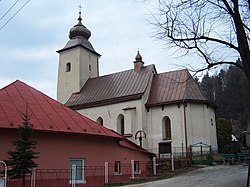
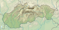
Lesnica (Hungarian: Erdős, until 1899: Lesnicz, German: Leschnitz) is a large village and municipality in the Stará Ľubovňa District in the Prešov Region of northern Slovakia.
Lesnica | |
|---|---|
Village | |
 Local church | |
| Coordinates: 49°24′00″N 20°28′00″E / 49.40000°N 20.46667°E | |
| Country | |
| Region | Prešov |
| District | Stará Ľubovňa |
| First mentioned | 1297 |
| Government | |
| • Mayor | Ján Gondek (SME, KDH, Smer-SD, SNS) |
| Area | |
| • Total | 14.6 km2 (5.6 sq mi) |
| Elevation | 485 m (1,591 ft) |
| Population (2024)[3] | |
| • Total | 488 |
| • Density | 33/km2 (87/sq mi) |
History
editIn historical records the village was first mentioned in 1297.[4][5] Before the establishment of independent Czechoslovakia in 1918, Lesnica was part of Szepes County within the Kingdom of Hungary. From 1939 to 1945, it was part of the Slovak Republic. On 25 January 1945, the Red Army dislodged the Wehrmacht from Lesnica and it was once again part of Czechoslovakia.
Geography
editThe municipality lies at an altitude of 485 metres.
References
edit- ^ "Zoznam zvolených starostov". volby.statistics.sk. Retrieved 14 May 2024.
- ^ "Register of Land" (PDF). www.skgeodesy.sk. Retrieved 14 May 2024.
- ^ "SODB2021 - Population - Basic results". www.scitanie.sk. Retrieved 14 May 2024.
- ^ Slovenské pohl'ady (in Slovak). Matica slovenská. 1978. p. 65. Retrieved 14 May 2024.
- ^ Kovalčík, Vlastimil (1998). Pod erbom severu (in Slovak). Hojnica. p. 27. ISBN 978-80-967868-0-0. Retrieved 14 May 2024.

