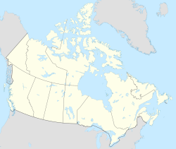
L'Anse-au-Loup (Town) is located on the banks of L'Anse-au-Loup Brook and the Strait of Belle Isle, in Newfoundland and Labrador province, Canada.[1][4]
L'Anse-au-Loup
Wolf Cove | |
|---|---|
Town | |
![Harbour installations,[1] Strait of Belle Isle, Anse-au-Loup Brook](http://up.wiki.x.io/wikipedia/commons/thumb/3/39/L%27Anse_au_Loup_960711_023_7158_4685.jpg/250px-L%27Anse_au_Loup_960711_023_7158_4685.jpg) Harbour installations,[1] Strait of Belle Isle, Anse-au-Loup Brook | |
L'Anse-au-Loup, Newfoundland & Labrador | |
| Coordinates: 51°31′33″N 56°50′01″W / 51.5257°N 56.8335°W | |
| Country | Canada |
| Province | Newfoundland and Labrador |
| Area | |
| • Land | 3.48 km2 (1.34 sq mi) |
| Population (2021)[3] | |
• Total | 692 |
| • Density | 160.5/km2 (416/sq mi) |
| Time zone | UTC-3:30 (Newfoundland Time) |
| • Summer (DST) | UTC-2:30 (Newfoundland Daylight) |
| Area code | 709 |
| Highways | |
History
editIn Quebec-Labrador Peninsula,[5] on the north shore of the Strait of Belle Isle, radiocarbon dating of archaeological sites leads geologists and archaeologists to date the presence of humans around 9,000 years ago, i.e. after the retreat of the ice from the last glaciation.[6]
After the glaciation, Newfoundland and Labrador was perhaps the last place to be populated by human groups. Small spear or dart points from Prince Edward Island are very similar to early artifacts found on the north shore of the Strait of Belle Isle. Archaeologists do not believe in coincidence, they rather put forward the thesis that the first Labradorians crossed the St. Lawrence River, travel East along the Lower North Shore, until arriving in Quebec-Labrador Peninsula, to end up settling there.[7]
So, the coasts of the Strait of Belle Isle, like those of Labrador, of which it is a part, have been populated for a very long time. Labrador is said to be the Markland of the Viking sagas, which probably describes the silver beaches of Groswater Bay. Long before the explorations of Jacques Cartier, Basque fishermen hunted whales on the northeast coast of the Strait of Belle-Île, in Red Bay.[8]
Located on the banks of L'Anse-au-Loup Brook and the Strait of Belle Isle, along the Trans-Labrador Highway (Route 510), the town of l'Anse-au-Loup[4] is an integral part of the heroic and action-rich history of the Labrador fishery, the whaling and cod fishing industry, the disputes between the governments of Quebec, as well as the establishment of permanent communities.[9] Rooted between Forteau and L'Anse-au-Diable,[10] the town was incorporated in 1975, the first mayor was Reginald O'Brien Sr.
Demographics
editIn the 2021 Census of Population conducted by Statistics Canada, L'Anse au Loup had a population of 692 residing in 302 of its 322 total private dwellings, a change of 24% from its 2016 population of 558. With a land area of 3.39 km2 (1.31 sq mi), it had a population density of 204.1/km2 (528.7/sq mi) in 2021.[3]
See also
edit- List of cities and towns in Newfoundland and Labrador
- L'Anse-au-Loup official Web site (Wolf Cove), Newfoundland and Labrador
References
edit- ^ a b "Town of L'Anse au Loup (SLDA)". Southern Labrador Development Association. 2024. Retrieved 26 August 2024.
L'Anse au Loup Brook flows from an interior valley and meanders through the sandy shoreline on its route to the ocean.
- ^ "L'Anse au Loup, T [Census subdivision], Newfoundland and Labrador and Canada [Country] (table) Census Profile". 2016 Census. Statistics Canada. Retrieved 27 February 2018.
- ^ a b "Population and dwelling counts: Canada, provinces and territories, census divisions and census subdivisions (municipalities), Newfoundland and Labrador". Statistics Canada. February 9, 2022. Retrieved March 15, 2022.
- ^ a b "Town of L'Anse au Loup". 2024. Retrieved 19 August 2024.
Officially incorporated in 1975, L'Anse au Loup is one of only a few rural towns in the province of Newfoundland and Labrador that still has a growing population
- ^ François Trudel (2001). ""Indigenous people and the fur trade in the Quebec-Labrador peninsula"" (PDF). Les Presses de l’Université Laval (coll. “Historical Atlas of Quebec”). Centre interuniversitaire d’études québécoises (CIEQ). pp. 3 of 52. Retrieved 27 August 2024.
The Peninsula of Quebec-Labrador, sometimes also called Ungava, Labrador, Ungava-Labrador or, politically, New Quebec and Labrador, is a vast territory of approximately one million square kilometers.
- ^ Lawrence Normore (2014). "L'Anse-au-Loup historical Background". Town of L'Anse au Loup. Retrieved 26 August 2024.
There are reports of fishermen sailing to Labrador from France at least as early as 1504,
- ^ Ralph T. Pastore; James A. Tuck (1998). "First Arrivals". Heritage Newfoundland & Labrador. Department of Archaeology and Department of History Memorial University of Newfoundland. Retrieved 27 August 2024.
Except for parts of the arctic, Newfoundland and Labrador was perhaps the last place to be populated by human groups.
- ^ James H. Marsh (4 March 2015). "Labrador (region)". Historica Canada (in French). Canadian Encyclopedia. Retrieved 29 August 2024.
In the early 19th century, thousands of fishermen and whale hunters from New England passed along its shores each year.
- ^ Jeff Butt (1998). "Labrador fishery (History)". Heritage Newfoundland & Labrador. Retrieved 29 August 2024.
Labrador's settlement history is similar to that of Newfoundland, even in terms of the policies adopted and the problems of exploitation encountered.
- ^ "CC21505-Pinware West (Map)" (PDF). Newfoundland & Labrador. 22 November 2021. Retrieved 29 August 2024.
Domestic Harvest Plan Map (L'Anse-au-Loup)
Further reading
edit- Newfoundland and Labrador Heritage Web Site, Impacts of Non-Indigenous Activities on the Innu, 2008.
- McGhee, Robert, and James A. Tuck. An Archaic Sequence from the Strait of Belle Isle, Labrador. Mercury series. Ottawa: National Museums of Canada, 1975.
- Tuck, James A. Newfoundland and Labrador Prehistory. Ottawa: National Museums of Canada, Archaeological Survey of Canada, 1976.

