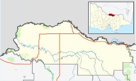
Katunga is a town in the Goulburn Valley region of northern Victoria, Australia. The town is located in the Shire of Moira local government area, 228 kilometres from the state capital, Melbourne. At the 2016 census, Katunga had a population of 996.[1]
| Katunga Victoria | |||||||||||||||
|---|---|---|---|---|---|---|---|---|---|---|---|---|---|---|---|
 Katunga General Store in June 2007 | |||||||||||||||
| Coordinates | 36°01′0″S 145°28′0″E / 36.01667°S 145.46667°E | ||||||||||||||
| Population | 996 (2016 census)[1] | ||||||||||||||
| Postcode(s) | 3640 | ||||||||||||||
| Location | |||||||||||||||
| LGA(s) | Shire of Moira | ||||||||||||||
| State electorate(s) | Shepparton | ||||||||||||||
| Federal division(s) | Nicholls | ||||||||||||||
| |||||||||||||||
Katunga Post Office opened on 10 June 1881.[2]
The local railway station was opened on the Goulburn Valley railway in 1888,[3] but today does not see regular passenger services. Katunga, similar to much of the surrounding area, is based on agriculture, including dairy production. Bizarrely, the town had two state primary schools with around 90 students at Katunga primary and 7 students at Katunga South primary just 2 km away. Katunga South closed at the end of 2021 after the last 3 students left.
The Katunga Football Club competing in the Picola & District Football League is based in the town.
References
edit- ^ a b Australian Bureau of Statistics (31 October 2012). "Katunga (State Suburb)". 2011 Census QuickStats. Retrieved 3 December 2014.
- ^ Premier Postal History. "Post Office List". Retrieved 11 April 2008.
- ^ Bob Whitehead (2008). Tocumwal Railway Centenary.
