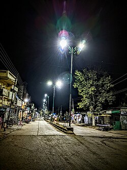
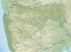
Karanja (Ghadge) is a tehsil town located within the Arvi subdivision and serves as a taluka (code 4961) in the Wardha district of Maharashtra, India.
Karanja (Ghadge) | |
|---|---|
Tehesil town | |
 Golibar Chowk at Karanja(gh) | |
| Coordinates: 21°9′39.47″N 78°24′32.76″E / 21.1609639°N 78.4091000°E | |
| Country | |
| State | Maharashtra |
| Region | Vidarbha |
| District | Wardha |
| Total villages in Tehsil | 121 |
| Government | |
| • Type | Nagar panchayat |
| • Body | Karanja Nagar panchayat |
| Population (2011) | |
• Total | 90,462 |
| Languages | |
| • Official | Marathi |
| • Other Languages | Hindi, English, Gujrati, Sindhi |
| Time zone | UTC+5:30 (IST) |
| Telephone code | 91-7156 |
| Vehicle registration | MH- 32 (Wardha District) |
| Website | under construction |
Karanja is located on National Highway 53 (India), also known as Asian Highway (AH46) or National Highway 6 (India, under the old numbering system). It is approximately 76 km from Nagpur, 75 km from Amravati, and 70 km from Wardha, placing it almost at the center of these major cities. Due to its strategic location, it serves as a convenient rest stop for tourists, travelers, and transport services.
The tehsil comprises around 60 gram panchayats and 102 villages. The majority of the population in Karanja consists of Hindus, with significant communities of Buddhists and Muslims also residing in the area.
In Hinduism, the majority of the population belongs to the Kshatriya Pawar caste, also known as Bhoyar Pawar. Other major Hindu castes in the area include Brahmin, Maratha, Kunbi, and Teli.
The region also has a significant population of tribals, such as the Gond community. Festivals like Holi, Diwali, Dasara, Pola, Ganesh Utsav, Muharram, and Eid al-Fitr are celebrated. [citation needed]
In 2015, Karanja was designated as a Nagar Panchayat.[citation needed]
The MahaOrange Plant
editThe MahaOrange Plant, located 2.5 km from Karanja (Ghadge), was established as a facility for exporting oranges and other fruits, such as banana. It was operational before 2009–2010, primarily exporting oranges. However, due to unknown circumstances, the plant shut down and remained non-functional for many years, presenting a significant challenge.
Although the plant is equipped with essential facilities for preparing fruits for export, such as grading, wax-coating, pre-cooling, and cold storage facilities, it lacks an attached processing unit. None of the available units were operational during its inactive period.
In January 2015, when MahaOrange took over the plant, Shridhar Thakre informed the Maharashtra State Agricultural Marketing Board (MSAMB)[1] that repairing the plant would be a priority, as reported by The Times of India.[2]
Golibar Chowk incident
editGolibar Chowk is one of the main squares in Karanja (Ghadge), located near the bus stop. The name of the square, Golibar (meaning "gunfire"), originates from an incident involving gunfire that occurred in the area. This गोळीमार (Golimar) incident remains a notable part of Karanja's history.[citation needed]
Sweet oranges
editKaranja (Ghadge) and its surrounding areas are known for producing high-quality oranges, renowned for their sweet taste.
Cotton and soybean
editCotton and soybean are also produced on a large scale in Karanja Tehsil.
Shree Vitthal Tekdi
editKaranja has a long landscape with a scenic view from Shri Vitthal Tekdi, where Shri Vitthal refers to Lord Krishna and Tekdi means hill. The hill is known for the Shri Vitthal Temple at the top. The flat area at the summit is a popular spot for morning and evening walks, and many sports enthusiasts visit for jogging, running, and exercise. During holy months, devotees gather in the evening and at night for bhajans.
Athawadi Bazaar ( weekly market)
editAthawadi Bazaar is a weekly market held every Sunday from 7:00 am to 11:30 pm, offering vegetables and other goods. It serves the everyday needs of Karanja town and nearby villages. Kacha chiwada and jalebi are popular items in the market.
References
edit- ^ "Home". msamb.com. Retrieved 21 November 2024.
- ^ "'Successful orange export due to support of farmers and entrepreneurs'". The Times of India. 3 April 2016. ISSN 0971-8257. Retrieved 21 November 2024.
- ^ "Wardha District Census 2011". Retrieved 21 January 2023.
- ^ "STD & PIN Codes". Retrieved 21 January 2023.
- ^ "Municipalities Wardha". Retrieved 21 January 2023.
- ^ "Tehsils of Wardha District". Retrieved 21 January 2023.
- ^ "Subdivision & Blocks". Retrieved 21 January 2023.
- ^ "The MahaOrangePlant reference 1". The Times of India. 3 April 2016. Retrieved 22 January 2023.


