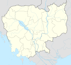
Pou Rieng (Khmer: ស្រុកពោធិ៍រៀង),[2] formerly Kampong Leav (Khmer: ស្រុកកំពង់លាវ), is a district located in Prey Veng province, in south-eastern Cambodia.
Pou Rieng
ស្រុកពោធិ៍រៀង | |
|---|---|
| Coordinates: 11°33′05″N 105°15′41″E / 11.5515°N 105.2615°E | |
| Country | |
| Province | Prey Veng |
| Communes | 6 |
| Villages | 31 |
| Population (2008)[1] | |
• Total | 29,259 |
| Time zone | +7 |
| Geocode | 1411 |
Administration
editAccording to the 1998 census, the Kampong Leav District consisted of 8 communes[3] with a total population of 55,054.[4] In 2008–2009 three communes—Baray, Cheung Tuek and Kampong Leav—formed a new district, the Prey Veng Municipality;[5] according to the 2008 census, the population of the resulting five-commune district was 29,259.[1]
In 2011 the district was renamed Pou Rieng (or Pur Rieng) and two communes which previously belonged to the Pea Reang district—Kampong Ruessei and Preaek Ta Sar—were added to the district.[2] In 2019 the Ta Kao Commune was incorporated to the Prey Veng Municipality.[2]
The following table shows the communes in the district as of 2020.[2]
| Code | Communes | Khmer |
|---|---|---|
| 141101 | Pou Rieng | ឃុំពោធិ៍រៀង |
| 141102 | Preaek Anteah | ឃុំព្រែកអន្ទះ |
| 141103 | Preaek Chrey | ឃុំព្រែកជ្រៃ |
| 141104 | Prey Kanlaong | ឃុំព្រៃកន្លោង |
| 141106 | Kampong Ruessei | ឃុំកំពង់ឫស្សី |
| 141107 | Preaek Ta Sar | ឃុំព្រែកតាសរ |
References
edit- ^ a b "2008 Census – Kampong Leav district". opendevelopmentcambodia.net. Open Development Cambodia. Retrieved 6 May 2020.
- ^ a b c d "Cambodia Gazetteer Database Online". National Committee for Sub-National Democratic Development. Retrieved 6 May 2020.
- ^ "General Population Census of Cambodia 1998 – Final Census Results (2nd Edition)" (PDF). National Institute of Statistics. August 2002. p. 196. Archived from the original (PDF) on 20 July 2011. Retrieved 7 May 2020.
- ^ General Population Census of Cambodia, 1998: Village Gazetteer. National Institute of Statistics. February 2000. p. 238.
- ^ "General Population Census of Cambodia 2008" (PDF). National Institute of Statistics. August 2009. p. 170. Retrieved 6 May 2020.
11°33′05″N 105°15′41″E / 11.5515°N 105.2615°E
