You can help expand this article with text translated from the corresponding article in French. (December 2008) Click [show] for important translation instructions.
|
Gertwiller (German: Gertweiler) is a commune in the Bas-Rhin department in Alsace in north-eastern France.[3]
Gertwiller | |
|---|---|
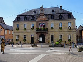
 The town hall in Gertwiller | |
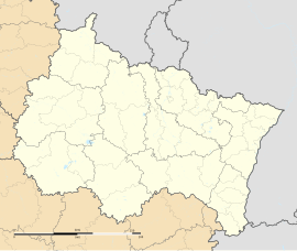
| Coordinates: 48°24′42″N 7°28′07″E / 48.4117°N 7.4686°E | |
| Country | France |
| Region | Grand Est |
| Department | Bas-Rhin |
| Arrondissement | Sélestat-Erstein |
| Canton | Obernai |
| Government | |
| • Mayor (2020–2026) | Rémy Huchelmann[1] |
Area 1 | 4.89 km2 (1.89 sq mi) |
| Population (2021)[2] | 1,273 |
| • Density | 260/km2 (670/sq mi) |
| Time zone | UTC+01:00 (CET) |
| • Summer (DST) | UTC+02:00 (CEST) |
| INSEE/Postal code | 67155 /67140 |
| Elevation | 165–245 m (541–804 ft) |
| 1 French Land Register data, which excludes lakes, ponds, glaciers > 1 km2 (0.386 sq mi or 247 acres) and river estuaries. | |
Positioned in the heart of the Alsace wine growing region, Gertwiller specialises in the manufacture of pain d'épices, a traditional sweet spicey confection not dissimilar from ginger bread. The tradition dates at least as far back as the eighteenth century, and by the start of the twentieth century there were at least 8 separate businesses manufacturing the speciality. Pain d'épice from Gertwiller became famous through the nineteenth and twentieth centuries and can be found at almost every village market or fête in the region. Although the breads are normally oval in shape, for lovers it is possible to buy heart shaped loaves. In its time Gertwiller has received the title of French capital of pain d'épice, in succession to more substantial settlements such as Rheims and Dijon. Although the business continues to thrive in Gertwiller, it is today concentrated in just two business one of which, 'Lips', opened in 1998 a museum dedicated to pain d'épice and popular art of the region.
Geography
editOn the north eastern edge of Barr, Gertwiller is positioned close to Mont Sainte-Odile, not far from the Andlau valley on the edge of the Vosges Mountains.
The village is some 20 kilometres (12 mi) north of Sélestat and 8 kilometres (5 mi) south of Obernai. Gertwiller is traversed by the little River Kirkneck which joins the Andlau near to Valff.
People
editLucien Blumer, painter, divides his time between Strasbourg and Gertwiller.
See also
editReferences
edit- ^ "Répertoire national des élus: les maires". data.gouv.fr, Plateforme ouverte des données publiques françaises (in French). 2 December 2020.
- ^ "Populations légales 2021" (in French). The National Institute of Statistics and Economic Studies. 28 December 2023.
- ^ INSEE commune file


