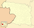
Size of this PNG preview of this SVG file: 512 × 425 pixels. Other resolutions: 289 × 240 pixels | 578 × 480 pixels | 925 × 768 pixels | 1,234 × 1,024 pixels | 2,467 × 2,048 pixels.
Original file (SVG file, nominally 512 × 425 pixels, file size: 505 KB)
File history
Click on a date/time to view the file as it appeared at that time.
| Date/Time | Thumbnail | Dimensions | User | Comment | |
|---|---|---|---|---|---|
| current | 11:17, 10 December 2010 |  | 512 × 425 (505 KB) | Miguillen | Colores según convención |
| 11:25, 14 November 2010 |  | 512 × 425 (250 KB) | Miguillen | == {{int:filedesc}} == {{Information |Description={{en|Location map of Province of Zamora}} Equirectangular projection, N/S stretching 130 %. Geographic limits of the map: * N: ° N * S: ° N * W: ° O * E: ° O {{es|Mapa d |
File usage
The following 2 pages use this file:
Global file usage
The following other wikis use this file:
- Usage on ba.wiki.x.io
- Usage on eo.wiki.x.io
- Zamoro (Hispanio)
- Provinco Zamoro
- Gallegos del Pan
- Benavente (Zamoro)
- Natura Parko Arribes del Duero
- Municipoj de Provinco Zamoro
- Jurisdikciaj teritorioj de Provinco Zamoro
- Abezames
- Aspariegos
- Bustillo del Oro
- Fresno de la Ribera
- Fuentesecas
- Malva (Zamora)
- Matilla la Seca
- Morales de Toro
- Peleagonzalo
- Ŝablono:Situo sur mapo Hispanio Provinco Zamoro
- Pinilla de Toro
- Pozoantiguo
- Toro (Zamora)
- Valdefinjas
- Venialbo
- Vezdemarbán
- Villalonso
- Villalube
- Villardondiego
- Villavendimio
- Argujillo
- La Bóveda de Toro
- Cañizal
- Castrillo de la Guareña
- Fuentelapeña
- Fuentesaúco
- Guarrate
- El Maderal
- El Pego
- San Miguel de la Ribera
- Vadillo de la Guareña
- Vallesa de la Guareña
- Villabuena del Puente
- Villaescusa (Zamora)
- Villamor de los Escuderos
- Arcenillas
- Casaseca de Campeán
- Casaseca de las Chanas
- Cazurra
- Corrales del Vino
- El Cubo de Tierra del Vino
- Cuelgamures
View more global usage of this file.