
Size of this preview: 800 × 593 pixels. Other resolutions: 320 × 237 pixels | 640 × 474 pixels | 900 × 667 pixels.
Original file (900 × 667 pixels, file size: 230 KB, MIME type: image/jpeg)
| This is a file from the Wikimedia Commons. Information from its description page there is shown below. Commons is a freely licensed media file repository. You can help. |
Summary
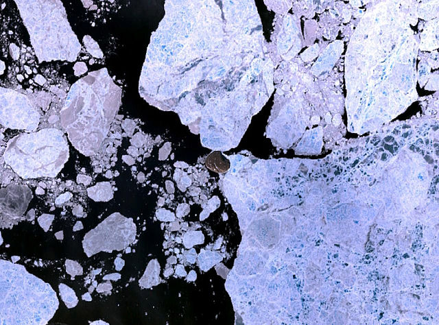
| Description | Hans Island, a disputed island in the Nares Strait near Greenland. NASA Landsat 7 image. |
| Date | 30 July 2005 (according to Exif data) |
| Source | Final image made using NASA World Wind. |
| Author | Photograph: NASA |
| Other versions | annotated version |
Licensing
| This image is in the public domain because it is a screenshot from NASA’s globe software World Wind using a public domain layer, such as Blue Marble, MODIS, Landsat, SRTM, USGS or GLOBE.
|
 |
File history
Click on a date/time to view the file as it appeared at that time.
| Date/Time | Thumbnail | Dimensions | User | Comment | |
|---|---|---|---|---|---|
| current | 23:43, 29 July 2005 | | 900 × 667 (230 KB) | Finlay McWalter | Hans Island, a disputed island in the Nares Strait near Greenland. NASA Landsat 7 image. Final image made using NASA World Wind. {{PD-USGov-NASA}} |
File usage
The following pages on the English Wikipedia use this file (pages on other projects are not listed):
Global file usage
The following other wikis use this file:
- Usage on be.wiki.x.io
- Usage on da.wiki.x.io
- Usage on es.wiki.x.io
- Usage on hy.wiki.x.io
- Usage on id.wiki.x.io
- Usage on ja.wiki.x.io
- Usage on pl.wiki.x.io
- Usage on ru.wiki.x.io
- Usage on so.wiki.x.io
- Usage on zh.wiki.x.io