
Size of this preview: 800 × 600 pixels. Other resolutions: 320 × 240 pixels | 640 × 480 pixels | 1,024 × 768 pixels.
Original file (1,024 × 768 pixels, file size: 876 KB, MIME type: image/jpeg)
| This is a file from the Wikimedia Commons. Information from its description page there is shown below. Commons is a freely licensed media file repository. You can help. |
Summary
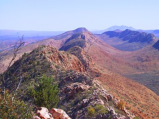
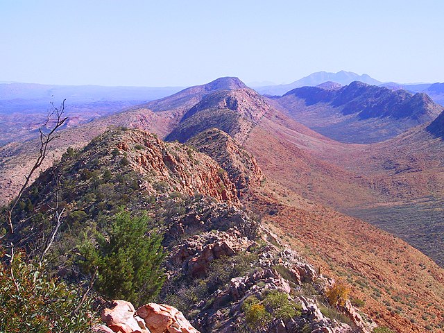
| Description | View along the West MacDonnell Ranges from Counts Point on the Larapinta Trail. Mount Sonder, one of the higherst mountains in the Northern Territory, is in the background. |
| Date | 13 July 2004 (according to Exif data) |
| Source | No machine-readable source provided. Own work assumed (based on copyright claims). |
| Author | No machine-readable author provided. Boticario assumed (based on copyright claims). |
Licensing
| I, the copyright holder of this work, release this work into the public domain. This applies worldwide. In some countries this may not be legally possible; if so: I grant anyone the right to use this work for any purpose, without any conditions, unless such conditions are required by law. |
Uploaded at en: by Felix Dance.
File history
Click on a date/time to view the file as it appeared at that time.
| Date/Time | Thumbnail | Dimensions | User | Comment | |
|---|---|---|---|---|---|
| current | 23:36, 17 April 2020 | | 1,024 × 768 (876 KB) | Allice Hunter | Colour adjustment |
| 14:00, 20 December 2005 |  | 1,024 × 768 (660 KB) | Boticario | == Summary == View along the West MacDonnell Ranges from the Larapinta Trail, near Glen Helen. Mount Sonder, one of the higherst mountains in the Northern Territory, is in the background. == Licensing == {{PD-self}} Uploaded at en: by [[:en:User |
File usage
The following 8 pages use this file:
Global file usage
The following other wikis use this file:
- Usage on bg.wiki.x.io
- Usage on ceb.wiki.x.io
- Usage on da.wiki.x.io
- Usage on de.wiki.x.io
- Usage on en.wikivoyage.org
- Usage on eo.wiki.x.io
- Usage on es.wiki.x.io
- Usage on et.wiki.x.io
- Usage on eu.wiki.x.io
- Usage on fr.wiki.x.io
- Usage on he.wiki.x.io
- Usage on hu.wiki.x.io
- Usage on it.wikivoyage.org
- Usage on ja.wiki.x.io
- Usage on lt.wiki.x.io
- Usage on ml.wiki.x.io
- Usage on ms.wiki.x.io
- Usage on nl.wiki.x.io
- Usage on pl.wiki.x.io
- Usage on pt.wiki.x.io
- Usage on ru.wiki.x.io
- Usage on simple.wiki.x.io
- Usage on si.wiki.x.io
- Usage on sk.wiki.x.io
- Usage on sv.wiki.x.io
- Usage on vi.wiki.x.io
- Usage on www.wikidata.org