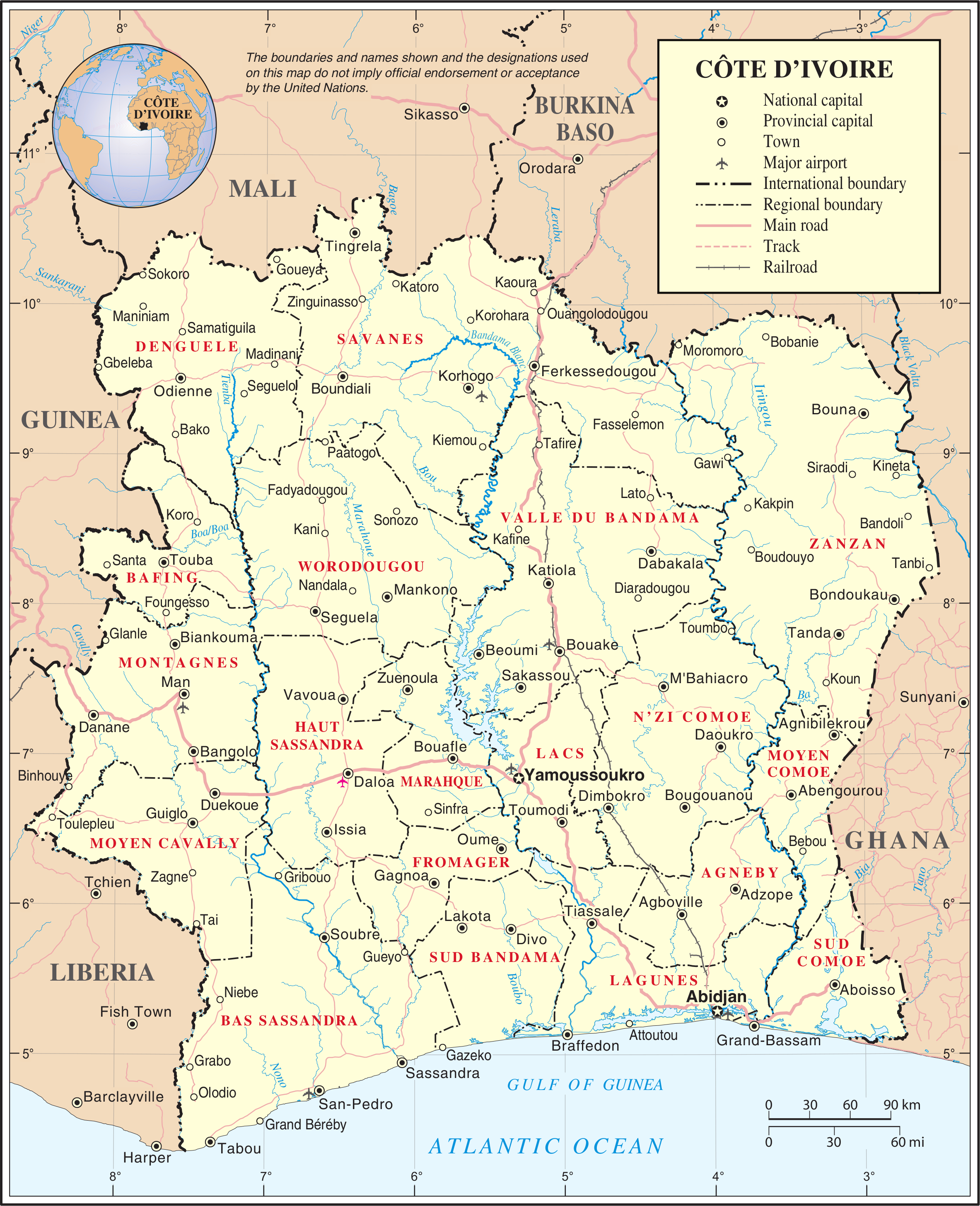
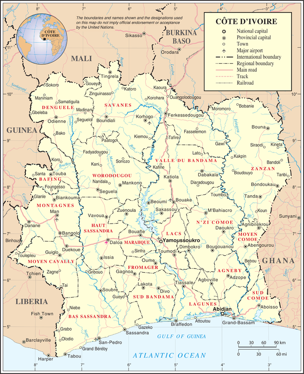
Original file (2,366 × 2,911 pixels, file size: 1.91 MB, MIME type: image/png)
| This is a file from the Wikimedia Commons. Information from its description page there is shown below. Commons is a freely licensed media file repository. You can help. |
| This image is a map derived from a United Nations map.
Unless stated otherwise, UN maps are to be considered in the public domain. This applies worldwide. UN maps are, in principle, open source material and you can use them in your work or for making your own map. UN requests however that you delete the UN name, logo and reference number upon any modification to the map. Content of your map will be your responsibility. You can state in your publication, if you wish, something like: based on UN map … (map name, map number, revision number and date). See: Geospatial Information Section. And: Geospatial, location data for a better world. |
 |
File history
Click on a date/time to view the file as it appeared at that time.
| Date/Time | Thumbnail | Dimensions | User | Comment | |
|---|---|---|---|---|---|
| current | 00:50, 24 October 2007 | | 2,366 × 2,911 (1.91 MB) | Jeroen | {{UN map}} Category:Maps of Côte d'Ivoire |
File usage
Global file usage
The following other wikis use this file:
- Usage on ca.wiki.x.io
- Usage on es.wiki.x.io
- Usage on fr.wiki.x.io
- Usage on gl.wiki.x.io
- Usage on ms.wiki.x.io
- Usage on nl.wiki.x.io
- Usage on pl.wiktionary.org
- Wybrzeże Kości Słoniowej
- Côte d'Ivoire
- Ivory Coast
- Кот-д'Ивуар
- Республика Кот-д'Ивуар
- Берег Слоновой Кости
- Кот-д'Івуар
- Кот д'Ивоар
- ساحل العاج
- كوت ديفوار
- Kodduwaar
- Pobrežie Slonoviny
- Boli Kosta
- Slonokoščena obala
- Ivoorkust
- โกตดิวัวร์
- Elfenbenskysten
- ଆଇଭରି କୋଷ୍ଟ
- Republika Pobrežia Slonoviny
- Кот-д’Івуар
- Usage on ro.wiki.x.io
- Usage on ru.wiki.x.io
- Usage on sw.wiki.x.io
- Usage on uk.wiki.x.io
- Usage on www.wikidata.org