Size of this preview: 691 × 600 pixels. Other resolutions: 277 × 240 pixels | 553 × 480 pixels | 885 × 768 pixels | 1,180 × 1,024 pixels | 1,756 × 1,524 pixels.
Original file (1,756 × 1,524 pixels, file size: 652 KB, MIME type: image/jpeg)
| This is a file from the Wikimedia Commons. Information from its description page there is shown below. Commons is a freely licensed media file repository. You can help. |
Summary
| Description |
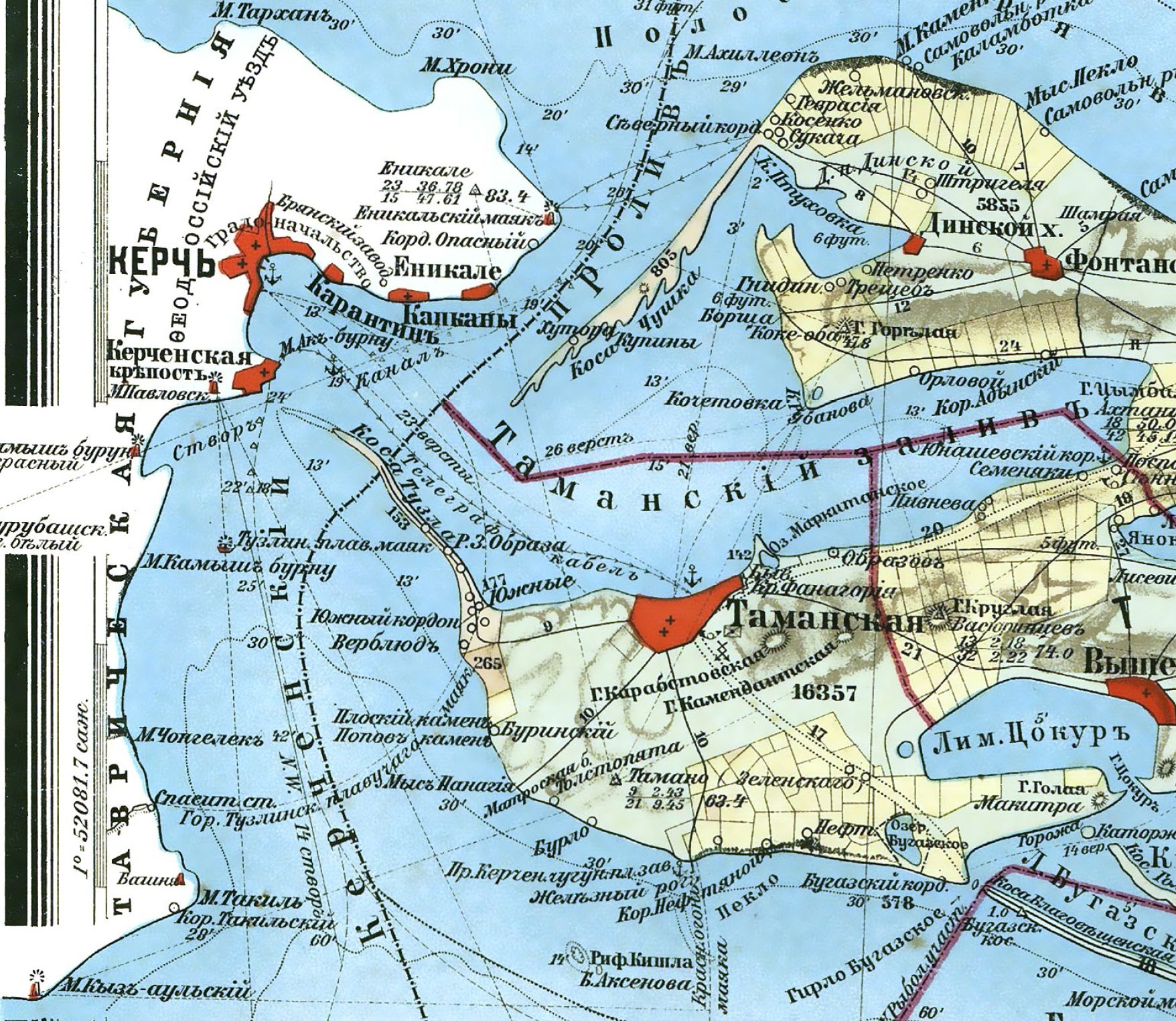
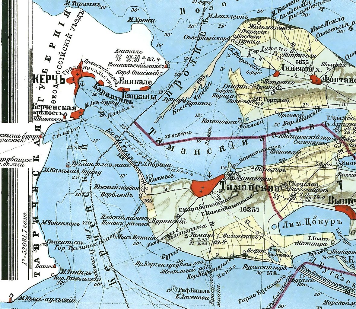
Русский: Карта Кубанской области и близких к ней Черноморской губернии и части Сухумского округа, 1902 год (фрагмент) |
| Date | |
| Source | http://www.myekaterinodar.ru/maps/kuban-area/ |
| Author | Н.С. Иваненко |
Licensing
|
This work is in the public domain in its country of origin and other countries and areas where the copyright term is the author's life plus 70 years or fewer. | |
| This file has been identified as being free of known restrictions under copyright law, including all related and neighboring rights. | |
File history
Click on a date/time to view the file as it appeared at that time.
| Date/Time | Thumbnail | Dimensions | User | Comment | |
|---|---|---|---|---|---|
| current | 11:31, 27 March 2014 | | 1,756 × 1,524 (652 KB) | Bogomolov.PL | better colors, better extent |
| 16:06, 3 December 2011 |  | 634 × 479 (406 KB) | Yuriy75 | {{Information |Description ={{ru|1=Карта Кубанской области и близких к ней Черноморской губернии и части Сухумского округа, 1902 год (фрагмент)}} |Source =htt |
File usage
The following pages on the English Wikipedia use this file (pages on other projects are not listed):
Global file usage
The following other wikis use this file:
- Usage on az.wiki.x.io
- Usage on ba.wiki.x.io
- Usage on ca.wiki.x.io
- Usage on de.wiki.x.io
- Usage on hr.wiki.x.io
- Usage on it.wiki.x.io
- Usage on ru.wiki.x.io
- Usage on sr.wiki.x.io
- Usage on uk.wiki.x.io