
Size of this preview: 800 × 533 pixels. Other resolutions: 320 × 213 pixels | 640 × 427 pixels | 963 × 642 pixels.
Original file (963 × 642 pixels, file size: 666 KB, MIME type: image/jpeg)
| This is a file from the Wikimedia Commons. Information from its description page there is shown below. Commons is a freely licensed media file repository. You can help. |
Summary
| Description |
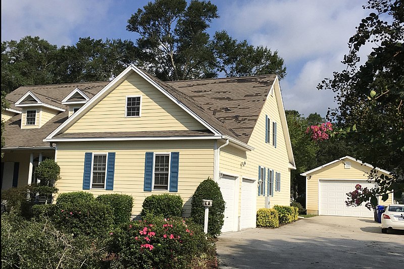
English: Example of EF0 tornado damage. This house in Sunset Beach, North Carolina lost shingles. The image has been cropped to focus on the damaged house |
| Date | |
| Source | https://services.dat.noaa.gov/arcgis/rest/services/nws_damageassessmenttoolkit/DamageViewer/MapServer/0/1973652/attachments/1230123 |
| Author | National Weather Service Forecast Office in Wilmington, North Carolina |
Licensing
This file is in the public domain in the United States because it was solely created by employees of the National Weather Service or National Severe Storms Laboratory using the Damage Assessment Toolkit (DAT), an interactive map and database.
|
File history
Click on a date/time to view the file as it appeared at that time.
| Date/Time | Thumbnail | Dimensions | User | Comment | |
|---|---|---|---|---|---|
| current | 02:46, 3 December 2019 | | 963 × 642 (666 KB) | TornadoLGS | User created page with UploadWizard |
File usage
The following pages on the English Wikipedia use this file (pages on other projects are not listed):
Global file usage
The following other wikis use this file:
- Usage on pl.wiki.x.io
- Usage on simple.wiki.x.io
- Usage on th.wiki.x.io