Size of this preview: 750 × 600 pixels. Other resolutions: 300 × 240 pixels | 600 × 480 pixels | 960 × 768 pixels | 1,280 × 1,024 pixels | 2,560 × 2,048 pixels | 6,000 × 4,800 pixels.
Original file (6,000 × 4,800 pixels, file size: 25.02 MB, MIME type: image/png)
| This is a file from the Wikimedia Commons. Information from its description page there is shown below. Commons is a freely licensed media file repository. You can help. |
| Description |
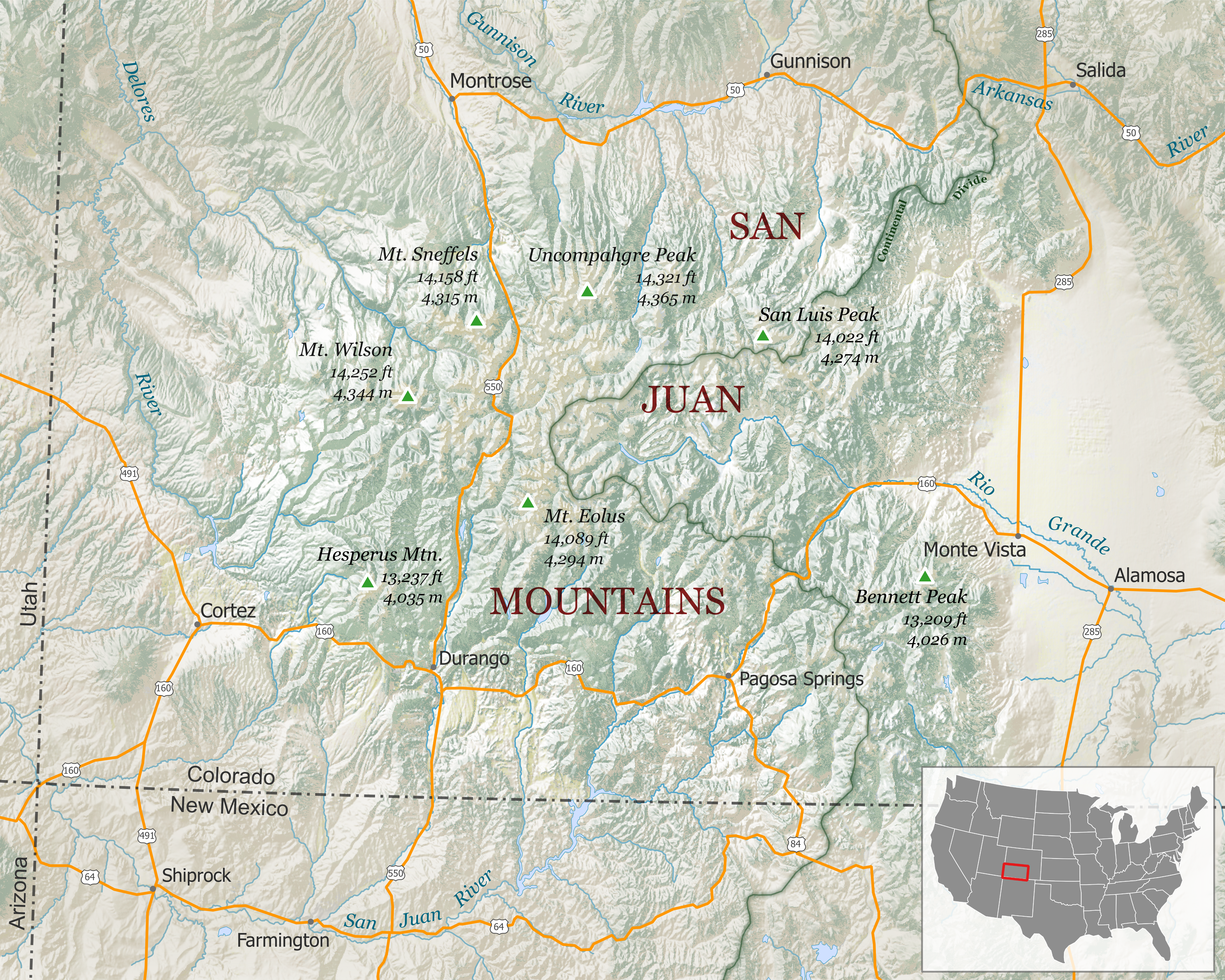
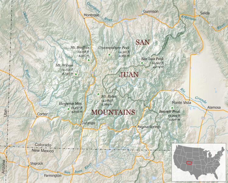
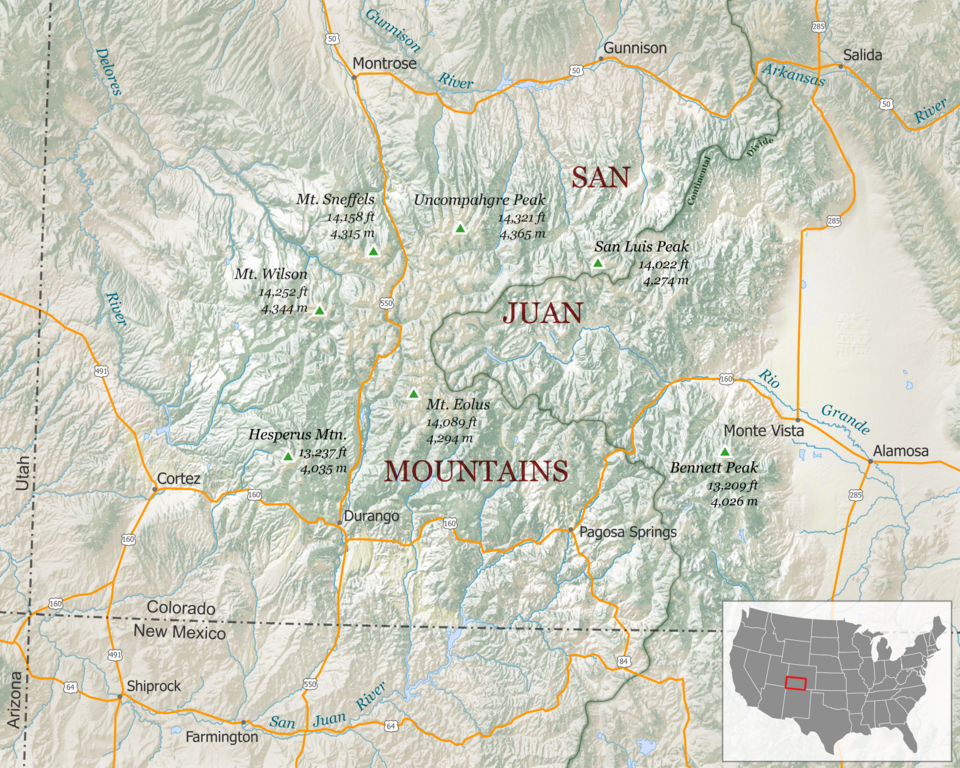
English: Map of the San Juan Mountains are of southern Colorado. Includes major highways, rivers, towns and peaks. Shaded relief basemap is used to visualize the terrain.
Scale - 1:1,200,000 Projection: North America Albers Data Sources: Land Cover, Highways, Shaded Relief, Cities/Towns; Hydrography – The National Map Small Scale Collection; Peaks – USGS GNIS; State Boundaries – Natural Earth data |
| Date | |
| Source | Own work |
| Author | Tanner Arrington |
| Permission (Reusing this file) |
This file is licensed under the Creative Commons Attribution-Share Alike 4.0 International license.
|
File history
Click on a date/time to view the file as it appeared at that time.
| Date/Time | Thumbnail | Dimensions | User | Comment | |
|---|---|---|---|---|---|
| current | 17:19, 14 September 2015 | | 6,000 × 4,800 (25.02 MB) | Tangnar123 | changed the line indicating the continental divide so that it was not confused with a trail |
| 16:35, 14 September 2015 |  | 6,000 × 4,800 (24.66 MB) | Tangnar123 | {{Information |Description ={{en|1=Map of the San Juan Mountains are of southern Colorado. Includes major highways, rivers, towns and peaks. Shaded relief basemap is used to visualize the terrain. }} |Source ={{own}} |Author =Tanner... |
File usage
The following pages on the English Wikipedia use this file (pages on other projects are not listed):
Global file usage
The following other wikis use this file:
- Usage on ceb.wiki.x.io
- Usage on cs.wiki.x.io
- Usage on es.wiki.x.io
- Usage on fr.wiki.x.io
- Usage on he.wiki.x.io
- Usage on lld.wiki.x.io
- Usage on nl.wiki.x.io
- Usage on no.wiki.x.io
- Usage on uk.wiki.x.io
- Usage on www.wikidata.org
- Usage on zh.wiki.x.io