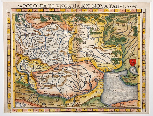
Size of this preview: 788 × 600 pixels. Other resolutions: 316 × 240 pixels | 631 × 480 pixels | 1,010 × 768 pixels | 1,280 × 974 pixels | 2,560 × 1,948 pixels | 3,186 × 2,424 pixels.
Original file (3,186 × 2,424 pixels, file size: 1.56 MB, MIME type: image/jpeg)
| This is a file from the Wikimedia Commons. Information from its description page there is shown below. Commons is a freely licensed media file repository. You can help. |
Summary
| Description |
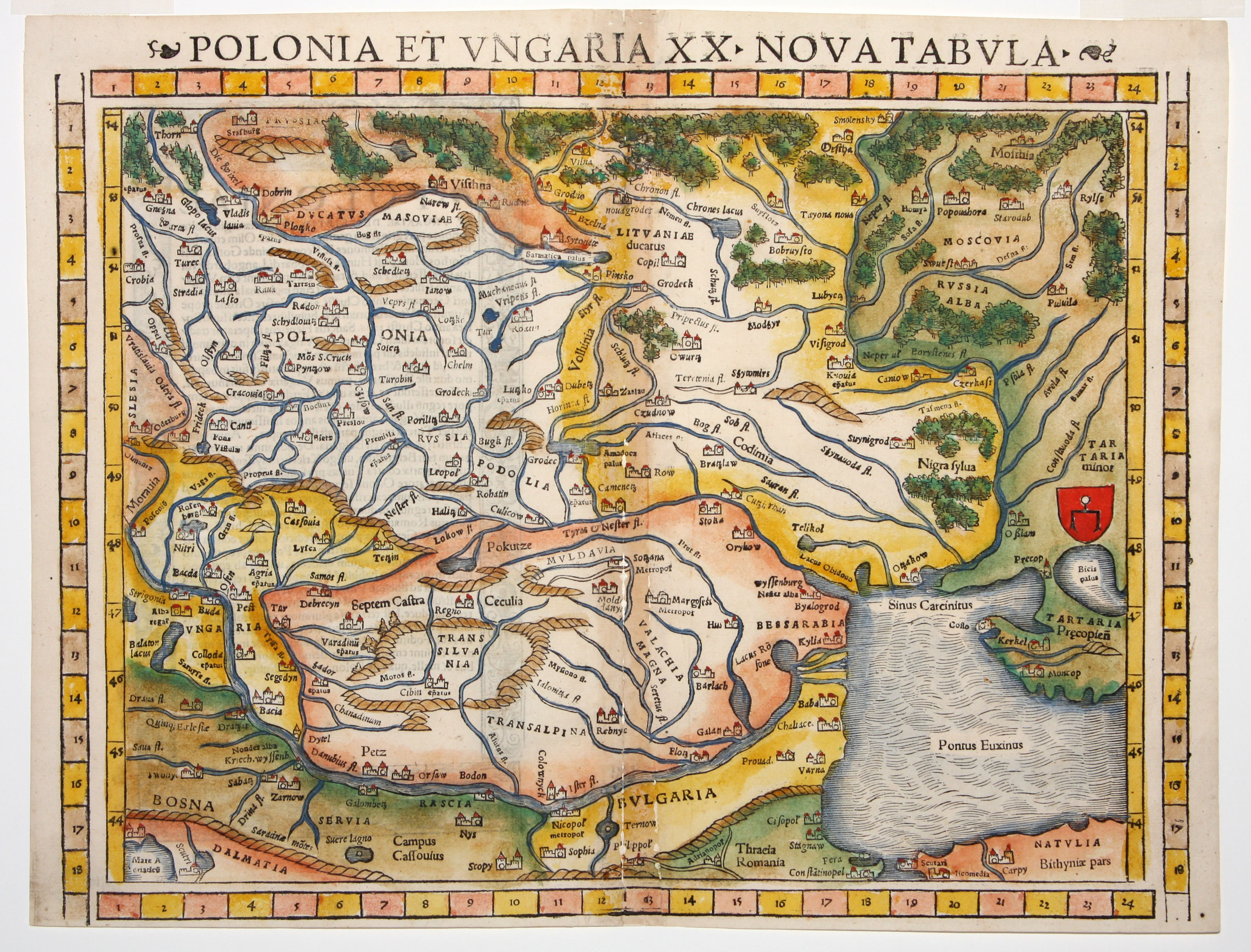
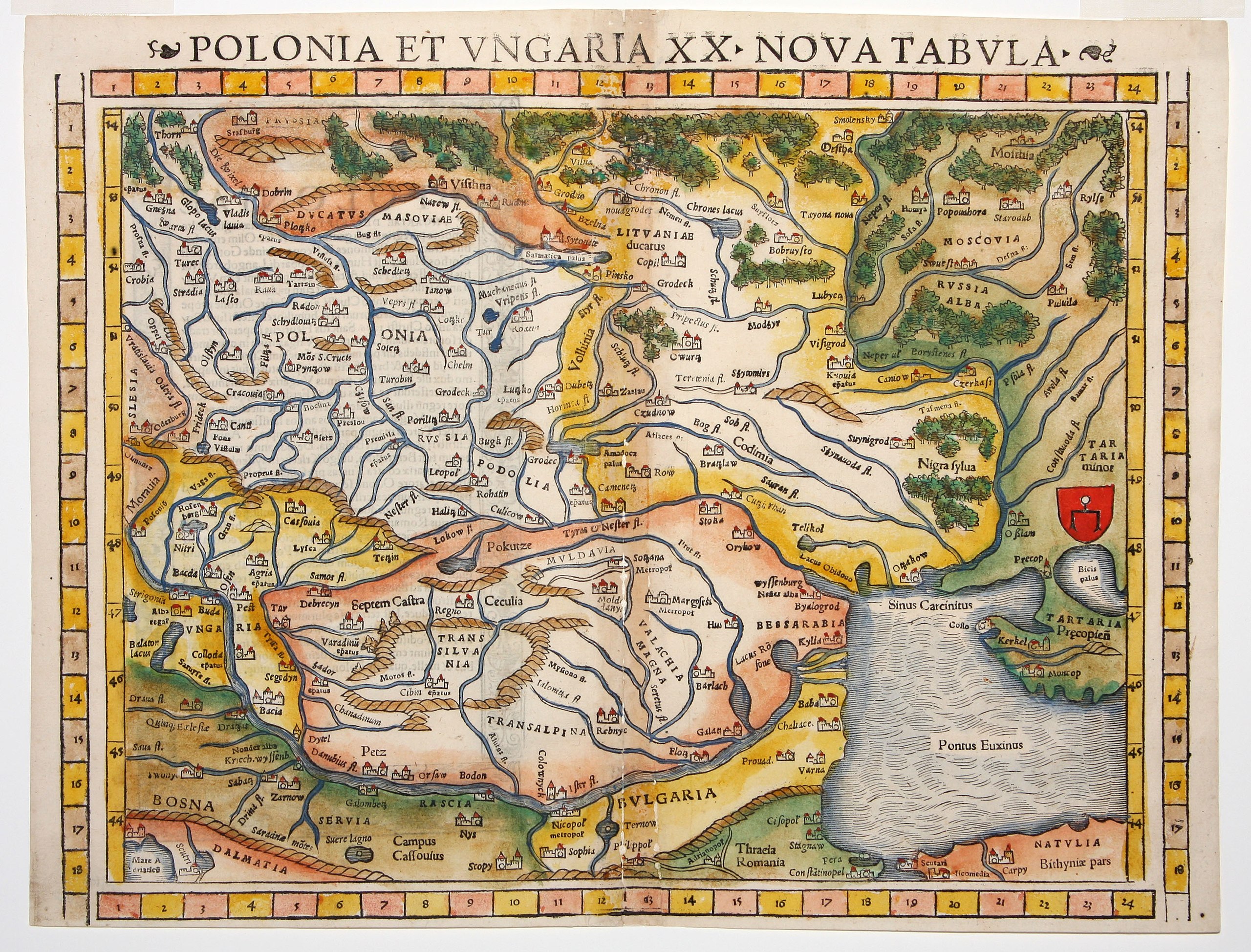
English: Polonia Et Ungaria XX Nova Tabula- Munster’s modern map of Poland and Hungary, from the rare 1552 Geographia edition, the only one to feature coordinate bars provided at top and bottom. Also displays Bulgaria, Romania, Moldova, Principality of Moldovia, Lithuania, Ukraine |
| Date | |
| Source | http://www.martayanlan.com/cgi-bin/display.cgi/Maps/39/4569? |
| Author | Sebastian Münster, Basel |
| Other versions |
Cropped: File:Polonia Et Ungaria XX Nova Tabula, detail of Kyiv episcopate (“Kyouia epatus”).jpg
|


.jpg)
Licensing
|
This work is in the public domain in its country of origin and other countries and areas where the copyright term is the author's life plus 70 years or fewer. | |
| This file has been identified as being free of known restrictions under copyright law, including all related and neighboring rights. | |
| Annotations | This image is annotated: View the annotations at Commons |
File history
Click on a date/time to view the file as it appeared at that time.
| Date/Time | Thumbnail | Dimensions | User | Comment | |
|---|---|---|---|---|---|
| current | 15:30, 22 May 2016 | | 3,186 × 2,424 (1.56 MB) | Dencey | User created page with UploadWizard |
File usage
The following pages on the English Wikipedia use this file (pages on other projects are not listed):
Global file usage
The following other wikis use this file:
- Usage on el.wiki.x.io
- Usage on hu.wiki.x.io
- Usage on lt.wikibooks.org
- Usage on sr.wiki.x.io
- Usage on uk.wiki.x.io