Size of this preview: 438 × 599 pixels. Other resolutions: 175 × 240 pixels | 351 × 480 pixels | 983 × 1,345 pixels.
Original file (983 × 1,345 pixels, file size: 338 KB, MIME type: image/jpeg)
Summary
edit
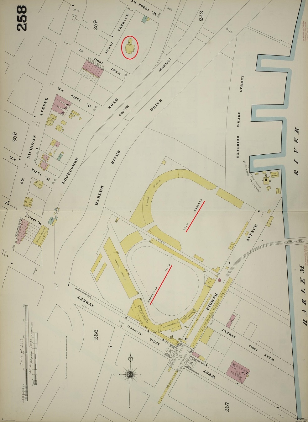
Sanborn map of the Polo Grounds and surroundsings in 1893. Taken from [1] and [2] Combined, rotated to true north, then altered slightly for readability. The circled building is the Morris–Jumel Mansion, which still stands.
Licensing
edit
| This work is in the public domain in the United States because it was published (or registered with the U.S. Copyright Office) before January 1, 1929. |
File history
Click on a date/time to view the file as it appeared at that time.
| Date/Time | Thumbnail | Dimensions | User | Comment | |
|---|---|---|---|---|---|
| current | 15:46, 23 June 2024 | | 983 × 1,345 (338 KB) | Baseball Bugs (talk | contribs) | Sanborn map of the Polo Grounds and surroundsings in 1893. Taken from [https://www.loc.gov/resource/g3804nm.g3804nm_g06116189311/?sp=41] and [https://www.loc.gov/resource/g3804nm.g3804nm_g06116189311/?sp=42] Combined, rotated to true north, then altered slightly for readability. The circled building is the Morris–Jumel Mansion, which still stands. |
You cannot overwrite this file.
File usage
The following page uses this file: