Size of this preview: 800 × 499 pixels. Other resolutions: 320 × 200 pixels | 640 × 399 pixels | 926 × 578 pixels.
Original file (926 × 578 pixels, file size: 19 KB, MIME type: image/png)
| This is a file from the Wikimedia Commons. Information from its description page there is shown below. Commons is a freely licensed media file repository. You can help. |
Summary
| Description |
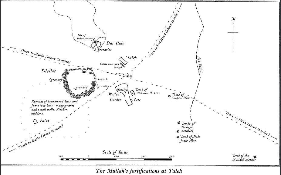
English: Plan of the remains of Taleh Fort |
| Date | |
| Source | The Geographical Journal Vol. 78, No. 2 (Aug., 1931) |
| Author | W. A. MacFadyen |
Licensing
| This file is made available under the Creative Commons CC0 1.0 Universal Public Domain Dedication. | |
| The person who associated a work with this deed has dedicated the work to the public domain by waiving all of their rights to the work worldwide under copyright law, including all related and neighboring rights, to the extent allowed by law. You can copy, modify, distribute and perform the work, even for commercial purposes, all without asking permission.
|
File history
Click on a date/time to view the file as it appeared at that time.
| Date/Time | Thumbnail | Dimensions | User | Comment | |
|---|---|---|---|---|---|
| current | 14:53, 10 July 2024 | | 926 × 578 (19 KB) | User-duck | Cropped 24 % vertically, 24 % areawise using CropTool with lossless mode. |
| 06:04, 3 June 2020 |  | 926 × 762 (45 KB) | Apothecarist | Uploaded a work by W. A. MacFadyen from The Geographical Journal Vol. 78, No. 2 (Aug., 1931) with UploadWizard |
File usage
The following 7 pages use this file:
Global file usage
The following other wikis use this file:
- Usage on ja.wiki.x.io