
Size of this PNG preview of this SVG file: 390 × 390 pixels. Other resolutions: 240 × 240 pixels | 480 × 480 pixels | 768 × 768 pixels | 1,024 × 1,024 pixels | 2,048 × 2,048 pixels.
Original file (SVG file, nominally 390 × 390 pixels, file size: 19 KB)
| This is a file from the Wikimedia Commons. Information from its description page there is shown below. Commons is a freely licensed media file repository. You can help. |
| Description |
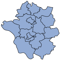
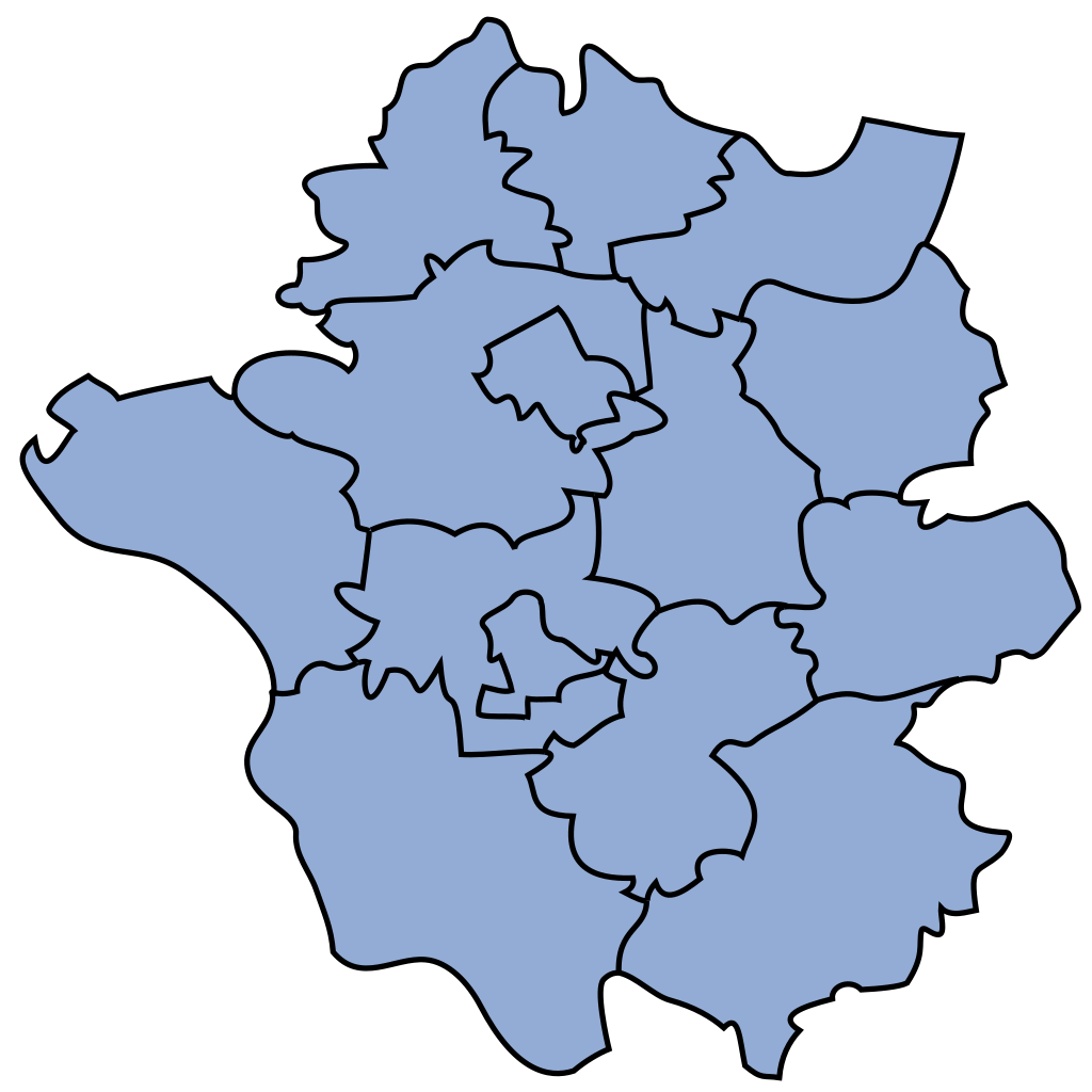
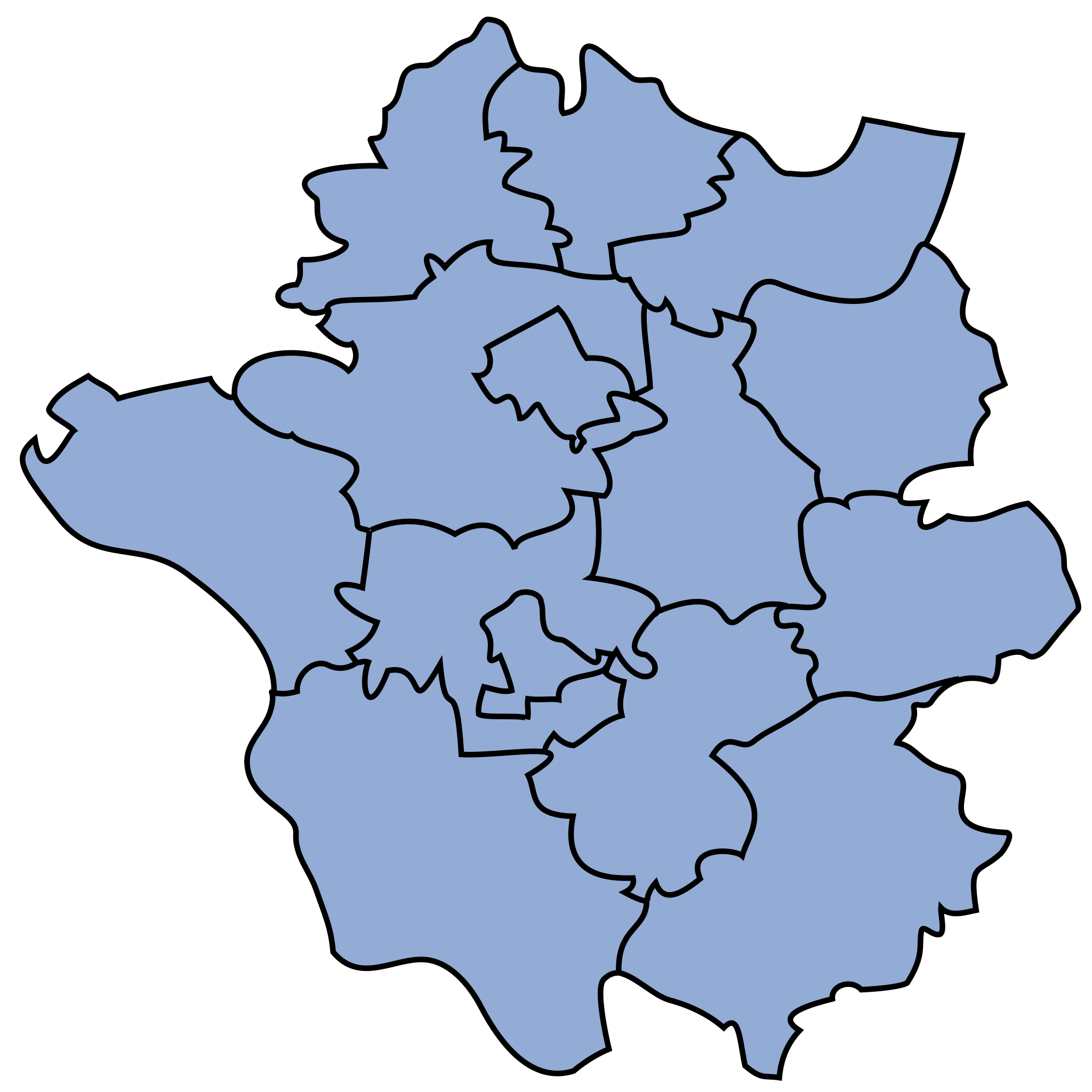
English: Map of communes of Garwolin county
Polski: Mapa gmin powiatu garwolińskiego
This W3C-unspecified vector image was created with Inkscape . |
||||||||
| Date | 5 October 2006 (upload date) | ||||||||
| Source | Own work | ||||||||
| Author | sfu | ||||||||
| Permission (Reusing this file) |
I, the copyright holder of this work, hereby publish it under the following licenses:
This file is licensed under the Creative Commons Attribution-Share Alike 2.5 Generic, 2.0 Generic and 1.0 Generic license.
You may select the license of your choice. |

File history
Click on a date/time to view the file as it appeared at that time.
| Date/Time | Thumbnail | Dimensions | User | Comment | |
|---|---|---|---|---|---|
| current | 14:56, 5 October 2006 | | 390 × 390 (19 KB) | Sfu | {{Information |Description={{english}}Map of communes of Garwolin county {{polish}}Mapa gmin powiatu garwolińskiego |Source=own work |Date=5.10.2006 |Author=sfu |Permission={{self2|GFDL|cc- |
File usage
The following pages on the English Wikipedia use this file (pages on other projects are not listed):
Global file usage
The following other wikis use this file:
- Usage on azb.wiki.x.io
- Usage on be.wiki.x.io
- Usage on fa.wiki.x.io
- Usage on fr.wiki.x.io
- Usage on lt.wiki.x.io
- Usage on ru.wiki.x.io
- Usage on uk.wiki.x.io
- Usage on vi.wiki.x.io
- Usage on zh.wiki.x.io