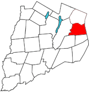
Otsego_County_outline_map_Roseboom_red.png (180 × 191 pixels, file size: 19 KB, MIME type: image/png)
File history
Click on a date/time to view the file as it appeared at that time.
| Date/Time | Thumbnail | Dimensions | User | Comment | |
|---|---|---|---|---|---|
| current | 22:56, 3 April 2006 |  | 180 × 191 (19 KB) | Cbarown | Map of Otsego county, with the Town of Roseboom in red. This is a modified version of the image used for the Town of Cherry Valley wikipedia entry. The original image: http://up.wiki.x.io/wikipedia/en/6/63/Otsego_County_outline_map_Cherry_Valley |
File usage
The following page uses this file:
Global file usage
The following other wikis use this file:
- Usage on tt.wiki.x.io
- Usage on www.wikidata.org
