
Size of this PNG preview of this SVG file: 701 × 526 pixels. Other resolutions: 320 × 240 pixels | 640 × 480 pixels | 1,024 × 768 pixels | 1,280 × 960 pixels | 2,560 × 1,921 pixels.
Original file (SVG file, nominally 701 × 526 pixels, file size: 3.17 MB)
| This is a file from the Wikimedia Commons. Information from its description page there is shown below. Commons is a freely licensed media file repository. You can help. |
| Description |
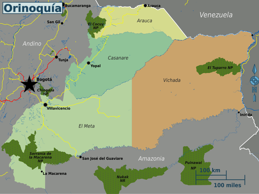
English: Map of the Orinoquía's travel regions |
|||
| Date | ||||
| Source | OpenStreetMap | |||
| Author | Peter Fitzgerald, OpenStreetMap | |||
| Permission (Reusing this file) |
This file is licensed under the Creative Commons Attribution-Share Alike 2.0 Generic license.
|
|||
| Other versions |
PNG files: |
File history
Click on a date/time to view the file as it appeared at that time.
| Date/Time | Thumbnail | Dimensions | User | Comment | |
|---|---|---|---|---|---|
| current | 18:21, 20 May 2013 | | 701 × 526 (3.17 MB) | Peterfitzgerald | {{Information |Description ={{en|1=Map of the Orinoquía's travel regions}} |Source =[http://openstreetmap.org OpenStreetMap] |Author =Peter Fitzgerald, [http://openstreetmap.org OpenStreetMap] |Date ... |
File usage
The following 2 pages use this file:
Global file usage
The following other wikis use this file:
- Usage on ast.wiki.x.io
- Usage on es.wiki.x.io
- Usage on gl.wiki.x.io