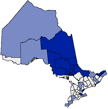
Ontario_French_service_areas.png (378 × 379 pixels, file size: 7 KB, MIME type: image/png)
File history
Click on a date/time to view the file as it appeared at that time.
| Date/Time | Thumbnail | Dimensions | User | Comment | |
|---|---|---|---|---|---|
| current | 00:42, 8 February 2010 |  | 378 × 379 (7 KB) | Dragfyre | French service areas in Ontario. Monochrome blue version of [http://commons.wikimedia.org/wiki/File:Ontario_French_service_areas.png http://commons.wikimedia.org/wiki/File:Ontario_French_service_areas.png] |
| 11:43, 20 January 2008 |  | 378 × 379 (7 KB) | Voyager | French service areas in Ontario {{PD-user|Earl Andrew}} Category:Maps of Ontario |
File usage
The following 2 pages use this file:
Global file usage
The following other wikis use this file:
- Usage on ca.wiki.x.io
- Usage on de.wiki.x.io
- Usage on fr.wiki.x.io
