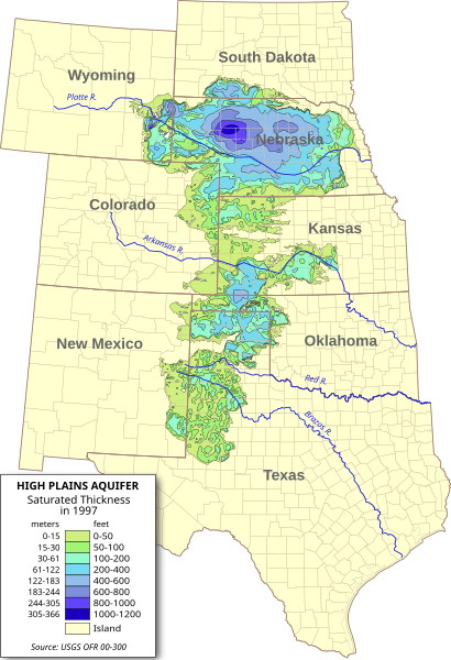
Size of this PNG preview of this SVG file: 410 × 600 pixels. Other resolutions: 164 × 240 pixels | 328 × 480 pixels | 525 × 768 pixels | 700 × 1,024 pixels | 1,399 × 2,048 pixels | 656 × 960 pixels.
Original file (SVG file, nominally 656 × 960 pixels, file size: 1.36 MB)
File history
Click on a date/time to view the file as it appeared at that time.
| Date/Time | Thumbnail | Dimensions | User | Comment | |
|---|---|---|---|---|---|
| current | 06:56, 31 July 2009 |  | 656 × 960 (1.36 MB) | Kbh3rd | Removed labels from paths so they should render properly with the wikimedia software. :( |
| 23:38, 30 July 2009 |  | 656 × 960 (1.36 MB) | Kbh3rd | {{Information |Description={{en|1=Digital map of the saturated thickness of the High Plains aquifer in parts of Kansas, Nebraska, New Mexico, Oklahoma, [[:en:Sout |
File usage
The following 4 pages use this file:
Global file usage
The following other wikis use this file:
- Usage on ar.wiki.x.io
- Usage on de.wiki.x.io
- Usage on eo.wiki.x.io
- Usage on es.wiki.x.io
- Usage on fi.wiki.x.io
- Usage on fr.wiki.x.io
- Usage on ko.wiki.x.io
- Usage on ml.wiki.x.io
- Usage on www.wikidata.org
- Usage on zh.wiki.x.io

