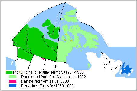
NwtelOperatingAreaMap.png (453 × 303 pixels, file size: 35 KB, MIME type: image/png)
File history
Click on a date/time to view the file as it appeared at that time.
| Date/Time | Thumbnail | Dimensions | User | Comment | |
|---|---|---|---|---|---|
| current | 08:35, 22 September 2009 |  | 453 × 303 (35 KB) | Gcapp1959 | Reverted to version as of 08:31, 22 September 2009 |
| 08:34, 22 September 2009 |  | 453 × 303 (35 KB) | Gcapp1959 | Reverted to version as of 08:31, 22 September 2009 | |
| 08:33, 22 September 2009 |  | 453 × 303 (35 KB) | Gcapp1959 | larger map, distinguished 3 Kitikmeot locations served prior to 1992; showed Atlin as white area | |
| 08:31, 22 September 2009 |  | 453 × 303 (35 KB) | Gcapp1959 | larger map, distinguished 3 Kitikmeot locations served prior to 1992; showed Atlin as white area | |
| 20:57, 28 January 2008 |  | 302 × 218 (15 KB) | Gcapp1959 | Created by Gcapp1959 |
File usage
The following page uses this file:

