No higher resolution available.
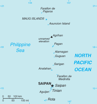
Northern_Mariana_Islands-CIA_WFB_Map.png (325 × 349 pixels, file size: 6 KB, MIME type: image/png)
| This is a file from the Wikimedia Commons. Information from its description page there is shown below. Commons is a freely licensed media file repository. You can help. |

|
This map image could be re-created using vector graphics as an SVG file. This has several advantages; see Commons:Media for cleanup for more information. If an SVG form of this image is available, please upload it and afterwards replace this template with
{{vector version available|new image name}}.
It is recommended to name the SVG file “Northern Mariana Islands-CIA WFB Map.svg”—then the template Vector version available (or Vva) does not need the new image name parameter. |
This image is in the public domain because it contains materials that originally came from the United States Central Intelligence Agency's World Factbook.
|
 |
File history
Click on a date/time to view the file as it appeared at that time.
| Date/Time | Thumbnail | Dimensions | User | Comment | |
|---|---|---|---|---|---|
| current | 05:14, 13 February 2022 | | 325 × 349 (6 KB) | Lojwe | Cropped 1 % horizontally, 1 % vertically using CropTool with precise mode. |
| 09:10, 30 January 2006 |  | 328 × 352 (7 KB) | Hoshie | Updated map of the CNMI from the CIA World Factbook, 10 Jan 06 rev: http://www.cia.gov/cia/publications/factbook/maps/cq-map.gif | |
| 09:17, 27 March 2005 |  | 329 × 355 (5 KB) | Wolfman~commonswiki | {{CIA-map}} |
File usage
The following 10 pages use this file:
- Golden white-eye
- Index of Northern Mariana Islands–related articles
- List of Northern Mariana Islands territorial symbols
- List of lakes of the Northern Mariana Islands
- Maug Islands
- National Register of Historic Places listings in the Northern Mariana Islands
- Non-voting members of the United States House of Representatives
- Northern Mariana Islands's at-large congressional district
- Outline of the Northern Mariana Islands
- File talk:Northern Mariana Islands-CIA WFB Map.png
Global file usage
The following other wikis use this file:
- Usage on bn.wiki.x.io
- Usage on ca.wiki.x.io
- Usage on ch.wiki.x.io
- Usage on de.wiki.x.io
- Usage on en.wikisource.org
- Usage on es.wiki.x.io
- Usage on et.wiki.x.io
- Usage on fi.wiki.x.io
- Usage on fo.wiki.x.io
- Usage on fr.wiki.x.io
- Usage on fy.wiki.x.io
- Usage on gl.wiki.x.io
- Usage on hu.wiki.x.io
- Usage on id.wiki.x.io
- Usage on it.wiki.x.io
- Usage on ja.wiki.x.io
- Usage on ka.wiki.x.io
- Usage on nl.wiki.x.io
- Usage on no.wiki.x.io
- Usage on pl.wiki.x.io
- Usage on pl.wiktionary.org
- Usage on pt.wiki.x.io
- Usage on ru.wiki.x.io
View more global usage of this file.