
Size of this preview: 521 × 599 pixels. Other resolutions: 209 × 240 pixels | 418 × 480 pixels | 649 × 746 pixels.
Original file (649 × 746 pixels, file size: 352 KB, MIME type: image/jpeg)
| This is a file from the Wikimedia Commons. Information from its description page there is shown below. Commons is a freely licensed media file repository. You can help. |
| Description |
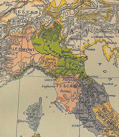
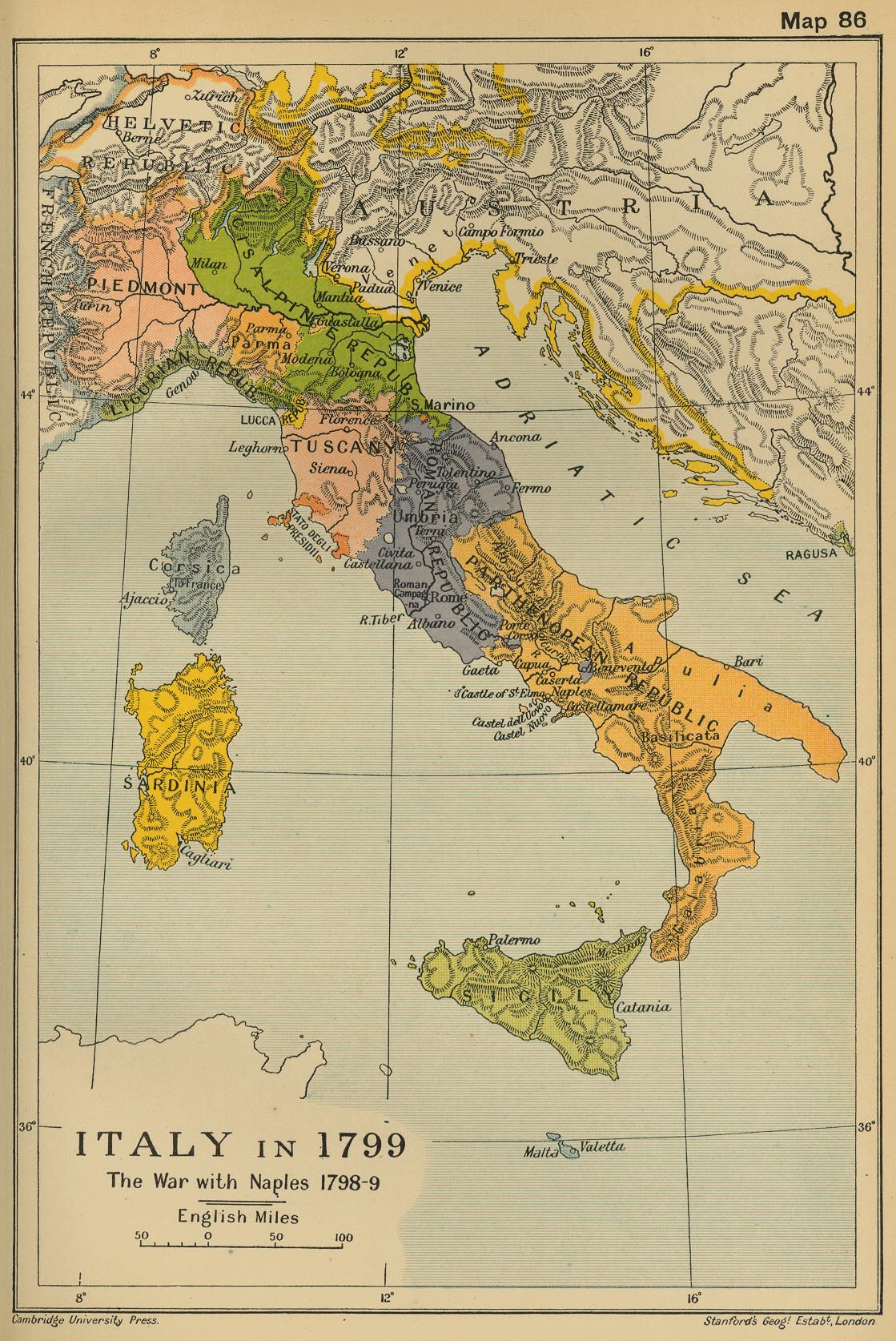
Deutsch: Karte van Norditalien und Mittelitalien im Jahr 1799.
English: Map of Northern and Central Italy in 1799. |
||||
| Date | |||||
| Source | The Cambridge Modern History Atlas. London: Cambridge University Press, 1912, Map 86 | ||||
| Author | Adolphus William Ward | ||||
| Permission (Reusing this file) |
|
||||
| Other versions |
 |
||||
File history
Click on a date/time to view the file as it appeared at that time.
| Date/Time | Thumbnail | Dimensions | User | Comment | |
|---|---|---|---|---|---|
| current | 22:56, 20 April 2006 | | 649 × 746 (352 KB) | Crux | This image was copied from wikipedia:de. The original description was: Norditalien und Mittelitalien im Jahr 1799, aus: Ward, Adolphus William. The Cambridge Modern History Atlas. London: Cambridge University Press, 1912, Karte 86. {{PD-old}} {| border |
File usage
The following pages on the English Wikipedia use this file (pages on other projects are not listed):
Global file usage
The following other wikis use this file:
- Usage on ar.wiki.x.io
- Usage on az.wiki.x.io
- Usage on br.wiki.x.io
- Usage on ca.wiki.x.io
- Usage on cs.wiki.x.io
- Usage on da.wiki.x.io
- Usage on de.wiki.x.io
- Usage on es.wiki.x.io
- Usage on et.wiki.x.io
- Usage on fa.wiki.x.io
- Usage on fi.wiki.x.io
- Usage on fr.wiki.x.io
- Usage on gl.wiki.x.io
- Usage on hu.wiki.x.io
- Usage on id.wiki.x.io
- Usage on it.wiki.x.io
- Usage on ja.wiki.x.io
- Usage on ko.wiki.x.io
- Usage on krc.wiki.x.io
- Usage on mk.wiki.x.io
- Usage on nl.wiki.x.io
- Usage on no.wiki.x.io
- Usage on pl.wiki.x.io
- Usage on sh.wiki.x.io
- Usage on simple.wiki.x.io
- Usage on sv.wiki.x.io
- Usage on th.wiki.x.io
- Usage on tr.wiki.x.io
View more global usage of this file.