
Size of this preview: 800 × 436 pixels. Other resolutions: 320 × 174 pixels | 640 × 349 pixels | 1,131 × 616 pixels.
Original file (1,131 × 616 pixels, file size: 152 KB, MIME type: image/jpeg)
| This is a file from the Wikimedia Commons. Information from its description page there is shown below. Commons is a freely licensed media file repository. You can help. |
Summary
| Description |
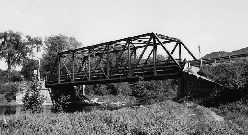
English: The former Lamoille River Route 15-A Bridge, Morristown, Vermont. This bridge was replaced in 2007.
|
||
| Date | |||
| Source | http://focus.nps.gov/pdfhost/docs/NRHP/Photos/91001607.pdf | ||
| Author | HCR |
| Camera location | | View this and other nearby images on: OpenStreetMap |
|---|
Licensing
This work is in the public domain because it was published in the United States between 1978 and March 1, 1989 without a copyright notice, and its copyright was not subsequently registered with the U.S. Copyright Office within 5 years.
|
 |
File history
Click on a date/time to view the file as it appeared at that time.
| Date/Time | Thumbnail | Dimensions | User | Comment | |
|---|---|---|---|---|---|
| current | 12:41, 16 December 2017 | | 1,131 × 616 (152 KB) | Magicpiano | User created page with UploadWizard |
File usage
The following pages on the English Wikipedia use this file (pages on other projects are not listed):
Global file usage
The following other wikis use this file:
- Usage on sv.wiki.x.io
- Usage on www.wikidata.org