Size of this PNG preview of this SVG file: 222 × 599 pixels. Other resolutions: 89 × 240 pixels | 177 × 480 pixels | 284 × 768 pixels | 379 × 1,024 pixels | 758 × 2,048 pixels | 250 × 675 pixels.
Original file (SVG file, nominally 250 × 675 pixels, file size: 4 KB)
File history
Click on a date/time to view the file as it appeared at that time.
| Date/Time | Thumbnail | Dimensions | User | Comment | |
|---|---|---|---|---|---|
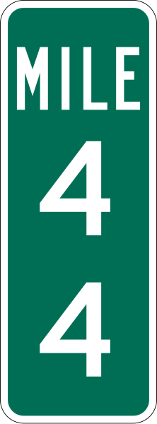
| current | 04:27, 24 November 2006 | 250 × 675 (4 KB) | TwinsMetsFan | {{Information |Description=250 mm by 675 mm (10 in by 27 in) two-digit mile marker, made to the specifications of the [http://mutcd.fhwa.dot.gov/SHSm/guide.pdf 2004 edition of Standard Highway Signs] (sign D10-2). Uses the [http://www.triskele.com/fonts/i |
File usage
More than 100 pages use this file. The following list shows the first 100 pages that use this file only. A full list is available.
- Arkansas Highway 7
- Central Artery
- Central Expressway (Dallas)
- Central Freeway
- Colonial Parkway
- Florida's Turnpike
- Florida State Road 906
- Florida State Road 9B
- Georgia State Route 13
- Georgia State Route 14
- Georgia State Route 15
- Georgia State Route 16
- Georgia State Route 20
- Georgia State Route 5
- Georgia State Route 515
- Georgia State Route 520
- Georgia State Route 6
- Georgia State Route 74
- Georgia State Route 85
- Georgia State Route 9
- Georgia State Route 92
- Hardy Toll Road
- Hawaii Route 61
- Henry G. Shirley Memorial Highway
- Jones Boulevard
- Massachusetts Route 28
- Massachusetts Route 3A
- Nevada State Route 115
- Nevada State Route 146
- Nevada State Route 147
- Nevada State Route 161
- Nevada State Route 599
- Nevada State Route 610
- Nevada State Route 612
- Nevada State Route 88
- New York State Route 27
- New York State Route 32
- Richmond–Petersburg Turnpike
- Rock Creek and Potomac Parkway
- Schuylkill Expressway
- South Carolina Highway 9
- State Line Avenue
- Tennessee State Route 171
- Tennessee State Route 2
- Tennessee State Route 317
- Texas State Highway 33
- Texas State Highway 34
- Texas State Highway 35
- Texas State Highway 37
- Texas State Highway 55
- Texas State Highway 56
- Texas State Highway 6
- Texas State Highway 65
- Texas State Highway 75
- Texas State Highway 95
- Texas State Highway Loop 375
- U.S. Route 111
- U.S. Route 151
- U.S. Route 165
- U.S. Route 167
- U.S. Route 176
- U.S. Route 240
- U.S. Route 258
- U.S. Route 259
- U.S. Route 277
- U.S. Route 280
- U.S. Route 30 in Pennsylvania
- U.S. Route 319
- U.S. Route 31W
- U.S. Route 341
- U.S. Route 371
- U.S. Route 378
- U.S. Route 48
- U.S. Route 66 in Oklahoma
- U.S. Route 72 Alternate
- U.S. Route 73
- U.S. Route 96
- Valley Boulevard
- Virginia State Route 150
- Virginia State Route 164
- Virginia State Route 288
- Virginia State Route 31
- Virginia State Route 6
- Virginia State Route 895
- West Side Elevated Highway
- West Virginia Route 114
- West Virginia Route 2
- West Virginia Route 45
- West Virginia Route 46
- West Virginia Route 55
- West Virginia Route 8
- West Virginia Route 88
- West Virginia Route 92
- West Virginia Route 97
- Westpark Tollway
- Wisconsin Highway 100
- Wisconsin Highway 29
- Wisconsin Highway 35
- Talk:U.S. Route 80
- Talk:U.S. Route 84
View more links to this file.
Global file usage
The following other wikis use this file:
- Usage on as.wiki.x.io
- Usage on id.wiki.x.io
- Usage on km.wiki.x.io
- Usage on kn.wiki.x.io
- Usage on ta.wiki.x.io
- Usage on tl.wiki.x.io
- Usage on tum.wiki.x.io
- Usage on zh.wiki.x.io
