
Size of this PNG preview of this SVG file: 800 × 536 pixels. Other resolutions: 320 × 215 pixels | 640 × 429 pixels | 1,024 × 687 pixels | 1,280 × 858 pixels | 2,560 × 1,716 pixels | 974 × 653 pixels.
Original file (SVG file, nominally 974 × 653 pixels, file size: 218 KB)
| This is a file from the Wikimedia Commons. Information from its description page there is shown below. Commons is a freely licensed media file repository. You can help. |
| Description | |||
| Date | |||
| Source | Own work | ||
| Author | Yavidaxiu | ||
| Permission (Reusing this file) |
|
File history
Click on a date/time to view the file as it appeared at that time.
| Date/Time | Thumbnail | Dimensions | User | Comment | |
|---|---|---|---|---|---|
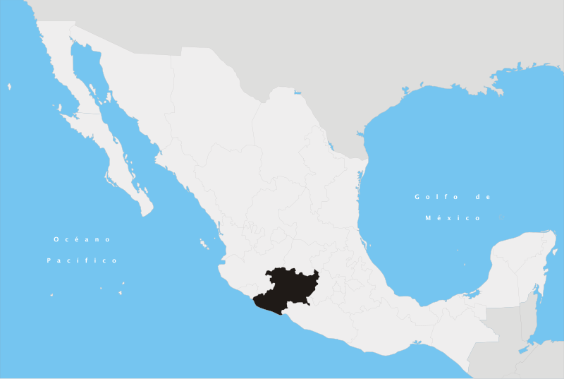
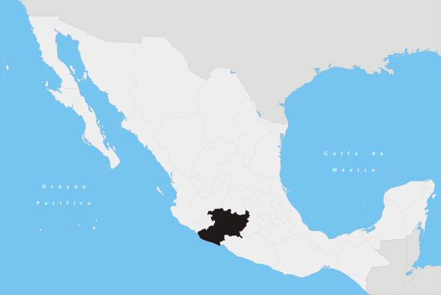
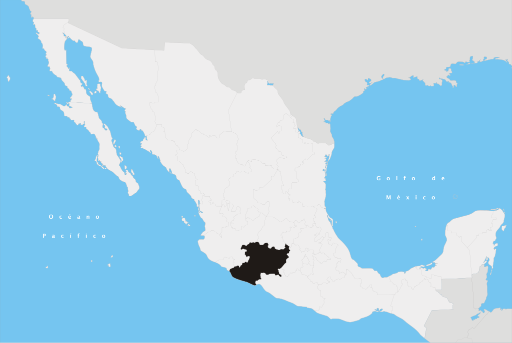
| current | 17:41, 27 April 2007 | | 974 × 653 (218 KB) | Yavidaxiu | {{Information |Description={{es|Ubicación del estado de Michoacán en la República Mexicana}} |Source= Trabajo propio |Date= 20 de abril de 2007 |Author= Yavidaxiu |Permission= {{PD-self}} |other_versions= }} Category:Maps of Michoacán [[Category: |
File usage
More than 100 pages use this file. The following list shows the first 100 pages that use this file only. A full list is available.
- Acuitzio
- Acuitzio del Canje, Michoacán
- Aguililla
- Angangueo
- Apatzingán
- Aporo, Michoacán
- Aquila, Michoacán
- Ario Municipality
- Arteaga Municipality, Michoacán
- Buenavista, Michoacán
- Carindapaz
- Cerro del Quinceo
- Charapan
- Charo Municipality
- Chavinda
- Cherán
- Chinicuila
- Churumuco
- Ciudad Hidalgo, Michoacán
- Coahuayana
- Coalcomán de Vázquez Pallares
- Coeneo de la Libertad
- Copándaro
- Cotija de la Paz
- El Rodeo de San Antonio, Michoácan
- El Triunfo, Michoacán
- El limon de papatzindan
- Erongarícuaro
- Felipe Carrillo Puerto, Michoacán
- Gabriel Zamora
- Huetamo
- Ihuatzio
- Ixtlán de los Hervores
- Jacona, Michoacán
- Jiquilpan, Michoacán
- Jiquilpan de Juárez
- Jungapeo
- Juárez Municipality, Michoacán
- La Huacana Municipality
- La Piedad
- La Placita de Morelos
- Lagunillas, Michoacán
- Lagunillas Municipality, Michoacán
- Los Reyes, Michoacán
- Lázaro Cárdenas, Michoacán
- Maravatío
- Marcos Castellanos
- Michoacán
- Morelia Cathedral
- Nuevo San Juan Parangaricutiro
- Nuevo Urecho
- Paracho de Verduzco
- Parácuaro
- Pastor Ortiz
- Penjamillo
- Peribán
- Puruándiro
- Pátzcuaro
- Quiroga, Michoacán
- Sahuayo
- San Antonio Tariácuri
- San José de Gracia, Michoacán
- San Lucas Municipality, Michoacán
- San Pedro Jácuaro
- Santa Ana Maya
- Sierra Madre del Sur
- Susupuato
- Tancítaro
- Tangamandapio
- Tangancícuaro
- Tarascan Plateau
- Taretan
- Tarímbaro
- Tecomatán
- Tepalcatepec
- Tingambato
- Tingüindín
- Tiquicheo
- Tlalpujahua
- Tlazazalca
- Tocuaro
- Tocumbo Municipality
- Tumbiscatío
- Turicato
- Tuxpan, Michoacán
- Tuzantla
- Tzintzuntzan, Michoacán
- Tzintzuntzan Municipality
- Uruapan
- Valle de Guadalupe, Michoacán
- Villa Mendoza
- Villafuerte, Michoacán
- Yurécuaro
- Zacapu
- Zamora, Michoacán
- Zamora Municipality, Michoacán
- Zitácuaro
- Álvaro Obregón, Michoacán
- Álvaro Obregón Municipality
- Wikipedia:WikiProject Mexico/State templates
View more links to this file.
Global file usage
The following other wikis use this file:
- Usage on af.wiki.x.io
- Usage on br.wiki.x.io
- Usage on cy.wiki.x.io
- Usage on es.wiki.x.io
- Usage on fa.wiki.x.io
- Usage on id.wiki.x.io
- Usage on ka.wiki.x.io
- Usage on km.wiki.x.io
- Usage on ko.wiki.x.io
- Usage on lt.wiki.x.io
- Usage on lv.wiki.x.io
- Usage on mg.wiki.x.io
- Usage on mr.wiki.x.io
- Usage on pl.wiki.x.io
- Usage on pnb.wiki.x.io
- Usage on pt.wiki.x.io
- Usage on ru.wiki.x.io
- Usage on sco.wiki.x.io
- Usage on sc.wiki.x.io
- Usage on sk.wiki.x.io
- Usage on tr.wiki.x.io
- Usage on ur.wiki.x.io
- Usage on vi.wiki.x.io
View more global usage of this file.