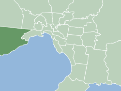
MelbLGA-Wyndham.gif (250 × 188 pixels, file size: 6 KB, MIME type: image/gif, 0.1 s)
File history
Click on a date/time to view the file as it appeared at that time.
| Date/Time | Thumbnail | Dimensions | User | Comment | |
|---|---|---|---|---|---|
| current | 05:26, 20 November 2006 |  | 250 × 188 (6 KB) | JohnnoShadbolt | {{Information |Description=Map of Melbourne's Local Government Areas, highlighting City of Wyndham |Source=Own work. |Date=2006-11-20 |Author=[http://en.wiki.x.io/wiki/User:JohnnoShadbolt John Shadbolt] |Per |
File usage
The following 25 pages use this file:
- City of Wyndham
- Cocoroc, Victoria
- Eynesbury, Victoria
- Hoppers Crossing, Victoria
- Laverton, Victoria
- Laverton North
- Little River, Victoria
- Local government areas of Victoria
- Mambourin, Victoria
- Manor Lakes, Victoria
- Mount Cottrell, Victoria
- Mount Rothwell
- Point Cook, Victoria
- Quandong, Victoria
- Tarneit, Victoria
- Truganina, Victoria
- Werribee, Victoria
- Werribee South, Victoria
- Williams Landing
- Wyndham Vale
- User:JohnnoShadbolt/Maps
- User:PK2/Local government areas of Victoria
- User:ThylacineHunter/LGA
- Template:City of Wyndham suburbs
- Category:City of Wyndham
Global file usage
The following other wikis use this file:
- Usage on vi.wiki.x.io
- Usage on zh.wiki.x.io
